Cof Cymru: National Historic Assets of Wales · Wales
12 Monk Street
Monmouth, Monmouthshire, Wales
A Grade II listed building in Monmouth, Monmouthshire, designated on 27 October 1965.
The record
- Designation
- Listed building, Grade II
- Broad class
- Domestic
- Date of designation
- 27 October 1965
- Locality
- Monmouth
- Town
- Monmouth
- Community
- Monmouth
- Unitary authority
- Monmouthshire
- Country
- Wales
- Coordinates
- 51.81445, -2.71323
- Cadw reference
- 2277
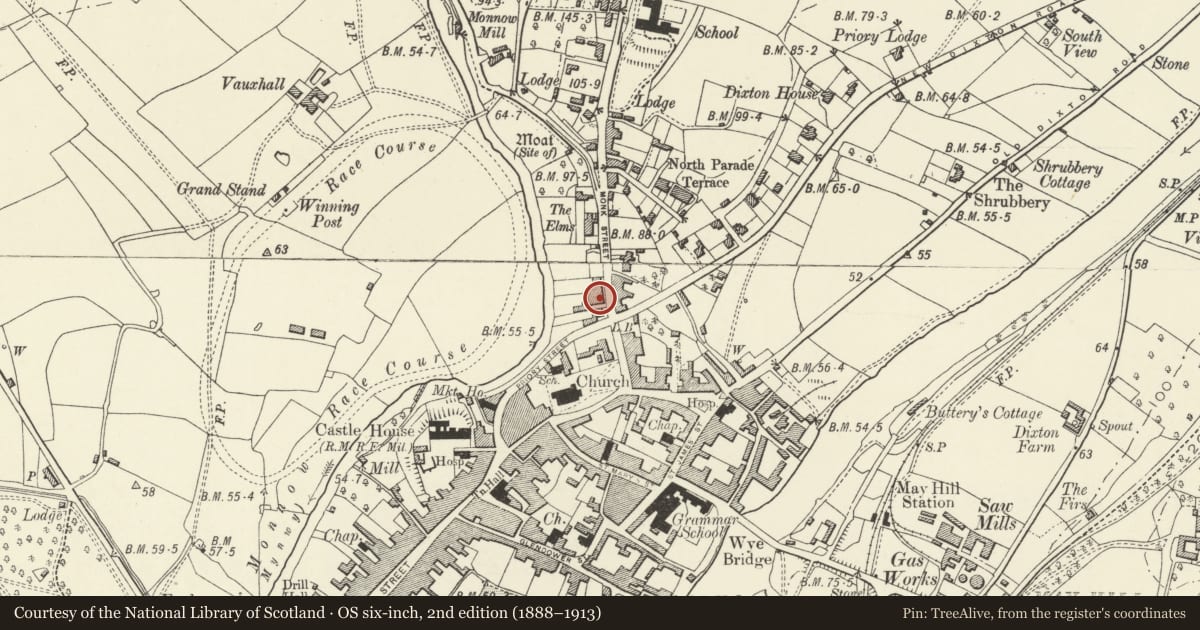
Slide toward Today to fade the historical sheet and see the modern map underneath.
David Rumsey Map Collection, Stanford LibrariesDavid Rumsey Map Collection, Stanford LibrariesDavid Rumsey Map Collection, Stanford LibrariesDavid Rumsey Map Collection, Stanford LibrariesDavid Rumsey Map Collection, Stanford Libraries
5 historical maps cover this location, the earliest the 1636 map "Cornubia : Devonia, Somersetus, Dorcestria, Wiltonia, Glocestria ..." (David Rumsey Map Collection, Stanford Libraries).
Historical maps covering this location
- 1636 · Cornubia : Devonia, Somersetus, Dorcestria, Wiltonia, Glocestria ... (David Rumsey Map Collection, Stanford Libraries)
- 1830 · V.3:11-15:XV.Britisches Reich. A. Kon: England. a. England ab sich: Shire:15-17, 33 (David Rumsey Map Collection, Stanford Libraries)
- 1895 · Sheet 11. Ordnance Survey of England and Wales. (David Rumsey Map Collection, Stanford Libraries)
- 1896 · 233 Monmouth (Hills) (David Rumsey Map Collection, Stanford Libraries)
- 1901 · Sheet 14. (David Rumsey Map Collection, Stanford Libraries)
Cadw's description
Location
On the principal road which runs north-south on the east side of Monmouth town centre.
History
Early C19 house, apparently unaltered on main elevation.
Exterior
Roughcast render, with stucco quoin only to left and eaves cornice, Welsh slate roof with unusual rear slope swept down to lower cross range. Double depth central entrance plan. Three storeys, four bays, with all bays on the left being blind recesses. The ground floor has an open pedimented porch with fluted Doric columns in bay 3; 6-panel door with transom light and panelled reveals. This is flanked by two 8 over 8 pane sashes. The first floor has three more windows the same. The second floor has two 4 over 4 pane sashes with an additional blind recess over the door. Plain roof with tall stack to both gables. Left return wall has one late C20 plastic sash type window and shows the roof stepping down to a two storey rear wing. Rear elevation not seen.
Interior
Interior not seen at resurvey.
Reason for designation
Included for its special architectural interest as a well preserved early C19 classical house in a good group.
Nearby in the register
- 14 Monk StreetDomesticunder 1 mi
- 16 Monk StreetDomesticunder 1 mi
- Hendre HouseNo class recordedunder 1 mi
- 18 Monk StreetNo class recordedunder 1 mi
Other entries of the same register within about three miles of this one, by straight line.