Cof Cymru: National Historic Assets of Wales · Wales
The Slater's Arms
Corris, Gwynedd, Wales
A Grade II listed building in Corris, Machynlleth, Gwynedd, designated on 6 December 1999.
The record
- Designation
- Listed building, Grade II
- Broad class
- Commercial
- Date of designation
- 6 December 1999
- Locality
- Corris
- Town
- Machynlleth
- Community
- Corris
- Unitary authority
- Gwynedd
- Country
- Wales
- Coordinates
- 52.65453, -3.84199
- Cadw reference
- 22752
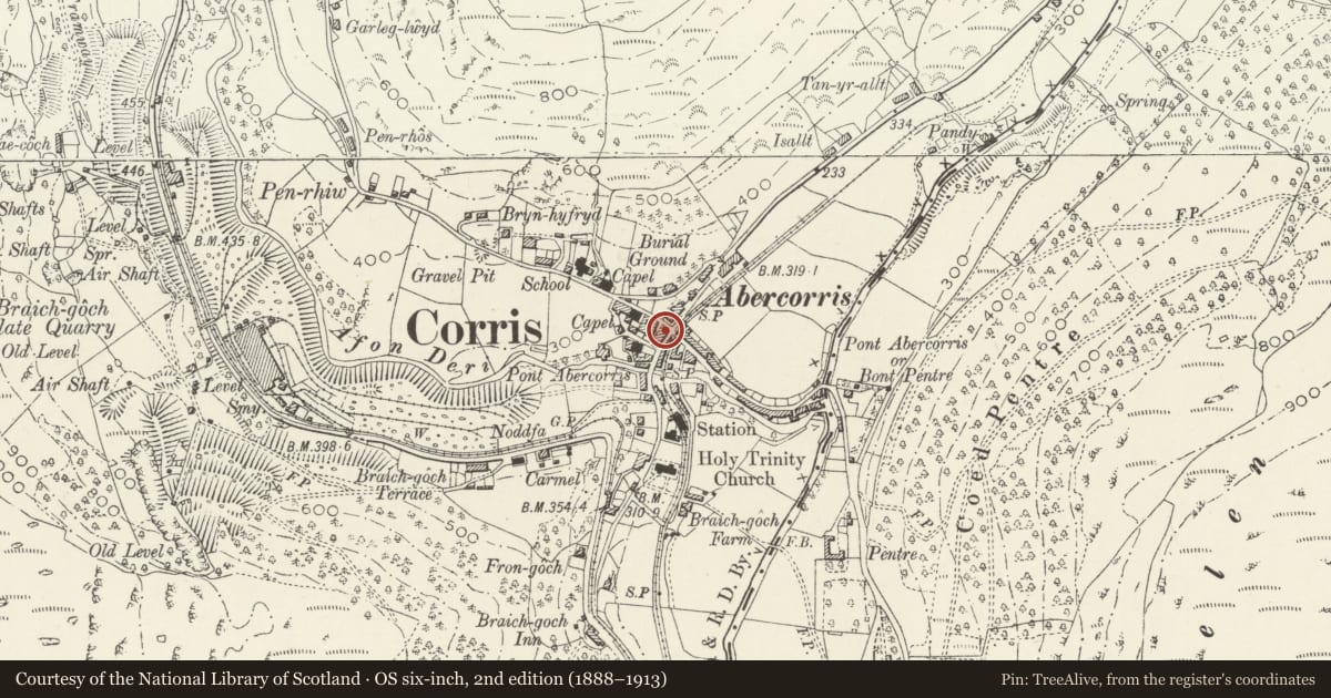
Slide toward Today to fade the historical sheet and see the modern map underneath.
David Rumsey Map Collection, Stanford LibrariesDavid Rumsey Map Collection, Stanford LibrariesLlyfrgell Genedlaethol Cymru – The National Library of WalesDavid Rumsey Map Collection, Stanford LibrariesDavid Rumsey Map Collection, Stanford Libraries
5 historical maps cover this location, the earliest the 1795 map "To Sir Watkin Williams-Wynn Bart ... the map of the six counties of North Wales is most humbly inscribed by his obedient humble servant" (Llyfrgell Genedlaethol Cymru – The National Library of Wales).
Historical maps covering this location
- 1795 · To Sir Watkin Williams-Wynn Bart ... the map of the six counties of North Wales is most… (Llyfrgell Genedlaethol Cymru – The National Library of Wales)
- 1830 · V.3:11-15:XV. Britisches Reich. A. Kon: England. b. Frstenthum Wales: Shire: 37-40 (David Rumsey Map Collection, Stanford Libraries)
- 1883 · Watershed map England, Wales 3. (David Rumsey Map Collection, Stanford Libraries)
- 1899 · 149 Barmouth (Hills) (David Rumsey Map Collection, Stanford Libraries)
- 1901 · Sheet 9 and 10. (David Rumsey Map Collection, Stanford Libraries)
Cadw's description
Location
The inn is on the corner of Bridge Street and the road running up from the bridge over the Afon Dulas crossing Bridge Street and continuing to the NW.
History
The inn was probably built between 1860 and 1870.
Exterior
The building is built of stone rubble, rendered, lined and painted to the front, with raised scalloped quoins and eared and shouldered moulded window architraves. Slate roof with 2 roof lights. Two storeys, three window bays, the frontage to the road is symmetrical, offset to the left, with a recessed central battened door with cover mouldings and overlight, all raised over a step. A former portico has been removed. The window architraves are raised above the window and contain a small plaster wreath. Twelve paned sashes. Stone gable end stacks. Various irregular windows at the rear.
Interior
Internal lobby, with a larger room to the right, and small bar to the left.
Reason for designation
Included as a building with the strong mid C19 character of a country inn, embedded in the tight matrix of the centre of Corris.
Nearby in the register
- Pant-y-celynDomesticunder 1 mi
- Pant-y-celynDomesticunder 1 mi
- Capel Salem including front wall and railingsReligious, Ritual and Funeraryunder 1 mi
- Idris HouseCommercialunder 1 mi
Other entries of the same register within about three miles of this one, by straight line.