Cof Cymru: National Historic Assets of Wales · Wales
Chest Tomb at St Dyfnog's Church
Llanrhaeadr-Yng-Nghinmeirch, Denbighshire, Wales
A Grade II listed building in Llanrhaeadr, Llanrhaeadr-Yng-Nghinmeirch, Denbighshire, designated on 29 November 1999.
The record
- Designation
- Listed building, Grade II
- Broad class
- Religious, Ritual and Funerary
- Date of designation
- 29 November 1999
- Locality
- Llanrhaeadr
- Community
- Llanrhaeadr-Yng-Nghinmeirch
- Unitary authority
- Denbighshire
- Country
- Wales
- Coordinates
- 53.15961, -3.37472
- Cadw reference
- 22676
Slide toward Today to fade the historical sheet and see the modern map underneath.
David Rumsey Map Collection, Stanford LibrariesLlyfrgell Genedlaethol Cymru – The National Library of WalesDavid Rumsey Map Collection, Stanford LibrariesDavid Rumsey Map Collection, Stanford LibrariesDavid Rumsey Map Collection, Stanford Libraries
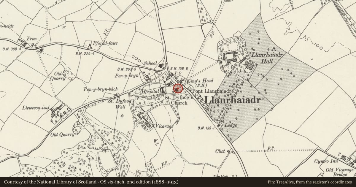
5 historical maps cover this location, the earliest the 1608 map "(13) Cambriae Typus." (David Rumsey Map Collection, Stanford Libraries).
Historical maps covering this location
- 1608 · (13) Cambriae Typus. (David Rumsey Map Collection, Stanford Libraries)
- 1795 · To Sir Watkin Williams-Wynn Bart ... the map of the six counties of North Wales is most… (Llyfrgell Genedlaethol Cymru – The National Library of Wales)
- 1830 · V.3:11-15:XV. Britisches Reich. A. Kon: England. b. Frstenthum Wales: Shire: 37-40 (David Rumsey Map Collection, Stanford Libraries)
- 1883 · Watershed map England, Wales 3. (David Rumsey Map Collection, Stanford Libraries)
- 1901 · Sheet 9 and 10. (David Rumsey Map Collection, Stanford Libraries)
Cadw's description
Location
Immediately to the E of the church, within the churchyard.
History
Mid C17 chest tomb, dated 1642.
Exterior
Heavy tombslab supported on side piers and end panels; the side panels have been removed. The tombslab has a raised strapwork border and has a lengthy incised inscription. This records the tomb as belonging to John ap Robert of Porth, who died in 1642 aged 95; the inscription gives sixteen generations of his genealogical descent back to the king of Powys. Below this is a raised shield motif with the (later) incised initials HD. The ends have paired arched niches with guilloche decoration to the central pier; the sides and corners have applied fluted columns.
Reason for designation
Listed for its special interest as a particularly good C17 chest tomb with unusual inscription.
Group value with other listed items at St Dyfnog's Church.
Nearby in the register
- Chest Tomb of Captain WynnReligious, Ritual and Funeraryunder 1 mi
- Parish Church of St DyfnogReligious, Ritual and Funeraryunder 1 mi
- Lychgate and Churchyard Walls, including Sundial Base, at St Dyfnog's ChurchReligious, Ritual and Funeraryunder 1 mi
- The SmithyIndustrialunder 1 mi
Other entries of the same register within about three miles of this one, by straight line.