Cof Cymru: National Historic Assets of Wales · Wales
Incline and Drumhouses
Llanddeiniolen, Gwynedd, Wales
A Grade II listed building in Gilfach Ddu, Caernarfon, Llanddeiniolen, Gwynedd, designated on 4 November 1999.
The record
- Designation
- Listed building, Grade II
- Broad class
- Industrial
- Date of designation
- 4 November 1999
- Locality
- Gilfach Ddu
- Town
- Caernarfon
- Community
- Llanddeiniolen
- Unitary authority
- Gwynedd
- Country
- Wales
- Coordinates
- 53.12341, -4.11528
- Cadw reference
- 22661
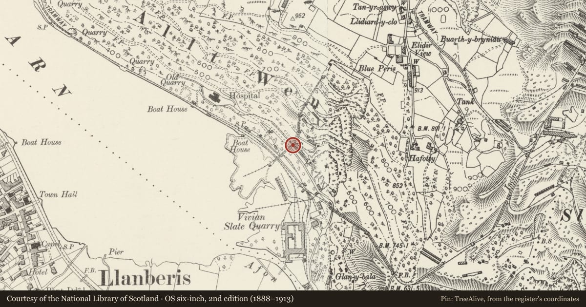
Slide toward Today to fade the historical sheet and see the modern map underneath.
David Rumsey Map Collection, Stanford LibrariesDavid Rumsey Map Collection, Stanford LibrariesDavid Rumsey Map Collection, Stanford LibrariesDavid Rumsey Map Collection, Stanford LibrariesDavid Rumsey Map Collection, Stanford Libraries
5 historical maps cover this location, the earliest the 1896 map "Sheet 7. Ordnance Survey of England and Wales." (David Rumsey Map Collection, Stanford Libraries).
Historical maps covering this location
- 1896 · Sheet 7. Ordnance Survey of England and Wales. (David Rumsey Map Collection, Stanford Libraries)
- 1899 · 106 Bangor (Hills) (David Rumsey Map Collection, Stanford Libraries)
- 1899 · 106 Bangor (Outline) (David Rumsey Map Collection, Stanford Libraries)
- 1901 · Sheet 9 and 10. (David Rumsey Map Collection, Stanford Libraries)
- 1919 · Sheet 41. Anglesey. (David Rumsey Map Collection, Stanford Libraries)
Cadw's description
Location
Incline and drumhouses rising from the old floor (now car park of the Welsh Slate Museum) to the top level of the former Vivian Slate Quarry; massive slate retaining wall located immediately to the north of the reconstructed section of incline.
History
The Vivian Quarry, an open hillside quarry worked on 6 levels, formed part of the Dinorwic Quarry, first established in 1787, taking over existing workings in the area, the first incline being built in 1789. By the 1830s there was a tramway system on each terrace of the quarry, steam locomotives being introduced in the 1870s. The eventual scale of the quarry was such that its output of c100,000 tons p.a. in the late 1890s put in on a par with Penrhyn, representing almost a quarter of the total production of Welsh slate. The quarry finally closed in 1969. The first drumhouse and lowest pitch of the incline above the former Padarn Railway has been restored to full working order (based on the form of the incline in 1910) by the Welsh Slate Museum and is not included on this List.
Exterior
Incline runs in 5 tandem pitches, the lower 3 (including the section reconstructed by the Slate Museum) with much of the track and gear intact. The 4 unrestored drumhouses are of rubblestone and slate slab construction with gable-ended slate roofs. All retain their brake-drums and cabling, the brake mechanisms to the lower inclines being of massive cast-iron construction, operated via spur gears and "ship's wheel" controls with elaborate remote control crimp sprags. Double drumhouse on top level.
Reason for designation
Included as a remarkably well-preserved incline with drumhouses and counter balances forming an integral part of the former Vivian Slate Quarry and particularly important for the impressive physical evidence it provides for the distribution of slate away from the quarry.
Scheduled Ancient Monument (198).
Nearby in the register
- Vivian Slate Quarry, Inclines, Walia & associated structuresQuarryunder 1 mi
- Locomotive ShedTransportunder 1 mi
- Locomotive ShedTransportunder 1 mi
- Dinorwic Quarry: Hafod Owen Winding Engine, Locomotive Shed, Main Waterwheel and HousingWheelhouseunder 1 mi
Other entries of the same register within about three miles of this one, by straight line.