Cof Cymru: National Historic Assets of Wales · Wales
Rhydyfelin, formerly known as 1 Wyle Cop
Mawddwy, Gwynedd, Wales
A Grade II listed building in Dinas Mawddwy, Machynlleth, Mawddwy, Gwynedd, designated on 4 November 1999.
The record
- Designation
- Listed building, Grade II
- Broad class
- Domestic
- Date of designation
- 4 November 1999
- Locality
- Dinas Mawddwy
- Town
- Machynlleth
- Community
- Mawddwy
- Unitary authority
- Gwynedd
- Country
- Wales
- Coordinates
- 52.71946, -3.69137
- Cadw reference
- 22604
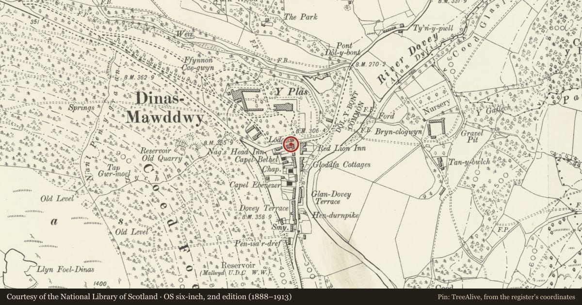
Slide toward Today to fade the historical sheet and see the modern map underneath.
David Rumsey Map Collection, Stanford LibrariesDavid Rumsey Map Collection, Stanford LibrariesLlyfrgell Genedlaethol Cymru – The National Library of WalesDavid Rumsey Map Collection, Stanford LibrariesDavid Rumsey Map Collection, Stanford Libraries
5 historical maps cover this location, the earliest the 1795 map "To Sir Watkin Williams-Wynn Bart ... the map of the six counties of North Wales is most humbly inscribed by his obedient humble servant" (Llyfrgell Genedlaethol Cymru – The National Library of Wales).
Historical maps covering this location
- 1795 · To Sir Watkin Williams-Wynn Bart ... the map of the six counties of North Wales is most… (Llyfrgell Genedlaethol Cymru – The National Library of Wales)
- 1830 · V.3:11-15:XV. Britisches Reich. A. Kon: England. b. Frstenthum Wales: Shire: 37-40 (David Rumsey Map Collection, Stanford Libraries)
- 1883 · Watershed map England, Wales 3. (David Rumsey Map Collection, Stanford Libraries)
- 1899 · 150 Dinas-Mawddwy (Hills) (David Rumsey Map Collection, Stanford Libraries)
- 1901 · Sheet 9 and 10. (David Rumsey Map Collection, Stanford Libraries)
Cadw's description
Location
The house stands in a row of houses, on the cross road at the N end of the village, and near the corner and facing N over the former ground of Plas Dinas.
History
The building was probably erected in the early C19, as part of a short row of development. It was the home of a notable rakemaker, William Thomas (1879-1971), well known for his exceptional skill in this field.
Exterior
Built of local stone rubble, with a slate roof. Three storeys, 2 bays. Central 6-panelled door, the two central panels glazed, and 12-pane sash windows either side on ground and first floor. 8-pane single sash windows to the attic, close under the boxed eaves. All windows are deeply set in painted reveals, and the lower openings all have slate lintels. Brick stack on the left (E) gable end. The window to the right of the door on the ground floor is a C20 false sash, set in the stoned up opening of a former shop window, and the roof has one roof light on the front.
Reason for designation
Included as a good example of a more sophisticated town house, which has largely retained its original features and urban character.
Nearby in the register
- Pont Dol-y-BontTransportunder 1 mi
- Garden walls at Tan-y-bwlchGardens, Parks and Urban Spacesunder 1 mi
- West farmyard range at Tan-y-bwlchAgriculture and Subsistenceunder 1 mi
- North range of farm buildings at Tan-y-bwlchAgriculture and Subsistenceunder 1 mi
Other entries of the same register within about three miles of this one, by straight line.