Cof Cymru: National Historic Assets of Wales · Wales
Gwelfryn
Mawddwy, Gwynedd, Wales
A Grade II listed building in Minllyn, Dinas Mawddwy, Mawddwy, Gwynedd, designated on 4 November 1999.
The record
- Designation
- Listed building, Grade II
- Broad class
- Domestic
- Date of designation
- 4 November 1999
- Locality
- Minllyn
- Town
- Dinas Mawddwy
- Community
- Mawddwy
- Unitary authority
- Gwynedd
- Country
- Wales
- Coordinates
- 52.71362, -3.69011
- Cadw reference
- 22600
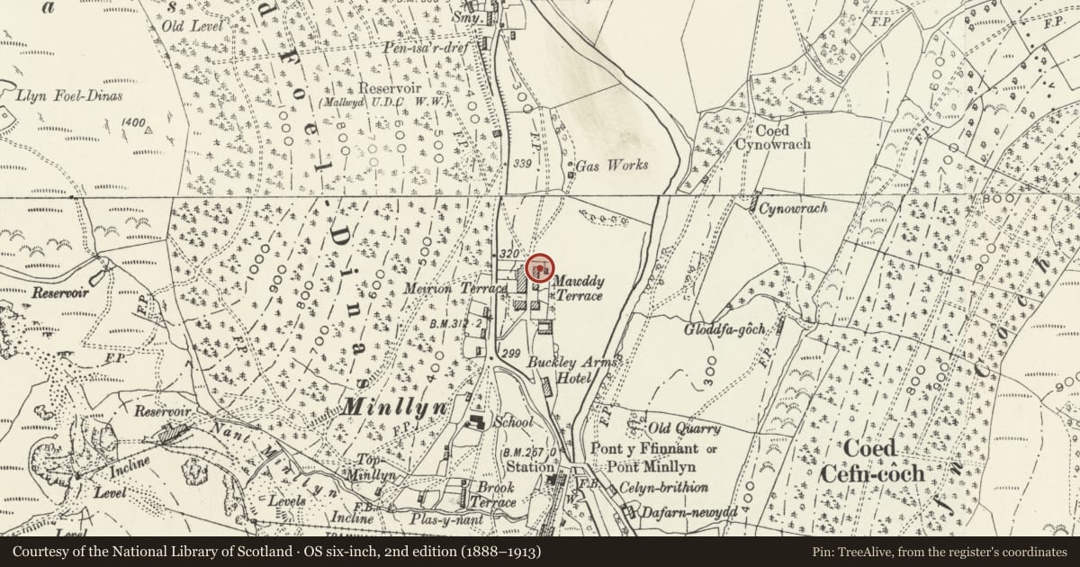
Slide toward Today to fade the historical sheet and see the modern map underneath.
David Rumsey Map Collection, Stanford LibrariesDavid Rumsey Map Collection, Stanford LibrariesLlyfrgell Genedlaethol Cymru – The National Library of WalesDavid Rumsey Map Collection, Stanford LibrariesDavid Rumsey Map Collection, Stanford Libraries
5 historical maps cover this location, the earliest the 1795 map "To Sir Watkin Williams-Wynn Bart ... the map of the six counties of North Wales is most humbly inscribed by his obedient humble servant" (Llyfrgell Genedlaethol Cymru – The National Library of Wales).
Historical maps covering this location
- 1795 · To Sir Watkin Williams-Wynn Bart ... the map of the six counties of North Wales is most… (Llyfrgell Genedlaethol Cymru – The National Library of Wales)
- 1830 · V.3:11-15:XV. Britisches Reich. A. Kon: England. b. Frstenthum Wales: Shire: 37-40 (David Rumsey Map Collection, Stanford Libraries)
- 1883 · Watershed map England, Wales 3. (David Rumsey Map Collection, Stanford Libraries)
- 1899 · 150 Dinas-Mawddwy (Hills) (David Rumsey Map Collection, Stanford Libraries)
- 1901 · Sheet 9 and 10. (David Rumsey Map Collection, Stanford Libraries)
Cadw's description
Location
On the E side of the road through Minllyn to Ysgol Gynradd Dinas Mawddwy.
History
Minllyn is a planned village associated with the anticipated expansion of industrial enterprises in the Mawddwy area, particularly the development of the slate industry. This was first established around 1800, including some metal extraction, proceeded with the development of a tramway to connect to the Mawddwy Railway, brought to Aberangell after 1865. The impetus came from Edmund Buckley, whose father, a wealthy Manchester industrialist, purchased the estate in 1856. He intended to develop Dinas Mawddwy as a model village, with new education facilities, a hotel, and chapels, served by the railway which was officially opened in 1868, the year he was elevated to the baronetage. Once the main road was diverted out of Dinas Mawddwy, Buckley built a mansion, Plas Dinas in 1864-7, Minllyn Cottages, 1868, and Mawddwy Terraces, 1870-76, all for his estate and industrial workers.
Exterior
Belongs to a group of Nos 7-14 Mawddwy Terrace.
The terrace of 8 worker's cottages is built in mountain-Gothic style with selected local slate laid on bed and has slate roofs. Two cottages, bilaterally symmetrical, form a large gable at each end, set slightly forward to master the central cottages. Each cottage has a 4-paned half-glazed door with plain overlight, and 4-paned horned sash windows to both floors, allow within triangular heads of shale voussoirs, and the upper floor windows in the central cottages set within five large raised and gabled dormers. Deep eaves throughout and extended purlins and ridge with shaped ends. Stone stacks on party walls, with necking string and outsetting heads. The large gable ends has decorative timber framing in the upper half. The internal partitions are said to be of slate slabs set on end, another innovation of Buckley and his architect, James Stephens.
The house, which forms the N side of the N end gable of the terrace, was probably originally designed as a shop for the village, the shop front radically altered in the 1950s to include a modern flush uPVC plate glass window.
Reason for designation
Included, notwithstanding alterations to some doors and windows, as one of a group of buildings in Minllyn retaining robust mountain gothic character and demonstrating the hopes of a wealthy indsutrialist to establish a planned town based economically on local industries, in mid Wales. Part of a carefully planned estate village, and of group value with other buildings in Minllyn.
Nearby in the register
- Cefn CoedDomesticunder 1 mi
- 12 Mawddwy TerraceDomesticunder 1 mi
- TrigfanDomesticunder 1 mi
- 10 Mawddwy TerraceDomesticunder 1 mi
Other entries of the same register within about three miles of this one, by straight line.