Cof Cymru: National Historic Assets of Wales · Wales
Pont Nant-y-dugoed (partly in Banwy community)
Mawddwy, Gwynedd, Wales
A Grade II listed building in Cwm Cewydd, Machynlleth, Mawddwy, Gwynedd, designated on 4 November 1999.
The record
- Designation
- Listed building, Grade II
- Broad class
- Transport
- Date of designation
- 4 November 1999
- Locality
- Cwm Cewydd
- Town
- Machynlleth
- Community
- Mawddwy
- Unitary authority
- Gwynedd
- Country
- Wales
- Coordinates
- 52.70631, -3.60336
- Cadw reference
- 22580
Slide toward Today to fade the historical sheet and see the modern map underneath.
David Rumsey Map Collection, Stanford LibrariesDavid Rumsey Map Collection, Stanford LibrariesLlyfrgell Genedlaethol Cymru – The National Library of WalesDavid Rumsey Map Collection, Stanford LibrariesDavid Rumsey Map Collection, Stanford Libraries
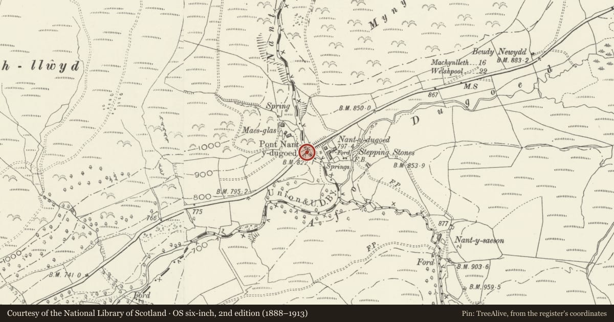
5 historical maps cover this location, the earliest the 1608 map "(13) Cambriae Typus." (David Rumsey Map Collection, Stanford Libraries).
Historical maps covering this location
- 1608 · (13) Cambriae Typus. (David Rumsey Map Collection, Stanford Libraries)
- 1795 · To Sir Watkin Williams-Wynn Bart ... the map of the six counties of North Wales is most… (Llyfrgell Genedlaethol Cymru – The National Library of Wales)
- 1883 · Watershed map England, Wales 3. (David Rumsey Map Collection, Stanford Libraries)
- 1899 · 150 Dinas-Mawddwy (Hills) (David Rumsey Map Collection, Stanford Libraries)
- 1901 · Sheet 9 and 10. (David Rumsey Map Collection, Stanford Libraries)
Cadw's description
Location
The bridge carries the main A458 Mallwyd to Welshpool road over the deep valley of the Nant-y-Dugoed
History
The bridge is one of a series of well constructed mid C19 bridges carrying the main road on a level over a series of narrow deep tributary valleys of the Afon Dugoed.
Exterior
Built of coursed squared rubble, with a single large semi-circular arch of flush even shale voussoirs springing from native rock and rising to a keystone. Flush spandrels and projecting string course, and a parapet of flat coping stones. The abutments are slightly battered and the parapet turns outwards at the ends to end in demi-piers. The arch spans approximately 7.8m, rising some 6.9m above the river, and carries a carriageway 5.4m wide with 50cm parapets.
Reason for designation
Listed as a fine example of mid C19 engineering, a masonry bridge of characteristic local type spanning a narrow gorge.
Nearby in the register
- Pont Nant-y-dugoed (partly in Mawddwy community)No class recordedunder 1 mi
- Ffridd Braich Llwyd Bronze Age Ritual ComplexRing Cairnunder 1 mi
- Pont Nant-yr-ehedyddTransportunder 1 mi
- Milestone at Bwlch-y-FedwenNo class recorded1 mi
Other entries of the same register within about three miles of this one, by straight line.