Cof Cymru: National Historic Assets of Wales · Wales
Pont Wrysgen
Mawddwy, Gwynedd, Wales
A Grade II listed building in Cwm Cewydd, Machynlleth, Mawddwy, Gwynedd, designated on 4 November 1999.
The record
- Designation
- Listed building, Grade II
- Broad class
- Transport
- Date of designation
- 4 November 1999
- Locality
- Cwm Cewydd
- Town
- Machynlleth
- Community
- Mawddwy
- Unitary authority
- Gwynedd
- Country
- Wales
- Coordinates
- 52.70362, -3.67342
- Cadw reference
- 22579
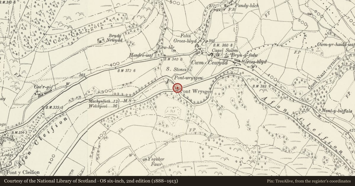
Slide toward Today to fade the historical sheet and see the modern map underneath.
David Rumsey Map Collection, Stanford LibrariesDavid Rumsey Map Collection, Stanford LibrariesLlyfrgell Genedlaethol Cymru – The National Library of WalesDavid Rumsey Map Collection, Stanford LibrariesDavid Rumsey Map Collection, Stanford Libraries
5 historical maps cover this location, the earliest the 1795 map "To Sir Watkin Williams-Wynn Bart ... the map of the six counties of North Wales is most humbly inscribed by his obedient humble servant" (Llyfrgell Genedlaethol Cymru – The National Library of Wales).
Historical maps covering this location
- 1795 · To Sir Watkin Williams-Wynn Bart ... the map of the six counties of North Wales is most… (Llyfrgell Genedlaethol Cymru – The National Library of Wales)
- 1830 · V.3:11-15:XV. Britisches Reich. A. Kon: England. b. Frstenthum Wales: Shire: 37-40 (David Rumsey Map Collection, Stanford Libraries)
- 1883 · Watershed map England, Wales 3. (David Rumsey Map Collection, Stanford Libraries)
- 1899 · 150 Dinas-Mawddwy (Hills) (David Rumsey Map Collection, Stanford Libraries)
- 1901 · Sheet 9 and 10. (David Rumsey Map Collection, Stanford Libraries)
Cadw's description
Location
The bridge carries the main A458 Mallwyd to Welshpool Road over the Afon Cleifion, SW of Cwm Cewydd.
History
Built probably in the mid C19 to provide a level crossing of the river at this point.
Exterior
Built of coursed squared rubble, with a single large semi-circular arch of flush even shale voussoirs springing from native rock and rising to a keystone. Flush spandrels and projecting string course, and a parapet of flat coping stones. The abutments are slightly battered and end in demi-piers. The arch spans approximately 10.7m, rising 6.2m above the river, and carries a carriageway 5.5m wide with 53cm parapets.
Reason for designation
Included as a robust and characterful C19 road bridge, one of a series of such bridges carrying the main road over small deep valleys of tributaries of the Afon Dugoed.
Nearby in the register
- Brigands InnCommercialunder 1 mi
- Bridge W of Pont y CleifionTransportunder 1 mi
- GorphwysfaDomesticunder 1 mi
- No 1 GorphwysfaDomesticunder 1 mi
Other entries of the same register within about three miles of this one, by straight line.