Cof Cymru: National Historic Assets of Wales · Wales
Y Rheithordy
Mawddwy, Gwynedd, Wales
A Grade II listed building in Mallwyd, Machynlleth, Mawddwy, Gwynedd, designated on 4 November 1999.
The record
- Designation
- Listed building, Grade II
- Broad class
- Domestic
- Date of designation
- 4 November 1999
- Locality
- Mallwyd
- Town
- Machynlleth
- Community
- Mawddwy
- Unitary authority
- Gwynedd
- Country
- Wales
- Coordinates
- 52.69631, -3.68338
- Cadw reference
- 22576
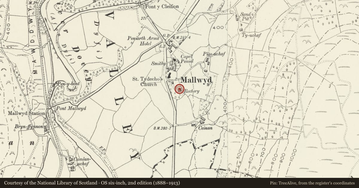
Slide toward Today to fade the historical sheet and see the modern map underneath.
David Rumsey Map Collection, Stanford LibrariesDavid Rumsey Map Collection, Stanford LibrariesLlyfrgell Genedlaethol Cymru – The National Library of WalesDavid Rumsey Map Collection, Stanford LibrariesDavid Rumsey Map Collection, Stanford Libraries
5 historical maps cover this location, the earliest the 1795 map "To Sir Watkin Williams-Wynn Bart ... the map of the six counties of North Wales is most humbly inscribed by his obedient humble servant" (Llyfrgell Genedlaethol Cymru – The National Library of Wales).
Historical maps covering this location
- 1795 · To Sir Watkin Williams-Wynn Bart ... the map of the six counties of North Wales is most… (Llyfrgell Genedlaethol Cymru – The National Library of Wales)
- 1830 · V.3:11-15:XV. Britisches Reich. A. Kon: England. b. Frstenthum Wales: Shire: 37-40 (David Rumsey Map Collection, Stanford Libraries)
- 1883 · Watershed map England, Wales 3. (David Rumsey Map Collection, Stanford Libraries)
- 1899 · 150 Dinas-Mawddwy (Hills) (David Rumsey Map Collection, Stanford Libraries)
- 1901 · Sheet 9 and 10. (David Rumsey Map Collection, Stanford Libraries)
Cadw's description
Location
The rectory stands S of the church, approached by a curved driveway off the A470.
History
The present building was erected in 1611 by Dr John Davies, the eminent scholar, and was extended and remodelled in the late C18 or early C19. A terrier of 1730 records the accommodation then extant, consisting of 2 grand rooms, 2 rooms above the stair, and closet with garrets over the buttery and milk-house.
Exterior
Built of local stone rubble, with slate roofs. Two storeys, attic and cellar, 'T'-plan with the main front elevation facing N, 3 bays, symmetrical, with a central gabled C20 porch, and four-paned windows to the main reception rooms either side. On the first floor, 16-pane sashes, and two 2-light gabled dormers to the attic storey. The gable chimney stacks are recessed at both ends. The rear wing is hipped, with an axial stack. A slated lean-to on the W side extends the service arrangements, and has itself a C20 glazed porch. The S end of the T-wing has 12-pane sashes to both ground and first floors.
Interior
Not accessible at the time of inspection. It is said to have evidence of the early house, including a large inglenook fireplace in the dining room, enclosed by later work, and transverse beams surviving from the early C17, including some work in the roof. There is a plain oak stair of the late C18 or early C19.
Reason for designation
Included as a substantial rural rectory with early origins and good late C18-early C19 external character. Also for its connections with Dr John Davies, one of the greatest of C17 Welsh scholars and promoters of the Welsh Language and culture, who added the tower and porch to the church, and carried out a number of beneficial works throughout the parish.
Nearby in the register
- Church of St TydechoReligious, Ritual and Funeraryunder 1 mi
- GorphwysfaDomesticunder 1 mi
- No 1 GorphwysfaDomesticunder 1 mi
- Brigands InnCommercialunder 1 mi
Other entries of the same register within about three miles of this one, by straight line.