Cof Cymru: National Historic Assets of Wales · Wales
Remains of churchyard cross in St Mary's churchyard
Risca, Caerphilly, Wales
A Grade II listed building in Risca, Caerphilly, designated on 22 October 1999.
The record
- Designation
- Listed building, Grade II
- Broad class
- Religious, Ritual and Funerary
- Date of designation
- 22 October 1999
- Locality
- Risca
- Community
- Risca
- Unitary authority
- Caerphilly
- Country
- Wales
- Coordinates
- 51.61398, -3.10418
- Cadw reference
- 22522
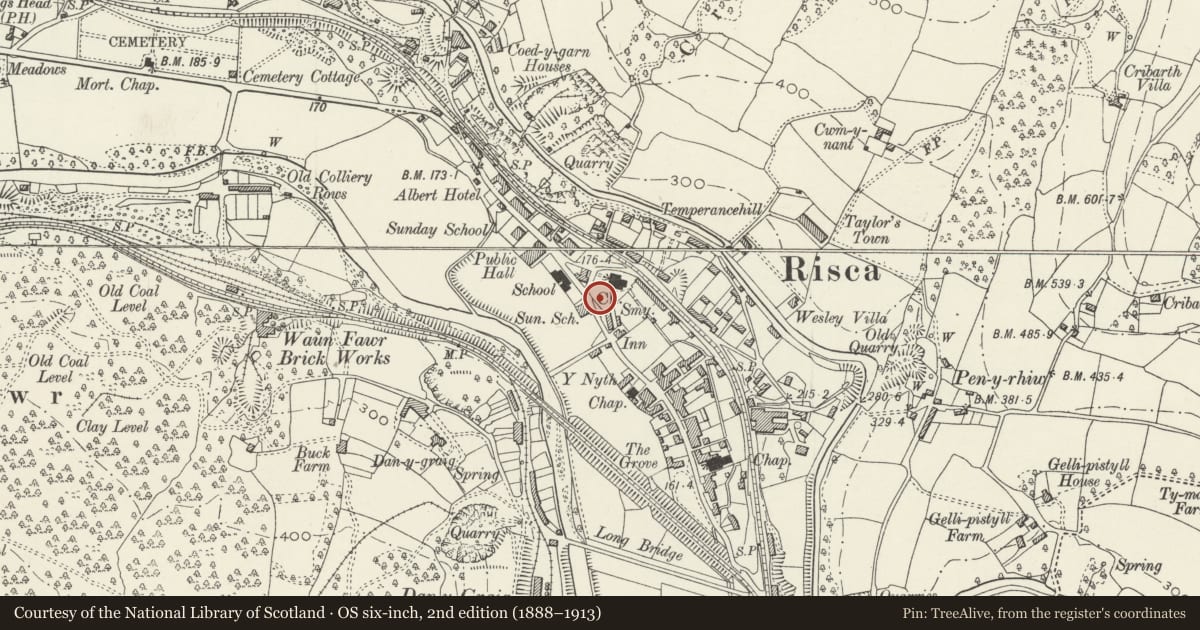
Slide toward Today to fade the historical sheet and see the modern map underneath.
David Rumsey Map Collection, Stanford LibrariesDavid Rumsey Map Collection, Stanford LibrariesDavid Rumsey Map Collection, Stanford LibrariesDavid Rumsey Map Collection, Stanford LibrariesDavid Rumsey Map Collection, Stanford Libraries
5 historical maps cover this location, the earliest the 1636 map "Cornubia : Devonia, Somersetus, Dorcestria, Wiltonia, Glocestria ..." (David Rumsey Map Collection, Stanford Libraries).
Historical maps covering this location
- 1636 · Cornubia : Devonia, Somersetus, Dorcestria, Wiltonia, Glocestria ... (David Rumsey Map Collection, Stanford Libraries)
- 1865 · England and Wales. England No. 6. (David Rumsey Map Collection, Stanford Libraries)
- 1895 · Sheet 11. Ordnance Survey of England and Wales. (David Rumsey Map Collection, Stanford Libraries)
- 1906 · 249 Newport (Hills) (David Rumsey Map Collection, Stanford Libraries)
- 1913 · Sheet 102. Newport. (David Rumsey Map Collection, Stanford Libraries)
Cadw's description
Location
Near the S churchyard wall close to main thoroughfare.
History
Churchyard crosses were erected in the later medieval period to indicate the sanctity of the ground for burial, to play a role in some parts of the liturgy and to serve as a focus for itinerant preachers. Some were truncated in post medieval period and used as sundials, which may have been the case here. The churchyard preceded the present church built 1852 on the site of a medieval church founded probably in C12. As the existing churchyard monuments are contemporary with or later than the church it is likely the churchyard was cleared at the time of the demolition and the cross may not be in its original position; it would have stood on a series of steps.
Exterior
Socket stone and part of shaft of a churchyard cross; the socket stone has chamfered angles and the shaft is broached at base.
Reason for designation
Included for its historic interest and for group value with the church, churchyard monuments and gateway.
Nearby in the register
- Church of St Mary RiscaReligious, Ritual and Funeraryunder 1 mi
- Entrance Gateway at Churchyard of St Mary RiscaReligious, Ritual and Funeraryunder 1 mi
- Church of St Mary and St MercuriusReligious, Ritual and Funeraryunder 1 mi
- Former Risca Collieries Workmen's InstituteEducationunder 1 mi
Other entries of the same register within about three miles of this one, by straight line.