Cof Cymru: National Historic Assets of Wales · Wales
Former Stable Range to W of Perthewig
Trefnant, Denbighshire, Wales
A Grade II listed building in Perthewig, Denbigh, Trefnant, Denbighshire, designated on 30 January 1968.
The record
- Designation
- Listed building, Grade II
- Broad class
- Agriculture and Subsistence
- Date of designation
- 30 January 1968
- Locality
- Perthewig
- Town
- Denbigh
- Community
- Trefnant
- Unitary authority
- Denbighshire
- Country
- Wales
- Coordinates
- 53.22808, -3.40241
- Cadw reference
- 225
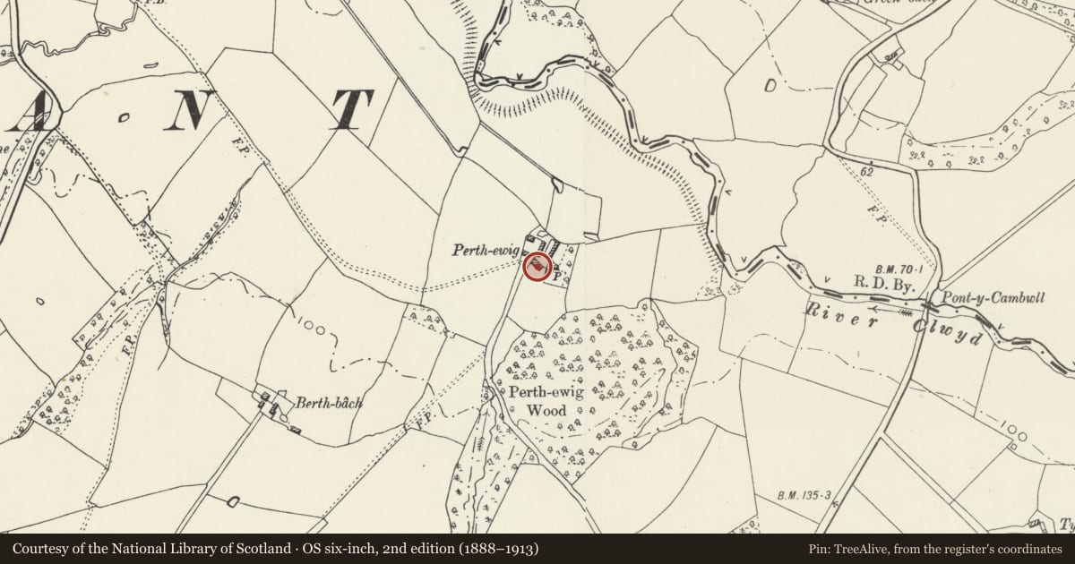
Slide toward Today to fade the historical sheet and see the modern map underneath.
David Rumsey Map Collection, Stanford LibrariesDavid Rumsey Map Collection, Stanford LibrariesLlyfrgell Genedlaethol Cymru – The National Library of WalesDavid Rumsey Map Collection, Stanford LibrariesDavid Rumsey Map Collection, Stanford Libraries
5 historical maps cover this location, the earliest the 1608 map "(13) Cambriae Typus." (David Rumsey Map Collection, Stanford Libraries).
Historical maps covering this location
- 1608 · (13) Cambriae Typus. (David Rumsey Map Collection, Stanford Libraries)
- 1795 · To Sir Watkin Williams-Wynn Bart ... the map of the six counties of North Wales is most… (Llyfrgell Genedlaethol Cymru – The National Library of Wales)
- 1830 · V.3:11-15:XV. Britisches Reich. A. Kon: England. b. Frstenthum Wales: Shire: 37-40 (David Rumsey Map Collection, Stanford Libraries)
- 1883 · Watershed map England, Wales 3. (David Rumsey Map Collection, Stanford Libraries)
- 1901 · Sheet 9 and 10. (David Rumsey Map Collection, Stanford Libraries)
Cadw's description
Location
Located immediately W of Perthewig, within a farmyard.
History
Dated 1687 and initialled 'H E P' (for Peake); former stable range, probably contemporary with the new parlour wing and barn at Perthewig.
Exterior
Two-storey rectangular building of red brick construction (English Garden Wall Bond) with medium-pitched slate roof, the former gable parapets removed. Five-bay ground floor with primary pegged oak entrance to far L and a further entrance with stable door to bay 4; C20 steel-framed windows to the remainder. All ground-floor openings have depressed brick relieving arches with modern brick infill below. Primary 2-light wooden leaded window to first floor at L, with a boarded loading bay in contemporary pegged frame to R. Between the floors is a decorative stringcourse of two oversailing header courses above a row of brick dentilations and with a further, diagonally-set dentilation course below. Above this, off-centre to the R, is a square stone plaque bearing the inscribed date 1687 together with the initials H E P. The L gable has a large central loading bay with boarded door and a further modern window. Adjoining to the R is a later single-storey carthouse; 2 bay, of rubble construction with slate roof. The front is open and there is a king-post truss within.
Interior
The interior was not inspected at the time of survey (10/97).
Reason for designation
Listed for its special historic interest as a late C17 dated brick stable range.
Group value with other listed items at Perthewig.
Nearby in the register
- Barn to NW of PerthewigAgriculture and Subsistenceunder 1 mi
- PerthewigDomesticunder 1 mi
- Pont-y-Cambwll (partly in Tremeirchion Community)Transportunder 1 mi
- Pont-y-cambwllTransportunder 1 mi
Other entries of the same register within about three miles of this one, by straight line.