Cof Cymru: National Historic Assets of Wales · Wales
Washouses to Nos. 1 & 2 Penrallt
Llandwrog, Gwynedd, Wales
A Grade II listed building in Glynllifon, Llandwrog, Gwynedd, designated on 30 September 1999.
The record
- Designation
- Listed building, Grade II
- Broad class
- Domestic
- Date of designation
- 30 September 1999
- Locality
- Glynllifon
- Community
- Llandwrog
- Unitary authority
- Gwynedd
- Country
- Wales
- Coordinates
- 53.08074, -4.29227
- Cadw reference
- 22438
Slide toward Today to fade the historical sheet and see the modern map underneath.
David Rumsey Map Collection, Stanford LibrariesDavid Rumsey Map Collection, Stanford LibrariesNational Library of ScotlandDavid Rumsey Map Collection, Stanford LibrariesLlyfrgell Genedlaethol Cymru – The National Library of Wales
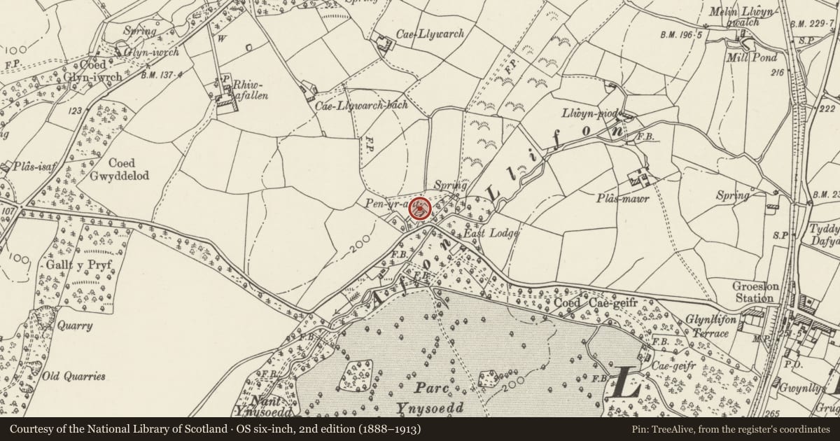
5 historical maps cover this location, the earliest the 1795 map "To Sir Watkin Williams-Wynn Bart ... the map of the six counties of North Wales is most humbly inscribed by his obedient humble servant" (Llyfrgell Genedlaethol Cymru – The National Library of Wales).
Historical maps covering this location
- 1795 · To Sir Watkin Williams-Wynn Bart ... the map of the six counties of North Wales is most… (Llyfrgell Genedlaethol Cymru – The National Library of Wales)
- 1883 · Watershed map England, Wales 3. (David Rumsey Map Collection, Stanford Libraries)
- 1888 · Caernarvonshire Sheet XVI.SW (National Library of Scotland)
- 1896 · Sheet 7. Ordnance Survey of England and Wales. (David Rumsey Map Collection, Stanford Libraries)
- 1901 · Sheet 9 and 10. (David Rumsey Map Collection, Stanford Libraries)
Cadw's description
Location
Situated immediately to north of Nos. 1 & 2 Penrallt.
History
Pair of wash houses built in association with Nos. 1 & 2 Penrallt.
Exterior
Pair of wash houses. Small single-storey rectangular building of irregularly coursed rubblestone with brownish red brick dressings; corrugated iron roof and sheeting to gable ends; central brick ridge stack with stepped capping and chimney pots. Front has boarded doors, right partly infilled and with window inserted, flanked by single-light windows with 2 horizontal bars and slate cills; boarded door to left gable end.
Interior
Left part retains incised slate fire surround but copper gone; right part not inspected at time of Survey.
Reason for designation
Included as a good example of a pair of later C19 wash houses having strong group value with their associated cottages.
Nearby in the register
- PenralltDomesticunder 1 mi
- East LodgeDomesticunder 1 mi
- High Bridge carrying road over East Drive and Afon LlifonDomesticunder 1 mi
- Stone Bridge carrying East Drive over Afon Llifon immediately north of one of the iron footbridgesDomesticunder 1 mi
Other entries of the same register within about three miles of this one, by straight line.