Cof Cymru: National Historic Assets of Wales · Wales
Sundial at the Church of St Twrog
Llandwrog, Gwynedd, Wales
A Grade II listed building in Llandwrog, Gwynedd, designated on 30 September 1999.
The record
- Designation
- Listed building, Grade II
- Broad class
- Religious, Ritual and Funerary
- Date of designation
- 30 September 1999
- Locality
- Llandwrog
- Community
- Llandwrog
- Unitary authority
- Gwynedd
- Country
- Wales
- Coordinates
- 53.07939, -4.31406
- Cadw reference
- 22416
Slide toward Today to fade the historical sheet and see the modern map underneath.
David Rumsey Map Collection, Stanford LibrariesDavid Rumsey Map Collection, Stanford LibrariesDavid Rumsey Map Collection, Stanford LibrariesDavid Rumsey Map Collection, Stanford LibrariesLlyfrgell Genedlaethol Cymru – The National Library of Wales
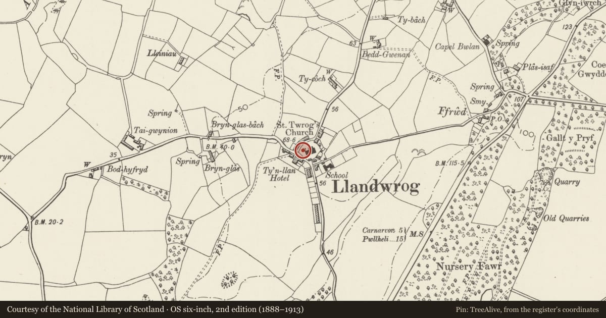
5 historical maps cover this location, the earliest the 1795 map "To Sir Watkin Williams-Wynn Bart ... the map of the six counties of North Wales is most humbly inscribed by his obedient humble servant" (Llyfrgell Genedlaethol Cymru – The National Library of Wales).
Historical maps covering this location
- 1795 · To Sir Watkin Williams-Wynn Bart ... the map of the six counties of North Wales is most… (Llyfrgell Genedlaethol Cymru – The National Library of Wales)
- 1883 · Watershed map England, Wales 3. (David Rumsey Map Collection, Stanford Libraries)
- 1896 · Sheet 7. Ordnance Survey of England and Wales. (David Rumsey Map Collection, Stanford Libraries)
- 1899 · 118 Nevin (Hills) (David Rumsey Map Collection, Stanford Libraries)
- 1901 · Sheet 9 and 10. (David Rumsey Map Collection, Stanford Libraries)
Cadw's description
Location
Situated on mound near the south-west corner of St Twrog's Churchyard.
History
Mid-C18 sundial. Brass plate to the top of the sundial is inscribed "1746 The Gift of R.G. Rector". Chamber beneath was formerly the so-called Death House for the parish, the registers showing that the bodies of seafarers found occasionally on the shore were brought here before burial.
Exterior
Local stone. Tapering baluster shaft with moulded capping and plinth on octagonal base. Inscribed brass plate with gnomon to top. Mound on which sundial sits covers stone chamber with brick barrel vault, approached down steep flight of slate steps (see History).
Reason for designation
Included as a well-preserved mid-C18 sundial, which has group value with St Twrog's Church and its churchyard wall.
Nearby in the register
- Lych-gate and churchyard wall at the Church of St TwrogReligious, Ritual and Funeraryunder 1 mi
- No.1 Tai'r Eglwys (Church Cottages)Domesticunder 1 mi
- No.2 Tai'r Eglwys (Church Cottages)Domesticunder 1 mi
- CilgantDomesticunder 1 mi
Other entries of the same register within about three miles of this one, by straight line.