Cof Cymru: National Historic Assets of Wales · Wales
Range of Outbuildings on N side of yard of Llys Mair
Whitford, Flintshire, Wales
A Grade II listed building in Whitford, Holywell, Flintshire, designated on 28 September 1999.
The record
- Designation
- Listed building, Grade II
- Broad class
- Domestic
- Date of designation
- 28 September 1999
- Locality
- Whitford
- Town
- Holywell
- Community
- Whitford
- Unitary authority
- Flintshire
- Country
- Wales
- Coordinates
- 53.29370, -3.28010
- Cadw reference
- 22367
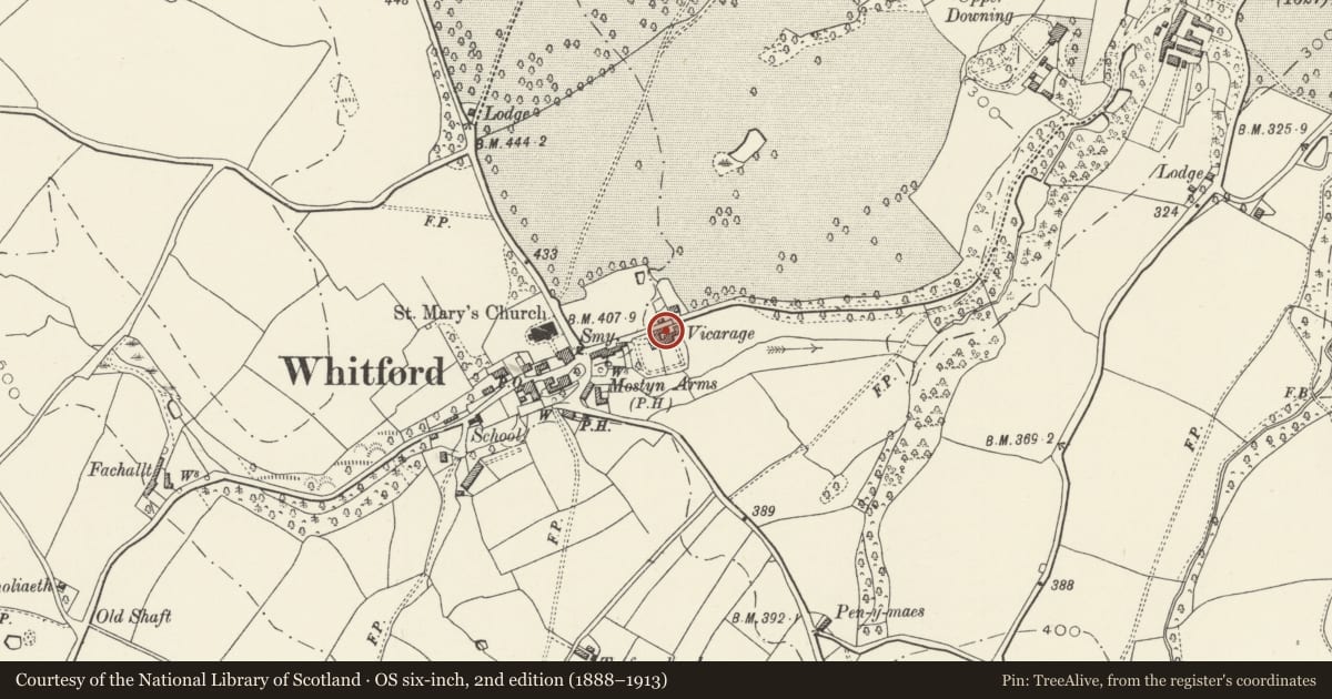
Slide toward Today to fade the historical sheet and see the modern map underneath.
David Rumsey Map Collection, Stanford LibrariesDavid Rumsey Map Collection, Stanford LibrariesDavid Rumsey Map Collection, Stanford LibrariesLlyfrgell Genedlaethol Cymru – The National Library of WalesDavid Rumsey Map Collection, Stanford Libraries
5 historical maps cover this location, the earliest the 1795 map "To Sir Watkin Williams-Wynn Bart ... the map of the six counties of North Wales is most humbly inscribed by his obedient humble servant" (Llyfrgell Genedlaethol Cymru – The National Library of Wales).
Historical maps covering this location
- 1795 · To Sir Watkin Williams-Wynn Bart ... the map of the six counties of North Wales is most… (Llyfrgell Genedlaethol Cymru – The National Library of Wales)
- 1830 · V.3:11-15:XV. Britisches Reich. A. Kon: England. b. Frstenthum Wales: Shire: 37-40 (David Rumsey Map Collection, Stanford Libraries)
- 1883 · Watershed map England, Wales 3. (David Rumsey Map Collection, Stanford Libraries)
- 1896 · 96 Liverpool (Hills) (David Rumsey Map Collection, Stanford Libraries)
- 1901 · Sheet 9 and 10. (David Rumsey Map Collection, Stanford Libraries)
Cadw's description
Location
The yard is to the E of the former vicarage. The rear of this building forms the boundary wall with Upper Downing Road.
History
Early-to-mid C19 range of outbuildings.
Exterior
Single-storey range of outbuildings, constructed of rubble stone under a slate roof. Wide central doorway with flat head and boarded doors. Planked door to L with brick jambs and a concrete lintel. Stable doors to R with brick surround. To its R is a small 2-light window with red brick dressings. The E gable has a square loft opening with planked door and a pair of ventilation slits below; blank rear elevation to road.
Interior
No access to interior at time of inspection.
Reason for designation
Listed for group value with former vicarage.
Nearby in the register
- Stable/Cartshed Range on S side of yard to Llys MairAgriculture and Subsistenceunder 1 mi
- Llys MairDomesticunder 1 mi
- Former Cartshed in rear yard of Llys MairAgriculture and Subsistenceunder 1 mi
- Telephone Call-boxCommunicationsunder 1 mi
Other entries of the same register within about three miles of this one, by straight line.