Cof Cymru: National Historic Assets of Wales · Wales
Brynaerau uchaf
Clynnog, Gwynedd, Wales
A Grade II listed building in Pontllyfni, Caernarfon, Clynnog, Gwynedd, designated on 15 September 1999.
The record
- Designation
- Listed building, Grade II
- Broad class
- Domestic
- Date of designation
- 15 September 1999
- Locality
- Pontllyfni
- Town
- Caernarfon
- Community
- Clynnog
- Unitary authority
- Gwynedd
- Country
- Wales
- Coordinates
- 53.04261, -4.33351
- Cadw reference
- 22343
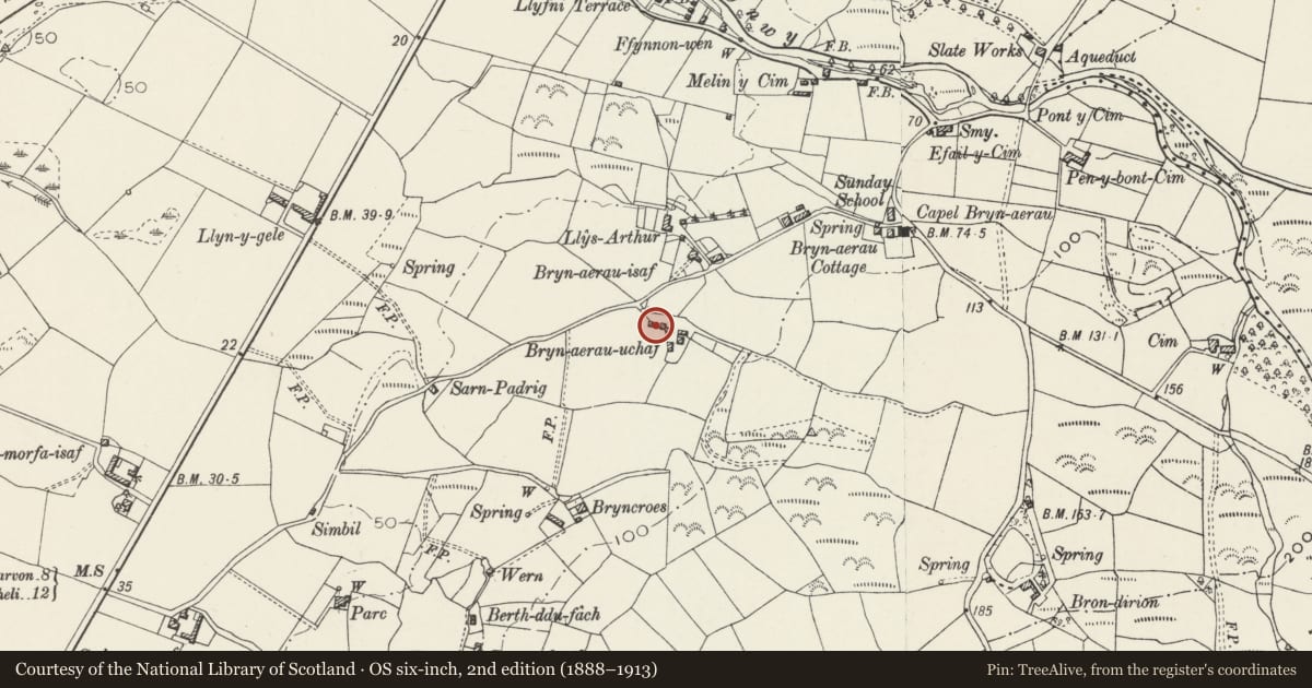
Slide toward Today to fade the historical sheet and see the modern map underneath.
David Rumsey Map Collection, Stanford LibrariesDavid Rumsey Map Collection, Stanford LibrariesDavid Rumsey Map Collection, Stanford LibrariesDavid Rumsey Map Collection, Stanford LibrariesLlyfrgell Genedlaethol Cymru – The National Library of Wales
5 historical maps cover this location, the earliest the 1795 map "To Sir Watkin Williams-Wynn Bart ... the map of the six counties of North Wales is most humbly inscribed by his obedient humble servant" (Llyfrgell Genedlaethol Cymru – The National Library of Wales).
Historical maps covering this location
- 1795 · To Sir Watkin Williams-Wynn Bart ... the map of the six counties of North Wales is most… (Llyfrgell Genedlaethol Cymru – The National Library of Wales)
- 1883 · Watershed map England, Wales 3. (David Rumsey Map Collection, Stanford Libraries)
- 1896 · Sheet 7. Ordnance Survey of England and Wales. (David Rumsey Map Collection, Stanford Libraries)
- 1899 · 118 Nevin (Hills) (David Rumsey Map Collection, Stanford Libraries)
- 1901 · Sheet 9 and 10. (David Rumsey Map Collection, Stanford Libraries)
Cadw's description
Location
The farm lies SE of the hamlet of Pontllyfni, on a minor road leading to the SW.
History
The building is probably of the C16 or early C17.
Exterior
Built of stone rubble on boulder foundations, and painted white. Renewed slate roof replacing thatch. Cement copings and gable stacks. One storey and attic. A central open gabled porch with round external arch, and a boarded door with 2 small glazed lights. Two and 3-light stained wood windows, set deeply in the walls each side of the doorway, and two small attic windows breaking the eaves line, with cat-slide roofs. Gable stacks with an added brick flue at the E end, and a small square window in the W gable end. Doors at the rear and added lean-to under an extension of the roof.
Interior
Not accessible at the time of inspection.
Reason for designation
Included, notwithstanding loss of detail, as a good example of a substantial lowland sub-medieval farmhouse retaining vernacular character.
Nearby in the register
- Pont-y-cimTransportunder 1 mi
- Pont y CimBridgeunder 1 mi
- Craig y Dinas CampHillfortunder 1 mi
- Penarth Burial ChamberChambered Tombunder 1 mi
Other entries of the same register within about three miles of this one, by straight line.