Cof Cymru: National Historic Assets of Wales · Wales
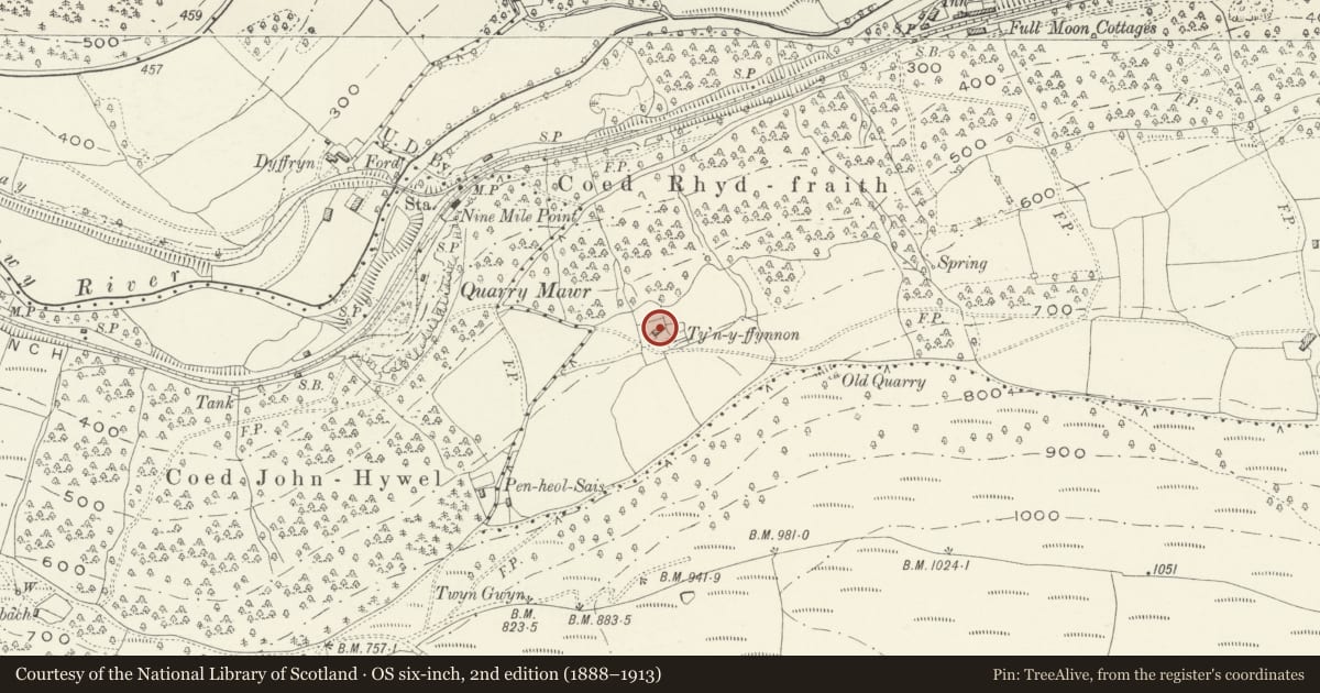
Ty'n-y-ffynnon
Ynysddu, Caerphilly, Wales
A Grade II listed building in Mynydd Grug, Ynysddu, Caerphilly, designated on 16 September 1999.
The record
- Designation
- Listed building, Grade II
- Broad class
- Domestic
- Date of designation
- 16 September 1999
- Locality
- Mynydd Grug
- Community
- Ynysddu
- Unitary authority
- Caerphilly
- Country
- Wales
- Coordinates
- 51.61125, -3.14664
- Cadw reference
- 22321
Slide toward Today to fade the historical sheet and see the modern map underneath.
David Rumsey Map Collection, Stanford LibrariesDavid Rumsey Map Collection, Stanford LibrariesDavid Rumsey Map Collection, Stanford LibrariesDavid Rumsey Map Collection, Stanford LibrariesDavid Rumsey Map Collection, Stanford Libraries
5 historical maps cover this location, the earliest the 1636 map "Cornubia : Devonia, Somersetus, Dorcestria, Wiltonia, Glocestria ..." (David Rumsey Map Collection, Stanford Libraries).
Historical maps covering this location
- 1636 · Cornubia : Devonia, Somersetus, Dorcestria, Wiltonia, Glocestria ... (David Rumsey Map Collection, Stanford Libraries)
- 1865 · England and Wales. England No. 6. (David Rumsey Map Collection, Stanford Libraries)
- 1895 · Sheet 11. Ordnance Survey of England and Wales. (David Rumsey Map Collection, Stanford Libraries)
- 1906 · 249 Newport (Hills) (David Rumsey Map Collection, Stanford Libraries)
- 1913 · Sheet 102. Newport. (David Rumsey Map Collection, Stanford Libraries)
Cadw's description
Location
High on the S slope of the Sirhowy Valley above Wattsville, reached by the mountain road running below the crest of Mynydd Grug and then down a farm track.
History
Probably mostly early-mid C19. Appears on Machen Ttithe Map of 1841.
Exterior
Mountain farmhouse. Of limewashed stone with stone-tiled roof incorporating 3 half-dormers to front and corniced brick ridge and end stacks. Casement windows mostly with small panes and stone sills. 2-window range to ground floor with boarded door end right. To rear a catslide roof over outshut with curtailed roof to 2-storey end bay on right; this has a 16-pane first floor casement window and boarded door below. Attached to front is a rectangular rubble wall with wicket gate creating a small courtyard; attached to right and stepped down is a small barn bay with doorway and ventilation slit.
Reason for designation
Listed as an uncommon survival in this area of a small regional mountain farmstead retaining almost all its original exterior fabric and character.
Nearby in the register
- Former Penllwyn Tramroad Viaduct at Nine Mile PointTransportunder 1 mi
- Church of St JohnReligious, Ritual and Funerary1 mi
- House Platforms to W of Mynydd MachenHouse Platform1 mi
- War Memorial within Railed EnclosureCommemorative1 mi
Other entries of the same register within about three miles of this one, by straight line.