Cof Cymru: National Historic Assets of Wales · Wales
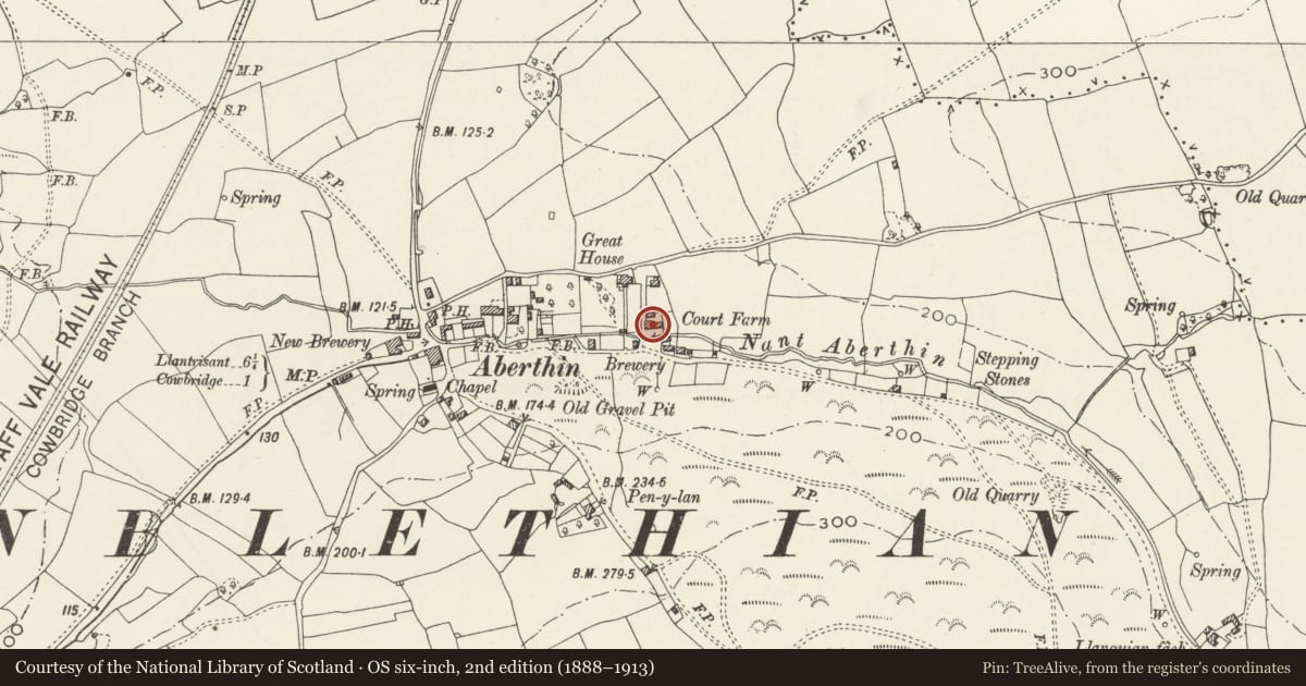
Range of buildings at Court Farm
Cowbridge with Llanblethian, Vale of Glamorgan, Wales
A Grade II listed building in Aberthin, Cowbridge with Llanblethian, Vale of Glamorgan, designated on 16 September 1999.
The record
- Designation
- Listed building, Grade II
- Broad class
- Domestic
- Date of designation
- 16 September 1999
- Locality
- Aberthin
- Community
- Cowbridge with Llanblethian
- Unitary authority
- Vale of Glamorgan
- Country
- Wales
- Coordinates
- 51.46734, -3.42494
- Cadw reference
- 22308
Slide toward Today to fade the historical sheet and see the modern map underneath.
David Rumsey Map Collection, Stanford LibrariesDavid Rumsey Map Collection, Stanford LibrariesDavid Rumsey Map Collection, Stanford LibrariesDavid Rumsey Map Collection, Stanford LibrariesDavid Rumsey Map Collection, Stanford Libraries
5 historical maps cover this location, the earliest the 1636 map "Cornubia : Devonia, Somersetus, Dorcestria, Wiltonia, Glocestria ..." (David Rumsey Map Collection, Stanford Libraries).
Historical maps covering this location
- 1636 · Cornubia : Devonia, Somersetus, Dorcestria, Wiltonia, Glocestria ... (David Rumsey Map Collection, Stanford Libraries)
- 1637 · The fourth table of England. Cornub. Devonia, Somerset etc. (David Rumsey Map Collection, Stanford Libraries)
- 1865 · England and Wales. England No. 6. (David Rumsey Map Collection, Stanford Libraries)
- 1897 · 262 Pontypridd (Hills) (David Rumsey Map Collection, Stanford Libraries)
- 1897 · 262 Pontypridd (Outline) (David Rumsey Map Collection, Stanford Libraries)
Cadw's description
Location
Set back to N of Nant Aberthin, about 120m SE of Great House (Ty Mawr).
History
Probably C19 rebuilding of earlier structure, incorporating dressed medieval stonework, perhaps from Llanquian Castle.
Exterior
Long 2-storey range in brown stone with paler freestone dressings, slate roof, rectangular stone chimneys. On first floor, five 2-light mullioned windows. On ground floor, from L, 2-light mullioned window, Gothic doorway, window (3-light), 2 more windows, doorway and further 2 windows. Left gable has stone steps up to first floor doorway.
Nearby in the register
- Gate House and bridge at Ty MawrDomesticunder 1 mi
- Great House (Ty Mawr), AberthinDomesticunder 1 mi
- The Sweetings (Including attached Barn and Stable Range to W)Domesticunder 1 mi
- Stalling Down Round BarrowRound Barrowunder 1 mi
Other entries of the same register within about three miles of this one, by straight line.