Cof Cymru: National Historic Assets of Wales · Wales
Stables/coach house at Plas Tirion
Llanrug, Gwynedd, Wales
A Grade II listed building in Llanrug, Gwynedd, designated on 27 August 1999.
The record
- Designation
- Listed building, Grade II
- Broad class
- Domestic
- Date of designation
- 27 August 1999
- Locality
- Llanrug
- Community
- Llanrug
- Unitary authority
- Gwynedd
- Country
- Wales
- Coordinates
- 53.14174, -4.20675
- Cadw reference
- 22242
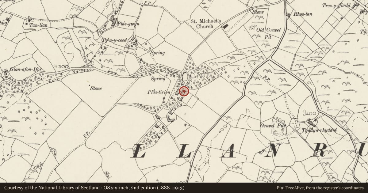
Slide toward Today to fade the historical sheet and see the modern map underneath.
David Rumsey Map Collection, Stanford LibrariesDavid Rumsey Map Collection, Stanford LibrariesDavid Rumsey Map Collection, Stanford LibrariesDavid Rumsey Map Collection, Stanford LibrariesDavid Rumsey Map Collection, Stanford Libraries
5 historical maps cover this location, the earliest the 1896 map "Sheet 7. Ordnance Survey of England and Wales." (David Rumsey Map Collection, Stanford Libraries).
Historical maps covering this location
- 1896 · Sheet 7. Ordnance Survey of England and Wales. (David Rumsey Map Collection, Stanford Libraries)
- 1899 · 106 Bangor (Outline) (David Rumsey Map Collection, Stanford Libraries)
- 1899 · 106 Bangor (Hills) (David Rumsey Map Collection, Stanford Libraries)
- 1901 · Sheet 9 and 10. (David Rumsey Map Collection, Stanford Libraries)
- 1919 · Sheet 41. Anglesey. (David Rumsey Map Collection, Stanford Libraries)
Cadw's description
Location
Situated on the south-west side of the yard on the other side of the track to the east of the house at Plas Tirion.
History
Built in the early C19 as part of the remodelling of the house and the erection of the walled garden and other structures at this time; the building is likely to have declined in importance after the construction of new stables for riding horses in c1880.
Exterior
2-storey rectangular plan building, aligned north-west to south-east. Roughly coursed rubblestone blocks, slate hung to rear; slate roof. Front has 3 eaves windows, left and centre C20 2-light casements, right a C19 12-paned sash, but all in their roughly square original openings. Wide double doors to left on ground floor with tall fixed-light 12-paned window and boarded door under narrow rectangular overlight to centre, all with large stone lintels. Right gable end has steps to first floor with substantial lean-to hood over doorway.
Interior
First floor has A-frame trusses with high collars; evidence of former partitioning for grooms' accommodation.
Reason for designation
Included as a well-preserved early C19 stables/coach house, having strong physical and functional association with the house and other structures at Plas Tirion.
Nearby in the register
- Walled garden at Plas TirionGardens, Parks and Urban Spacesunder 1 mi
- Stables at Plas TirionDomesticunder 1 mi
- Plas TirionDomesticunder 1 mi
- Lych-gate at Church of St MichaelReligious, Ritual and Funeraryunder 1 mi
Other entries of the same register within about three miles of this one, by straight line.