Cof Cymru: National Historic Assets of Wales · Wales
Blaennantgwinne Cottages
Llandybie, Carmarthenshire, Wales
A Grade II listed building in Pentre Gwenlais, Ammanford, Llandybie, Carmarthenshire, designated on 27 August 1999.
The record
- Designation
- Listed building, Grade II
- Broad class
- Domestic
- Date of designation
- 27 August 1999
- Locality
- Pentre Gwenlais
- Town
- Ammanford
- Community
- Llandybie
- Unitary authority
- Carmarthenshire
- Country
- Wales
- Coordinates
- 51.82718, -4.01893
- Cadw reference
- 22227
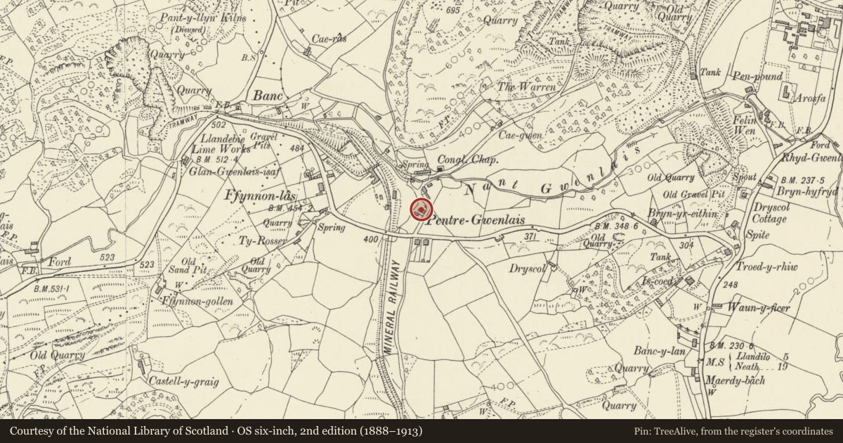
Slide toward Today to fade the historical sheet and see the modern map underneath.
David Rumsey Map Collection, Stanford LibrariesDavid Rumsey Map Collection, Stanford LibrariesDavid Rumsey Map Collection, Stanford LibrariesDavid Rumsey Map Collection, Stanford LibrariesDavid Rumsey Map Collection, Stanford Libraries
5 historical maps cover this location, the earliest the 1860 map "41. Caermathen." (David Rumsey Map Collection, Stanford Libraries).
Historical maps covering this location
- 1860 · 41. Caermathen. (David Rumsey Map Collection, Stanford Libraries)
- 1891 · Sheet 10. Ordnance Survey of England and Wales. . (David Rumsey Map Collection, Stanford Libraries)
- 1898 · 230 Ammanford (Hills) (David Rumsey Map Collection, Stanford Libraries)
- 1898 · 230 Ammanford (Outline) (David Rumsey Map Collection, Stanford Libraries)
- 1901 · Sheet 14. (David Rumsey Map Collection, Stanford Libraries)
Cadw's description
Location
To the south side of Nant Gwenlais, and reached from the present-day hamlet of Pentregwenlais by a lane north of the road.
History
Late C18 or early C19 cottages, included in the Tithe Survey, 1840, as Pentregwenlais cottages and gardens, owned by the Cawdor estate and occupied by William Owen. The two cottages were closed as unfit in the late 1960s. They are a remnant of what was formerly the thriving industrial hamlet of Pentregwenlais.
Exterior
Pair of cottages facing north, in rubble masonry with several courses of brickwork near to the eaves. Corrugated sheet roofing. The height in both cases suggests a croglofft. Each cottage has a central vertically boarded door between two windows. Central stone chimney shared by the two cottages. Small loft window in the east gable, of four panes. Both cottages have the window nearer to the central chimney smaller than the other. One casement window of six panes survives in the left cottage, one four-pane sash window in the right. There is also a single doorway in the rear wall, opposite to the chimney.
The floor level of the left cottage is about 0.5m higher than the right cottage.
Reason for designation
A pair of small early C19 cottages, retaining vernacular character and of a type now rare in this part of Carmarthenshire.
Nearby in the register
- Bank of Lime Kilns at Pentre Gwenlais Stone Quarry, Pentre Gwenlais Road (NE side)Industrialunder 1 mi
- Pant-y-llyn LimekilnsIndustrialunder 1 mi
- Felin Wen, LlandybieIndustrialunder 1 mi
- Cil-yr-ychen Lime KilnsIndustrialunder 1 mi
Other entries of the same register within about three miles of this one, by straight line.