Cof Cymru: National Historic Assets of Wales · Wales
Glynhir Bailiff's Cottage
Llandybie, Carmarthenshire, Wales
A Grade II listed building in Glynhir, Ammanford, Llandybie, Carmarthenshire, designated on 27 August 1999.
The record
- Designation
- Listed building, Grade II
- Broad class
- Agriculture and Subsistence
- Date of designation
- 27 August 1999
- Locality
- Glynhir
- Town
- Ammanford
- Community
- Llandybie
- Unitary authority
- Carmarthenshire
- Country
- Wales
- Coordinates
- 51.81817, -3.97502
- Cadw reference
- 22218
Slide toward Today to fade the historical sheet and see the modern map underneath.
David Rumsey Map Collection, Stanford LibrariesDavid Rumsey Map Collection, Stanford LibrariesDavid Rumsey Map Collection, Stanford LibrariesDavid Rumsey Map Collection, Stanford LibrariesDavid Rumsey Map Collection, Stanford Libraries
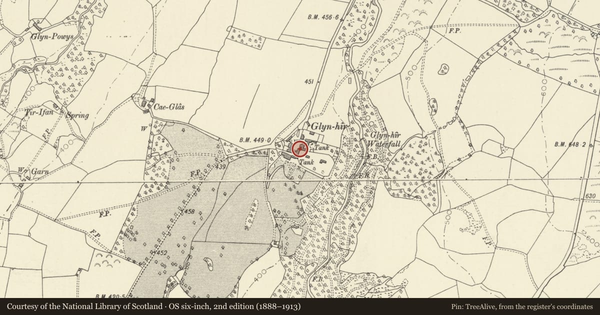
5 historical maps cover this location, the earliest the 1860 map "41. Caermathen." (David Rumsey Map Collection, Stanford Libraries).
Historical maps covering this location
- 1860 · 41. Caermathen. (David Rumsey Map Collection, Stanford Libraries)
- 1891 · Sheet 10. Ordnance Survey of England and Wales. . (David Rumsey Map Collection, Stanford Libraries)
- 1898 · 230 Ammanford (Hills) (David Rumsey Map Collection, Stanford Libraries)
- 1898 · 230 Ammanford (Outline) (David Rumsey Map Collection, Stanford Libraries)
- 1901 · Sheet 14. (David Rumsey Map Collection, Stanford Libraries)
Cadw's description
Location
To the south side of Glynhir farmyard; the rear is to the north side of the access yard to Glynhir mansion.
History
A farmhouse (with the Courtyard Cottage possibly as an attached original cottage) probably pre-dating the acquisition of Glynhir by Peter DuBuisson in 1770. This building and the barn are probably all that remain of the farmyard buildings and 'great improvements . . . made by the late owner' then referred to in the notice of sale of the estate.
Exterior
The centrepiece of a two-storey farmhouse range linked by an infill section to the east, slightly set back, to the Coach-house block. The cottage or former farmhouse faces north to the farmyard. Local sandstone rubble masonry, local sandstone roofing slabs with tile ridges. Rendered chimneys at each end of the cottage.
The north elevation of the Bailiff's cottage (to east of the Brewhouse link) is of two windows to the upper storey, with square openings tight to the eaves. Doorway and three windows below with cambered arches. Simple porch to doorway. All front elevation carpentry replaced.
The rear elevation, facing the mansion, is a range of three segmental-arched two-light casement windows of which the one to the right has been walled up. Each casement of four panes. Stone sills. Beneath the latter window is a ground storey fixed eight-pane window with a deep segmental head and a stone sill.
Reason for designation
Listed as a vernacular building of some character and for group value as one of an exceptionally complete series of estate buildings at Glynhir.
Nearby in the register
- Glynhir BarnAgriculture and Subsistenceunder 1 mi
- Glynhir Coach-houseDomesticunder 1 mi
- Glynhir Courtyard CottageAgriculture and Subsistenceunder 1 mi
- Glynhir Brewhouse and Yard WallDomesticunder 1 mi
Other entries of the same register within about three miles of this one, by straight line.