Cof Cymru: National Historic Assets of Wales · Wales
Garn Limekiln No. III (3rd from north in group)
Llanfihangel Aberbythych, Carmarthenshire, Wales
A Grade II listed building in Carmel Woods, Llanelli, Llanfihangel Aberbythych, Carmarthenshire, designated on 27 August 1999.
The record
- Designation
- Listed building, Grade II
- Broad class
- Industrial
- Date of designation
- 27 August 1999
- Locality
- Carmel Woods
- Town
- Llanelli
- Community
- Llanfihangel Aberbythych
- Unitary authority
- Carmarthenshire
- Country
- Wales
- Coordinates
- 51.82625, -4.04737
- Cadw reference
- 22189
Slide toward Today to fade the historical sheet and see the modern map underneath.
David Rumsey Map Collection, Stanford LibrariesDavid Rumsey Map Collection, Stanford LibrariesDavid Rumsey Map Collection, Stanford LibrariesDavid Rumsey Map Collection, Stanford LibrariesDavid Rumsey Map Collection, Stanford Libraries
5 historical maps cover this location, the earliest the 1860 map "41. Caermathen." (David Rumsey Map Collection, Stanford Libraries).
Historical maps covering this location
- 1860 · 41. Caermathen. (David Rumsey Map Collection, Stanford Libraries)
- 1891 · Sheet 10. Ordnance Survey of England and Wales. . (David Rumsey Map Collection, Stanford Libraries)
- 1898 · 230 Ammanford (Hills) (David Rumsey Map Collection, Stanford Libraries)
- 1898 · 230 Ammanford (Outline) (David Rumsey Map Collection, Stanford Libraries)
- 1901 · Sheet 14. (David Rumsey Map Collection, Stanford Libraries)
Cadw's description
Location
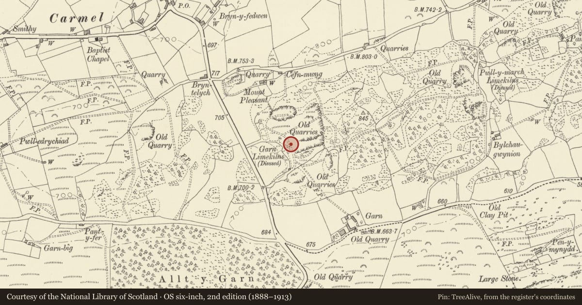
Near the middle of a group of four surviving kilns 100m east of the A476, reached by a short lane 200m south of Eglwys Fair, Carmel. Quarry to the east.
History
One of several limekilns at this location in use in c1876-85. At this time it had a tramway from the quarry. Disused by 1906.
The landholding was a part of the Cawdor estate named Tir-y-garn (based on Garn farmhouse, 300m south-east.
Exterior
A poorly accessible limekiln in limestone masonry. Straight front wall. Two working areas, each with a large semicircular outer arch. The left working holes only are accessible, with difficulty.
A road now runs over the top and the interior diameter is not ascertainable.
Reason for designation
One of the better-surviving limekilns in an area of intensive C19 and C20 quarrying and lime-burning industry; one of an important surviving contemporary group.
Nearby in the register
- Garn Limekiln No. II (2nd from north in group)Industrialunder 1 mi
- Garn Limekiln No. IV (southernmost in group)Industrialunder 1 mi
- Garn Limekiln No. I (northernmost in group)Industrialunder 1 mi
- Pwll-y-march LimekilnsIndustrialunder 1 mi
Other entries of the same register within about three miles of this one, by straight line.