Cof Cymru: National Historic Assets of Wales · Wales
Garden Wall of the Former Mansion
Llanfihangel Aberbythych, Carmarthenshire, Wales
A Grade II listed building in Golden Grove Park, Carmarthen, Llanfihangel Aberbythych, Carmarthenshire, designated on 27 August 1999.
The record
- Designation
- Listed building, Grade II
- Broad class
- Domestic
- Date of designation
- 27 August 1999
- Locality
- Golden Grove Park
- Town
- Carmarthen
- Community
- Llanfihangel Aberbythych
- Unitary authority
- Carmarthenshire
- Country
- Wales
- Coordinates
- 51.86394, -4.03752
- Cadw reference
- 22174
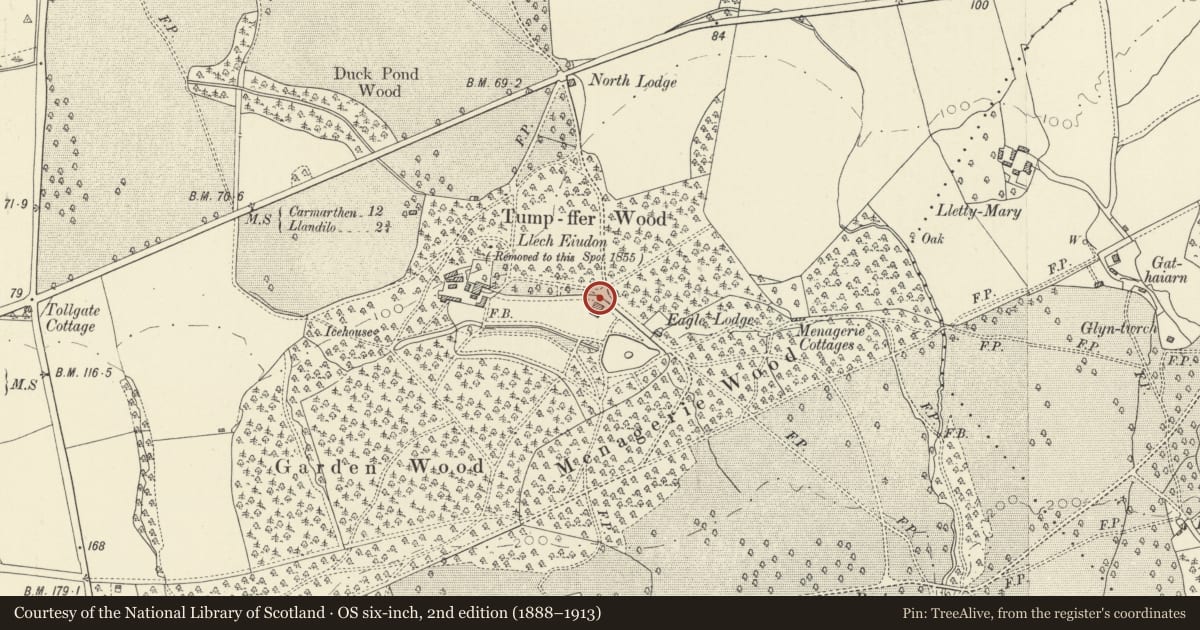
Slide toward Today to fade the historical sheet and see the modern map underneath.
David Rumsey Map Collection, Stanford LibrariesDavid Rumsey Map Collection, Stanford LibrariesDavid Rumsey Map Collection, Stanford LibrariesDavid Rumsey Map Collection, Stanford LibrariesDavid Rumsey Map Collection, Stanford Libraries
5 historical maps cover this location, the earliest the 1860 map "41. Caermathen." (David Rumsey Map Collection, Stanford Libraries).
Historical maps covering this location
- 1860 · 41. Caermathen. (David Rumsey Map Collection, Stanford Libraries)
- 1891 · Sheet 10. Ordnance Survey of England and Wales. . (David Rumsey Map Collection, Stanford Libraries)
- 1898 · 230 Ammanford (Hills) (David Rumsey Map Collection, Stanford Libraries)
- 1898 · 230 Ammanford (Outline) (David Rumsey Map Collection, Stanford Libraries)
- 1901 · Sheet 14. (David Rumsey Map Collection, Stanford Libraries)
Cadw's description
Location
Near the site of the old Golden Grove mansion, about 300m south of the North Lodge, extending from near Garden Cottage to near Eagle Lodge
History
Probably late C18, contemporary with the second Golden Grove mansion of the Vaughan family (which was built c1755). The wall runs east and south-east from the site of mansion to near the old line of the turnpike road, and formed the north side of the gardens.
Exterior
Part rubble masonry, part brickwork wall approximately 4-5m in height as surviving, about 0.6m in thickness. A gateway (dated 1854) has been formed at the west end for access to Garden Cottage.
Reason for designation
The last substantial survival of the environs of the Golden Grove of the Vaughan era.
Nearby in the register
- Eagle LodgeDomesticunder 1 mi
- North LodgeDomesticunder 1 mi
- Golden Grove TerraceDomesticunder 1 mi
- Golden Grove MansionDomesticunder 1 mi
Other entries of the same register within about three miles of this one, by straight line.