Cof Cymru: National Historic Assets of Wales · Wales
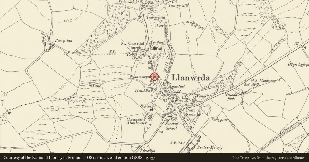
Plas Newydd including front railings and gate.
Llanwrda, Carmarthenshire, Wales
A Grade II listed building in Llanwrda, Carmarthenshire, designated on 20 July 1999.
The record
- Designation
- Listed building, Grade II
- Broad class
- Domestic
- Date of designation
- 20 July 1999
- Locality
- Llanwrda
- Town
- Llanwrda
- Community
- Llanwrda
- Unitary authority
- Carmarthenshire
- Country
- Wales
- Coordinates
- 51.96959, -3.87561
- Cadw reference
- 22031
Slide toward Today to fade the historical sheet and see the modern map underneath.
David Rumsey Map Collection, Stanford LibrariesDavid Rumsey Map Collection, Stanford LibrariesDavid Rumsey Map Collection, Stanford LibrariesDavid Rumsey Map Collection, Stanford LibrariesDavid Rumsey Map Collection, Stanford Libraries
5 historical maps cover this location, the earliest the 1860 map "41. Caermathen." (David Rumsey Map Collection, Stanford Libraries).
Historical maps covering this location
- 1860 · 41. Caermathen. (David Rumsey Map Collection, Stanford Libraries)
- 1891 · Sheet 10. Ordnance Survey of England and Wales. . (David Rumsey Map Collection, Stanford Libraries)
- 1898 · 212 Llandovery (Outline) (David Rumsey Map Collection, Stanford Libraries)
- 1898 · 212 Llandovery (Hills) (David Rumsey Map Collection, Stanford Libraries)
- 1901 · Sheet 14. (David Rumsey Map Collection, Stanford Libraries)
Cadw's description
Location
Situated on W side of A478 some 150m S of church.
History
Estate house dated 1866 on coping stone of front railing. Possibly built for the Bishop family of Dolgarreg, Myddfai.
Exterior
House, rubble stone with grey limestone quoins, steep slate overhanging roof and stone end stacks. One and a half storeys, two-window range of large triple casements, the centre one only opening, in yellow brick frames with slate sills. Upper windows break eaves under bargeboarded gables. End gables have similar fretted bargeboards. Entrance is in S end wall, half-glazed door in gabled slate-roofed porch with fishscale slates. Solid rear wall, open to S end with low wall, entry to E with timber piers and angle braces. Rear has small-paned casement pair windows two each floor and similar centre stair-light, in yellow brick surrounds.
Attached to front right corner is iron railing on low stone coping, one stone dated 1866. Two iron rod rails through flat stanchions with scroll tops. At left end is iron gate with dog-bars between 2 stone piers.
Reason for designation
Included as a good example of a mid to later C19 estate house.
Nearby in the register
- BorezellRecreationalunder 1 mi
- The War MemorialCommemorativeunder 1 mi
- Lychgate to Church of St CwrdafReligious, Ritual and Funeraryunder 1 mi
- Church of Saint CwrdafReligious, Ritual and Funeraryunder 1 mi
Other entries of the same register within about three miles of this one, by straight line.