Cof Cymru: National Historic Assets of Wales · Wales
Barley Mount
Llanwrda, Carmarthenshire, Wales
A Grade II listed building in Glanmynys, Llandovery, Llanwrda, Carmarthenshire, designated on 20 July 1999.
The record
- Designation
- Listed building, Grade II
- Broad class
- Domestic
- Date of designation
- 20 July 1999
- Locality
- Glanmynys
- Town
- Llandovery
- Community
- Llanwrda
- Unitary authority
- Carmarthenshire
- Country
- Wales
- Coordinates
- 51.98196, -3.85019
- Cadw reference
- 22027
Slide toward Today to fade the historical sheet and see the modern map underneath.
David Rumsey Map Collection, Stanford LibrariesDavid Rumsey Map Collection, Stanford LibrariesDavid Rumsey Map Collection, Stanford LibrariesDavid Rumsey Map Collection, Stanford LibrariesDavid Rumsey Map Collection, Stanford Libraries
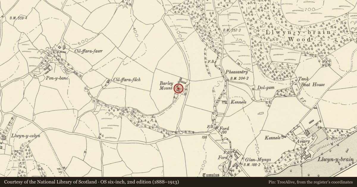
5 historical maps cover this location, the earliest the 1860 map "41. Caermathen." (David Rumsey Map Collection, Stanford Libraries).
Historical maps covering this location
- 1860 · 41. Caermathen. (David Rumsey Map Collection, Stanford Libraries)
- 1891 · Sheet 10. Ordnance Survey of England and Wales. . (David Rumsey Map Collection, Stanford Libraries)
- 1898 · 212 Llandovery (Outline) (David Rumsey Map Collection, Stanford Libraries)
- 1898 · 212 Llandovery (Hills) (David Rumsey Map Collection, Stanford Libraries)
- 1901 · Sheet 14. (David Rumsey Map Collection, Stanford Libraries)
Cadw's description
Location
Situated on slope W of Afon Mynys, up drive some 400m NE of W drive to Llwynybrain.
History
Late Georgian farmhouse, perhaps of c1800 with estate farm characteristics. Marked on 1837 Tithe Map as owned by Walter Rice of Llwynybrain and presumably built for the Rice family, owners of the estate from c1740.
Exterior
Farmhouse, yellow-washed rubble stone with hipped slate roofs and flat eaves. Two storeys, essentially T-plan but with outshuts each side of the rear wing giving an overall square plan. Single roughcast brick cross-axial chimney on rear ridge just behind front range. Three-window front of small 4-pane horned sashes. No sills to upper windows, cemented sills below, centre boarded door. Stone voussoirs to all openings.
Rear hipped centre with 4-pane sash each floor, outshut each side, door to right, window to left. Stone voussoirs. Roughcast on W side wall. E side of rear has window with stone voussoirs and door with timber lintel.
Interior
Not inspected, February 1999.
Reason for designation
Included as a small Georgian farmhouse with hipped roofs, T-plan and centre chimney unusual in the region, perhaps derived from pattern books.
Nearby in the register
- Cowshed at Barley MountAgriculture and Subsistenceunder 1 mi
- Barn range at Barley MountAgriculture and Subsistenceunder 1 mi
- Llanwrda Castle MoundMotteunder 1 mi
- Barn at PwllagdduAgriculture and Subsistenceunder 1 mi
Other entries of the same register within about three miles of this one, by straight line.