Cof Cymru: National Historic Assets of Wales · Wales
Hollybush Bridge over the Monmouthshire and Brecon Canal (partly in Malpas community)
Bettws, Newport, Wales
A Grade II listed building in Malpas, Bettws, Newport, designated on 24 June 1999.
The record
- Designation
- Listed building, Grade II
- Broad class
- Transport
- Date of designation
- 24 June 1999
- Locality
- Malpas
- Community
- Bettws
- Unitary authority
- Newport
- Country
- Wales
- Coordinates
- 51.60945, -3.01099
- Cadw reference
- 21949
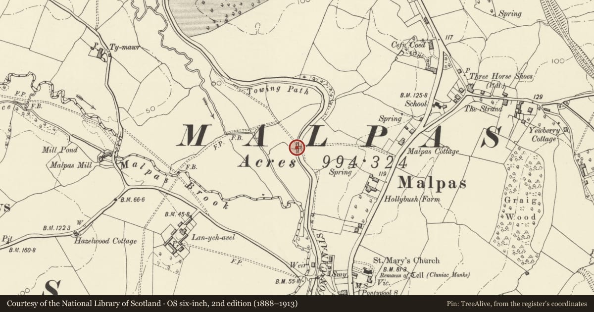
Slide toward Today to fade the historical sheet and see the modern map underneath.
David Rumsey Map Collection, Stanford LibrariesDavid Rumsey Map Collection, Stanford LibrariesDavid Rumsey Map Collection, Stanford LibrariesDavid Rumsey Map Collection, Stanford LibrariesDavid Rumsey Map Collection, Stanford Libraries
5 historical maps cover this location, the earliest the 1636 map "Cornubia : Devonia, Somersetus, Dorcestria, Wiltonia, Glocestria ..." (David Rumsey Map Collection, Stanford Libraries).
Historical maps covering this location
- 1636 · Cornubia : Devonia, Somersetus, Dorcestria, Wiltonia, Glocestria ... (David Rumsey Map Collection, Stanford Libraries)
- 1830 · V.3:11-15:XV.Britisches Reich. A. Kon: England. a. England ab sich: Shire:15-17, 33 (David Rumsey Map Collection, Stanford Libraries)
- 1895 · Sheet 11. Ordnance Survey of England and Wales. (David Rumsey Map Collection, Stanford Libraries)
- 1906 · 249 Newport (Hills) (David Rumsey Map Collection, Stanford Libraries)
- 1913 · Sheet 102. Newport. (David Rumsey Map Collection, Stanford Libraries)
Cadw's description
Location
Situated W of Hollybush Close, with recreations fields to the W. Bridge carries footpath in Hollybush Close and surrounding houses.
Exterior
See Record Number 21946 in Malpas Community for full description of this bridge.
Nearby in the register
- Hollybush Bridge over the Monmouthshire and Brecon Canal (partly in Bettws Community)Transportunder 1 mi
- Lychgate at Malpas ChurchReligious, Ritual and Funeraryunder 1 mi
- Allfrey Tomb, Malpas ChurchReligious, Ritual and Funeraryunder 1 mi
- Parish Church of St. MaryReligious, Ritual and Funeraryunder 1 mi
Other entries of the same register within about three miles of this one, by straight line.