Cof Cymru: National Historic Assets of Wales · Wales
The Laurels, and attached iron railings, gate piers and barn
Usk, Monmouthshire, Wales
A Grade II listed building in Usk, Monmouthshire, designated on 1 April 1974.
The record
- Designation
- Listed building, Grade II
- Broad class
- Domestic
- Date of designation
- 1 April 1974
- Locality
- Usk
- Town
- Usk
- Community
- Usk
- Unitary authority
- Monmouthshire
- Country
- Wales
- Coordinates
- 51.70383, -2.90400
- Cadw reference
- 2188
Slide toward Today to fade the historical sheet and see the modern map underneath.
David Rumsey Map Collection, Stanford LibrariesDavid Rumsey Map Collection, Stanford LibrariesDavid Rumsey Map Collection, Stanford LibrariesDavid Rumsey Map Collection, Stanford LibrariesDavid Rumsey Map Collection, Stanford Libraries
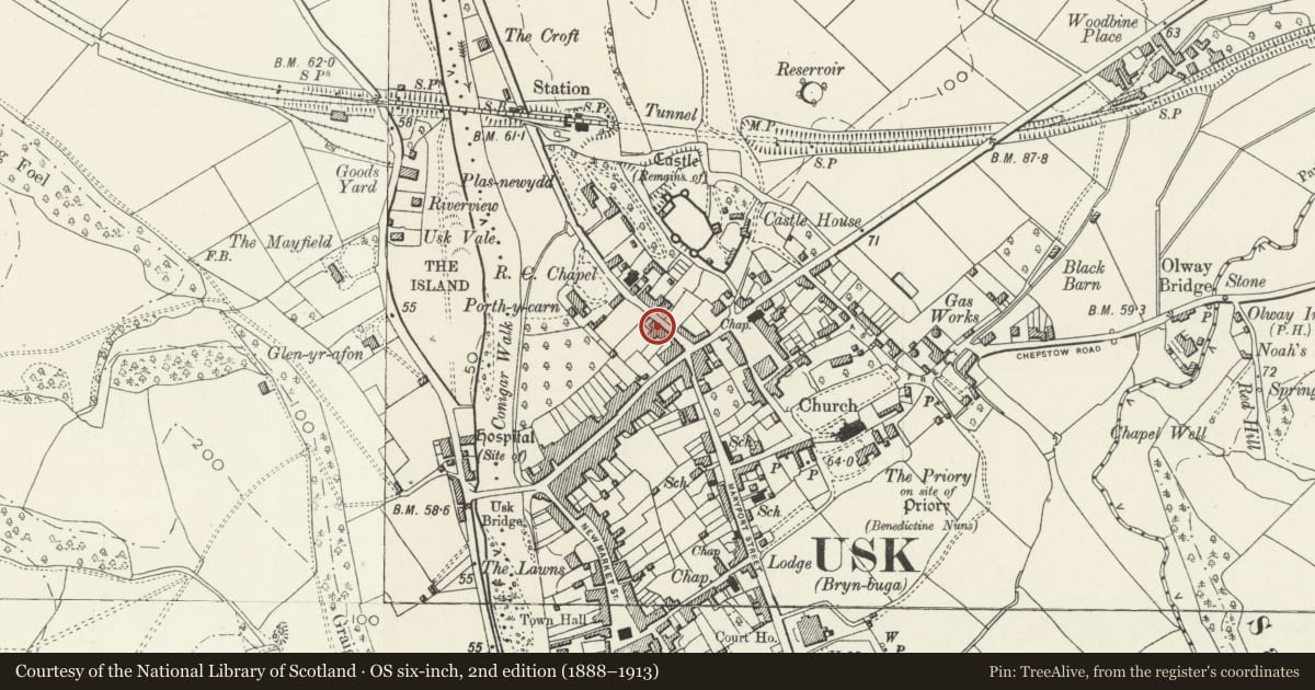
5 historical maps cover this location, the earliest the 1636 map "Cornubia : Devonia, Somersetus, Dorcestria, Wiltonia, Glocestria ..." (David Rumsey Map Collection, Stanford Libraries).
Historical maps covering this location
- 1636 · Cornubia : Devonia, Somersetus, Dorcestria, Wiltonia, Glocestria ... (David Rumsey Map Collection, Stanford Libraries)
- 1637 · The fourth table of England. Cornub. Devonia, Somerset etc. (David Rumsey Map Collection, Stanford Libraries)
- 1830 · V.3:11-15:XV.Britisches Reich. A. Kon: England. a. England ab sich: Shire:15-17, 33 (David Rumsey Map Collection, Stanford Libraries)
- 1895 · Sheet 11. Ordnance Survey of England and Wales. (David Rumsey Map Collection, Stanford Libraries)
- 1913 · Sheet 102. Newport. (David Rumsey Map Collection, Stanford Libraries)
Cadw's description
Location
At the N end of the terrace extending from The Three Salmons Hotel.
History
Early C19 frontage to an earlier, C16-17, farmhouse, indicated by the steeper pitched roof. One of the outermost plots of the medieval town, the small barn adjacent was built within the filled-in medieval town ditch. in C19/C20 the home of Sidney Hiley owner of Usk naptha works.
Exterior
Georgian frontage. Roughcast rendered and painted with steep-pitched slate roof, bracketed boarded eaves, narrow corniced brick end stacks. Two storeys. A symmetrical frontage: a 3-window range of sashes in reveals, tripartite except for one 12-pane sash at first floor centre. Central doorway with console-bracketed entablature, deep panelled reveals and 6-panelled door with polygonally glazed overlight. Painted plinth. Attached railings on kerb with scrolled and urn finials continuous with numbers 3 and 5, terminating at right in tall stone gatepiers with stepped caps. Long raised rear wing with rubble stone ground floor and first floor of brown brick with buff dressings; segmental arched sashesm Attached small stone barn of rubble with slate roof, blocked central doorway to road with timber lintel; remains of lime render.
Reason for designation
Listed as a Georgian townhouse retaining historic character and fabric. Group value with other listed buildings in Porthycarne Street.
Nearby in the register
- No.5 Porthycarne Street, and attached iron railingsDomesticunder 1 mi
- No.3 Porthycarne Street, and attached iron railingsDomesticunder 1 mi
- Old Bank House, and attached iron railingsDomesticunder 1 mi
- Littlebank, and attached iron railingsDomesticunder 1 mi
Other entries of the same register within about three miles of this one, by straight line.