Cof Cymru: National Historic Assets of Wales · Wales
Bridge to E of Bont-uchel Chapel
Cyffylliog, Denbighshire, Wales
A Grade II listed building in Bont-uchel, Cyffylliog, Denbighshire, designated on 17 June 1999.
The record
- Designation
- Listed building, Grade II
- Broad class
- Transport
- Date of designation
- 17 June 1999
- Locality
- Bont-uchel
- Community
- Cyffylliog
- Unitary authority
- Denbighshire
- Country
- Wales
- Coordinates
- 53.10951, -3.36884
- Cadw reference
- 21872
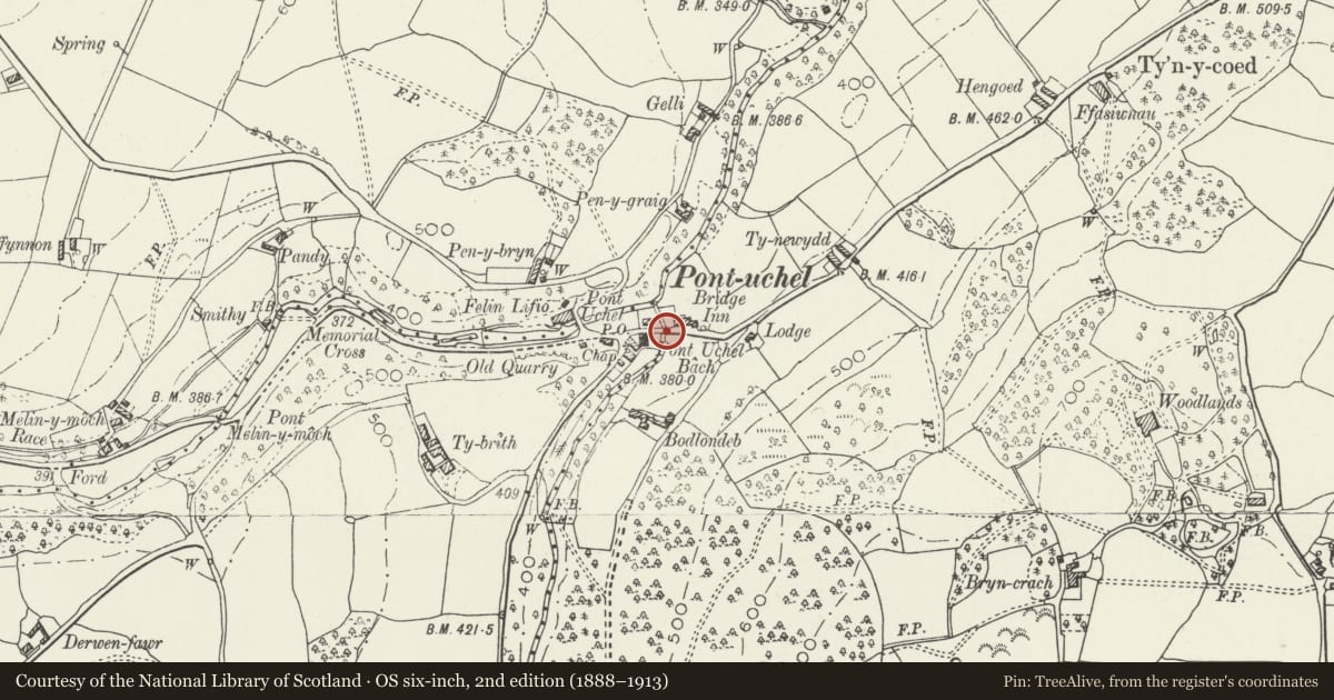
Slide toward Today to fade the historical sheet and see the modern map underneath.
David Rumsey Map Collection, Stanford LibrariesLlyfrgell Genedlaethol Cymru – The National Library of WalesDavid Rumsey Map Collection, Stanford LibrariesDavid Rumsey Map Collection, Stanford LibrariesDavid Rumsey Map Collection, Stanford Libraries
5 historical maps cover this location, the earliest the 1608 map "(13) Cambriae Typus." (David Rumsey Map Collection, Stanford Libraries).
Historical maps covering this location
- 1608 · (13) Cambriae Typus. (David Rumsey Map Collection, Stanford Libraries)
- 1795 · To Sir Watkin Williams-Wynn Bart ... the map of the six counties of North Wales is most… (Llyfrgell Genedlaethol Cymru – The National Library of Wales)
- 1830 · V.3:11-15:XV. Britisches Reich. A. Kon: England. b. Frstenthum Wales: Shire: 37-40 (David Rumsey Map Collection, Stanford Libraries)
- 1883 · Watershed map England, Wales 3. (David Rumsey Map Collection, Stanford Libraries)
- 1901 · Sheet 9 and 10. (David Rumsey Map Collection, Stanford Libraries)
Cadw's description
Location
Spanning a tributary of the Afon Clywedog at the eastern end of Bont-uchel village.
History
Road bridge, probably of early C19 date.
Exterior
Single-span road bridge of rubble construction; approximately 16m long. Tall, round-headed arch with rough-dressed voussoirs and projecting archrings. Plain projecting string-course at the springing, returned onto the soffit. Flat carriageway with rubble parapets, splayed at the approaches and terminating on both up- and down-stream sides in square piers; squared limestone copings. On either side of the arch on the lower section of the downstream side is flat rubble buttressing. Adjoining the eastern parapet on the downstream side is an associated section of wall. This steps down and curves outwards, whilst at the same time inclining slightly upwards in a short continuation; this terminates after approximately 8m where it joins a modern wall in front of the Bridge Hotel.
Reason for designation
Listed for its special interest as an early C19 road bridge retaining good character in a village context.
Group value with Bont Uchel.
Nearby in the register
- Bont-uchelTransportunder 1 mi
- Timber-framed Agricultural Building at Pistyll-GwynAgriculture and Subsistenceunder 1 mi
- Y Garth CampEnclosureunder 1 mi
- Farm outbuilding at HengoedDomesticunder 1 mi
Other entries of the same register within about three miles of this one, by straight line.