Cof Cymru: National Historic Assets of Wales · Wales
Field Cowhouse at Ty Newydd Farm
Llanberis, Gwynedd, Wales
A Grade II listed building in Llanberis, Caernarfon, Gwynedd, designated on 28 May 1999.
The record
- Designation
- Listed building, Grade II
- Broad class
- Agriculture and Subsistence
- Date of designation
- 28 May 1999
- Locality
- Llanberis
- Town
- Caernarfon
- Community
- Llanberis
- Unitary authority
- Gwynedd
- Country
- Wales
- Coordinates
- 53.11825, -4.13447
- Cadw reference
- 21847
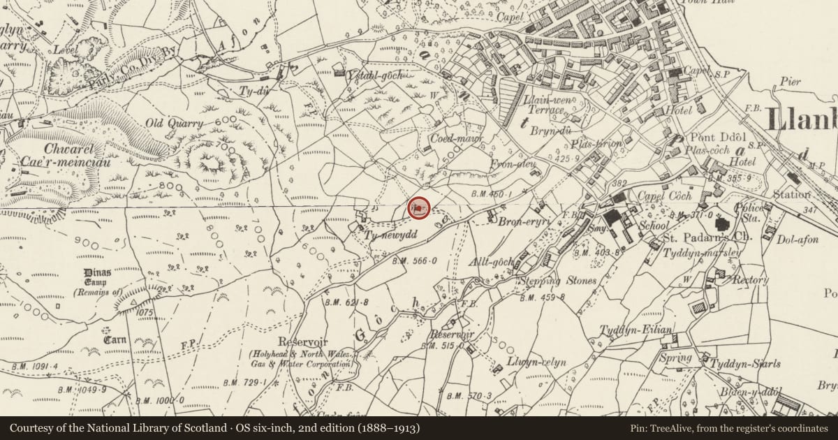
Slide toward Today to fade the historical sheet and see the modern map underneath.
David Rumsey Map Collection, Stanford LibrariesDavid Rumsey Map Collection, Stanford LibrariesDavid Rumsey Map Collection, Stanford LibrariesDavid Rumsey Map Collection, Stanford LibrariesDavid Rumsey Map Collection, Stanford Libraries
5 historical maps cover this location, the earliest the 1896 map "Sheet 7. Ordnance Survey of England and Wales." (David Rumsey Map Collection, Stanford Libraries).
Historical maps covering this location
- 1896 · Sheet 7. Ordnance Survey of England and Wales. (David Rumsey Map Collection, Stanford Libraries)
- 1899 · 106 Bangor (Hills) (David Rumsey Map Collection, Stanford Libraries)
- 1899 · 106 Bangor (Outline) (David Rumsey Map Collection, Stanford Libraries)
- 1901 · Sheet 9 and 10. (David Rumsey Map Collection, Stanford Libraries)
- 1919 · Sheet 41. Anglesey. (David Rumsey Map Collection, Stanford Libraries)
Cadw's description
Location
Situated on its own in fields immediately to the north of the track to Ty Newydd running off the minor road from Llanberis to Maen-Ilwyd-isaf.
History
Built in the mid-C19 as a field cowhouse, probably originally associated with the roughly contemporary farmhouse at Ty Newydd (not included on this list). The cowhouse is a good example of a once common regional farmbuilding type, the detached cowhouse standing on its own in fields. It is not shown on the 1838 Tithe Map.
Exterior
Cowhouse. Long rectangular roughly coursed rubblestone building with slate roof, aligned roughly east-west in 2 sections, the west end with a ramped access protected by a rubblestone retaining wall, to boarded door with slate lintel and threshhold in gable. Shorter section to right has infilled window below eaves to right; animal entrance to cowhouse on north side.
Interior
A-frame roof trusses.
Reason for designation
Listed as a well-preserved example of a mid-C19 field cowhouse, a characteristic farmbuilding type of the region and period, which forms a distinctive feature in the landscape.
Nearby in the register
- Snowdon ViewDomesticunder 1 mi
- Capel CochReligious, Ritual and Funeraryunder 1 mi
- DolperisCommercialunder 1 mi
- 57 Stryd Fawr (High Street)Commercialunder 1 mi
Other entries of the same register within about three miles of this one, by straight line.