Cof Cymru: National Historic Assets of Wales · Wales
Pen-y-bryn
Llanberis, Gwynedd, Wales
A Grade II listed building in Nant Peris, Caernarfon, Llanberis, Gwynedd, designated on 28 May 1999.
The record
- Designation
- Listed building, Grade II
- Broad class
- Domestic
- Date of designation
- 28 May 1999
- Locality
- Nant Peris
- Town
- Caernarfon
- Community
- Llanberis
- Unitary authority
- Gwynedd
- Country
- Wales
- Coordinates
- 53.10361, -4.07975
- Cadw reference
- 21835
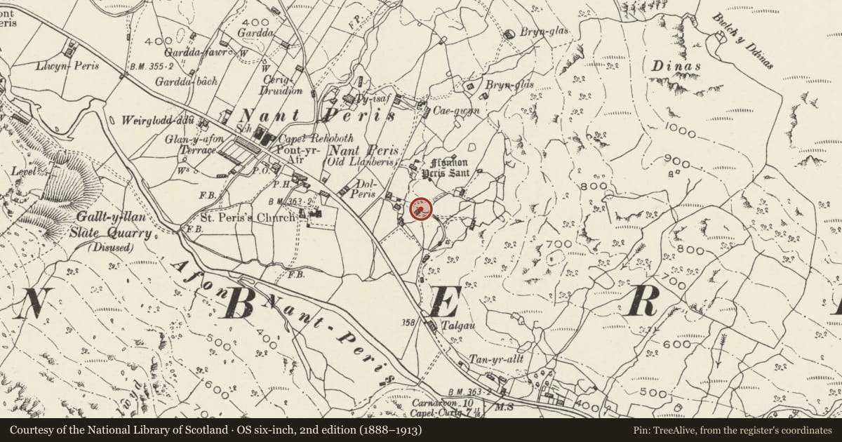
Slide toward Today to fade the historical sheet and see the modern map underneath.
David Rumsey Map Collection, Stanford LibrariesDavid Rumsey Map Collection, Stanford LibrariesDavid Rumsey Map Collection, Stanford LibrariesDavid Rumsey Map Collection, Stanford LibrariesDavid Rumsey Map Collection, Stanford Libraries
5 historical maps cover this location, the earliest the 1896 map "Sheet 7. Ordnance Survey of England and Wales." (David Rumsey Map Collection, Stanford Libraries).
Historical maps covering this location
- 1896 · Sheet 7. Ordnance Survey of England and Wales. (David Rumsey Map Collection, Stanford Libraries)
- 1899 · 106 Bangor (Outline) (David Rumsey Map Collection, Stanford Libraries)
- 1899 · 106 Bangor (Hills) (David Rumsey Map Collection, Stanford Libraries)
- 1901 · Sheet 9 and 10. (David Rumsey Map Collection, Stanford Libraries)
- 1919 · Sheet 41. Anglesey. (David Rumsey Map Collection, Stanford Libraries)
Cadw's description
Location
Located within its own small field system in a prominent position on rising ground above the A 4086 at Nant Peris.
History
Early C19 small farmhouse set within its own field system; not shown on the 1838 Tithe Map, the farmhouse is likely to have been built c1850.
Exterior
Farmhouse. 2-storey, 2-room plan with central staircase and integral end stacks; catslide lean-to to rear. Irregularly coursed rubblestone with distinctive wide-jointed white mortar, rendered to gable ends and rear; slate roof. 4-pane sashes, of reduced proportions and directly beneath eaves to first floor, with slate cills to either side of central C20 glazed door. Catslide lean-to to rear has had eaves raised and projects beyond original extent to left.
Interior
Interior not accessible at time of survey.
Reason for designation
Listed as a substantially unaltered mid-C19 small farmhouse, built within the local vernacular tradition, and forming a significant component in the dispersed settlement pattern of Nant Peris.
Nearby in the register
- Ffynnon BerisReligious, Ritual and Funeraryunder 1 mi
- Cwm-yr-WrachDomesticunder 1 mi
- Church of St PerisReligious, Ritual and Funeraryunder 1 mi
- TalgaeDomesticunder 1 mi
Other entries of the same register within about three miles of this one, by straight line.