Cof Cymru: National Historic Assets of Wales · Wales
Stables and Cart Shelter at Cefn Rhengwrt
Llanwnda, Gwynedd, Wales
A Grade II listed building in Saron, Caernarfon, Llanwnda, Gwynedd, designated on 28 May 1999.
The record
- Designation
- Listed building, Grade II
- Broad class
- Agriculture and Subsistence
- Date of designation
- 28 May 1999
- Locality
- Saron
- Town
- Caernarfon
- Community
- Llanwnda
- Unitary authority
- Gwynedd
- Country
- Wales
- Coordinates
- 53.09116, -4.31117
- Cadw reference
- 21826
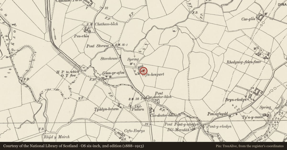
Slide toward Today to fade the historical sheet and see the modern map underneath.
David Rumsey Map Collection, Stanford LibrariesDavid Rumsey Map Collection, Stanford LibrariesDavid Rumsey Map Collection, Stanford LibrariesDavid Rumsey Map Collection, Stanford LibrariesLlyfrgell Genedlaethol Cymru – The National Library of Wales
5 historical maps cover this location, the earliest the 1795 map "To Sir Watkin Williams-Wynn Bart ... the map of the six counties of North Wales is most humbly inscribed by his obedient humble servant" (Llyfrgell Genedlaethol Cymru – The National Library of Wales).
Historical maps covering this location
- 1795 · To Sir Watkin Williams-Wynn Bart ... the map of the six counties of North Wales is most… (Llyfrgell Genedlaethol Cymru – The National Library of Wales)
- 1883 · Watershed map England, Wales 3. (David Rumsey Map Collection, Stanford Libraries)
- 1896 · Sheet 7. Ordnance Survey of England and Wales. (David Rumsey Map Collection, Stanford Libraries)
- 1899 · 105 Carnarvon (Hills) (David Rumsey Map Collection, Stanford Libraries)
- 1901 · Sheet 9 and 10. (David Rumsey Map Collection, Stanford Libraries)
Cadw's description
Location
Situated on the southern side of the farmyard at Cefn Rhengwrt.
History
The farm is not shown on the 1839 Tithe Map and it appears to be one of several planned farmsteads established by the Newborough Estate in this region after c1850.
Exterior
Stables and cart shelter. Long rectangular-plan building aligned roughly east-west, forming southern side of farmyard. Irregularly coursed rubblestone; slate roof with slate-coped verges and rooflights. Elliptical red brick arch to left for cart shelter with doorway to centre flanked by 2 vertically louvered windows with 2 further doorways and a narrow rectangular window to right, all with slate lintels.
Interior
A-frame trusses to eastern part; loft to western end.
Reason for designation
Included as a largely unaltered cart shelter and stables, forming part of the well-preserved mid-C19 planned Newborough Estate farmstead at Cefn Rhengwrt.
Nearby in the register
- Bothy and Pigsties at Cefn RhengwrtAgriculture and Subsistenceunder 1 mi
- Cefn RhengwrtDomesticunder 1 mi
- Cowhouse at Cefn RhengwrtAgriculture and Subsistenceunder 1 mi
- Glasfryn & TamariuDomesticunder 1 mi
Other entries of the same register within about three miles of this one, by straight line.