Cof Cymru: National Historic Assets of Wales · Wales
The Haven
Llanwnda, Gwynedd, Wales
A Grade II listed building in Rhos Isaf, Caernarfon, Llanwnda, Gwynedd, designated on 28 May 1999.
The record
- Designation
- Listed building, Grade II
- Broad class
- Domestic
- Date of designation
- 28 May 1999
- Locality
- Rhos Isaf
- Town
- Caernarfon
- Community
- Llanwnda
- Unitary authority
- Gwynedd
- Country
- Wales
- Coordinates
- 53.09220, -4.25961
- Cadw reference
- 21804
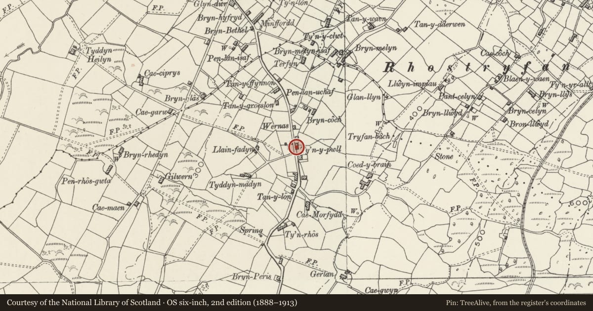
Slide toward Today to fade the historical sheet and see the modern map underneath.
David Rumsey Map Collection, Stanford LibrariesDavid Rumsey Map Collection, Stanford LibrariesDavid Rumsey Map Collection, Stanford LibrariesDavid Rumsey Map Collection, Stanford LibrariesLlyfrgell Genedlaethol Cymru – The National Library of Wales
5 historical maps cover this location, the earliest the 1795 map "To Sir Watkin Williams-Wynn Bart ... the map of the six counties of North Wales is most humbly inscribed by his obedient humble servant" (Llyfrgell Genedlaethol Cymru – The National Library of Wales).
Historical maps covering this location
- 1795 · To Sir Watkin Williams-Wynn Bart ... the map of the six counties of North Wales is most… (Llyfrgell Genedlaethol Cymru – The National Library of Wales)
- 1883 · Watershed map England, Wales 3. (David Rumsey Map Collection, Stanford Libraries)
- 1896 · Sheet 7. Ordnance Survey of England and Wales. (David Rumsey Map Collection, Stanford Libraries)
- 1899 · 105 Carnarvon (Hills) (David Rumsey Map Collection, Stanford Libraries)
- 1901 · Sheet 9 and 10. (David Rumsey Map Collection, Stanford Libraries)
Cadw's description
Location
Situated on the east side of the main village street at Rhos Isaf with a smaller cottage [Ferndale] attached to the north gable end; low brick wall with privet hedge in front.
History
Shown on the 1839 Tithe Map, the cottage is likely to have been built as a squatter's cottage in the early C19.
Exterior
Cottage. Single-storey 2-room plan. Roughly coursed limewashed rubblestone; graded slate roof. 4-paned sashes with slate cills to either side of slightly offset entrance with C20 door; substantial integral end stacks with slate drips, larger to right; small rooflight to left. Lean-to to left gable end has boarded door to front.
Interior
Interior not accessible at time of Survey.
Reason for designation
Included as a well-preserved example of an early C19 single-storey cottage, the roadside location of which suggests that it may have originated as a squatter's cottage.
Nearby in the register
- Tan-y-ffynnonDomesticunder 1 mi
- Bethel Chapel and attached cottages [Rhoslwyn and Bethel House)Religious, Ritual and Funeraryunder 1 mi
- Hut Group and Field System E of Coed-y-BrainHut Circle Settlementunder 1 mi
- Tryfan MawrDomesticunder 1 mi
Other entries of the same register within about three miles of this one, by straight line.