Cof Cymru: National Historic Assets of Wales · Wales
Lychgate of St David's Church
Llanarthney, Carmarthenshire, Wales
A Grade II listed building in Llanarthney village, Carmarthen, Llanarthney, Carmarthenshire, designated on 19 May 1999.
The record
- Designation
- Listed building, Grade II
- Broad class
- Religious, Ritual and Funerary
- Date of designation
- 19 May 1999
- Locality
- Llanarthney village
- Town
- Carmarthen
- Community
- Llanarthney
- Unitary authority
- Carmarthenshire
- Country
- Wales
- Coordinates
- 51.86144, -4.13007
- Cadw reference
- 21738
Slide toward Today to fade the historical sheet and see the modern map underneath.
David Rumsey Map Collection, Stanford LibrariesDavid Rumsey Map Collection, Stanford LibrariesDavid Rumsey Map Collection, Stanford LibrariesDavid Rumsey Map Collection, Stanford LibrariesDavid Rumsey Map Collection, Stanford Libraries
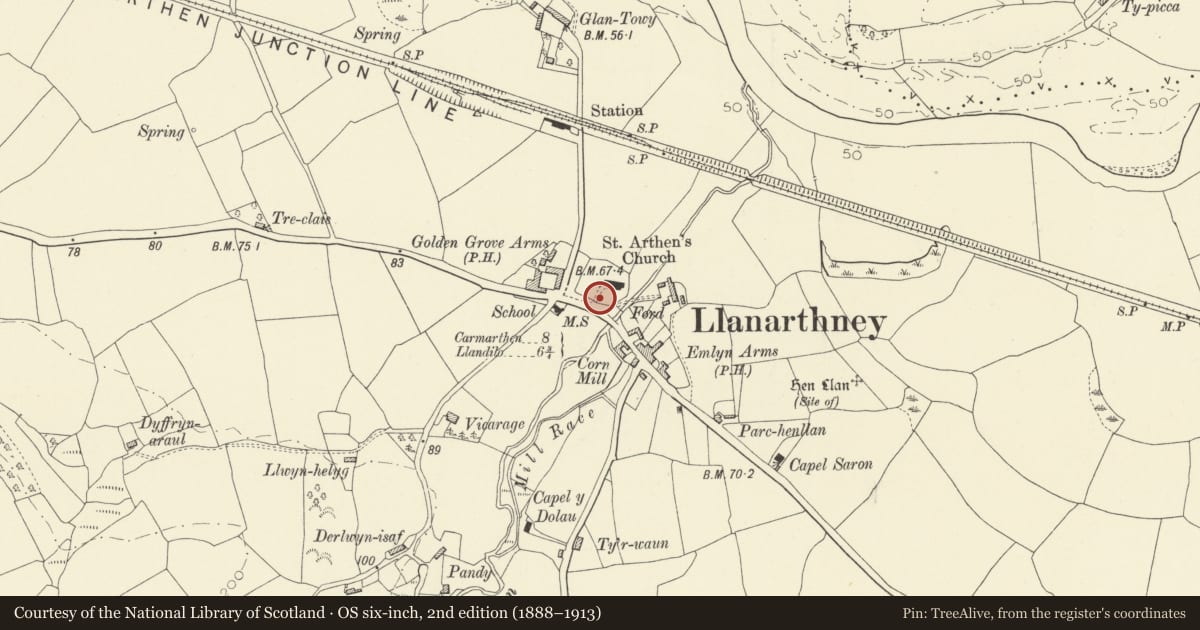
5 historical maps cover this location, the earliest the 1636 map "Cornubia : Devonia, Somersetus, Dorcestria, Wiltonia, Glocestria ..." (David Rumsey Map Collection, Stanford Libraries).
Historical maps covering this location
- 1636 · Cornubia : Devonia, Somersetus, Dorcestria, Wiltonia, Glocestria ... (David Rumsey Map Collection, Stanford Libraries)
- 1860 · 41. Caermathen. (David Rumsey Map Collection, Stanford Libraries)
- 1891 · Sheet 10. Ordnance Survey of England and Wales. . (David Rumsey Map Collection, Stanford Libraries)
- 1898 · 230 Ammanford (Hills) (David Rumsey Map Collection, Stanford Libraries)
- 1901 · Sheet 14. (David Rumsey Map Collection, Stanford Libraries)
Cadw's description
Location
At the entrance to Llanarthney Churchyard.
History
A lychgate possibly contemporary with the major alterations at the church in 1826; the low elliptical shape of the eaves beams and roof soffit suggests the Regency/early Victorian period.
Exterior
Hipped slate roof carried on two rendered and whitened rubble stone piers serving as support walls each side of the gate. Metal hips and ridge cover. The soffit of the roof between the piers is of a low elliptical shape. Monolith gatestones with pyramid tops stand centrally against the piers. Wrought-iron gates of rustic design, with close-set dog-railings below, a middle band of lozenges, and a top crest of curls and lozenge shapes.
Reason for designation
Listed as an early C19 lychgate of vernacular character and for group value with St. David's Church.
Nearby in the register
- Milestone opposite to Llanarthney ChurchTransportunder 1 mi
- Church of St David (also known as Church of St Arthneu or St Arthney).Religious, Ritual and Funeraryunder 1 mi
- Former Llanarthney National SchoolEducationunder 1 mi
- Old SmithyIndustrialunder 1 mi
Other entries of the same register within about three miles of this one, by straight line.