Cof Cymru: National Historic Assets of Wales · Wales
Turbine House at Pontsticill Water Treatment Works
Vaynor, Merthyr Tydfil, Wales
A Grade II listed building in Pontsticill, Vaynor, Merthyr Tydfil, designated on 19 May 1999.
The record
- Designation
- Listed building, Grade II
- Broad class
- Water Supply and Drainage
- Date of designation
- 19 May 1999
- Locality
- Pontsticill
- Community
- Vaynor
- Unitary authority
- Merthyr Tydfil
- Country
- Wales
- Coordinates
- 51.79636, -3.36363
- Cadw reference
- 21732
Slide toward Today to fade the historical sheet and see the modern map underneath.
David Rumsey Map Collection, Stanford LibrariesDavid Rumsey Map Collection, Stanford LibrariesDavid Rumsey Map Collection, Stanford LibrariesDavid Rumsey Map Collection, Stanford LibrariesDavid Rumsey Map Collection, Stanford Libraries
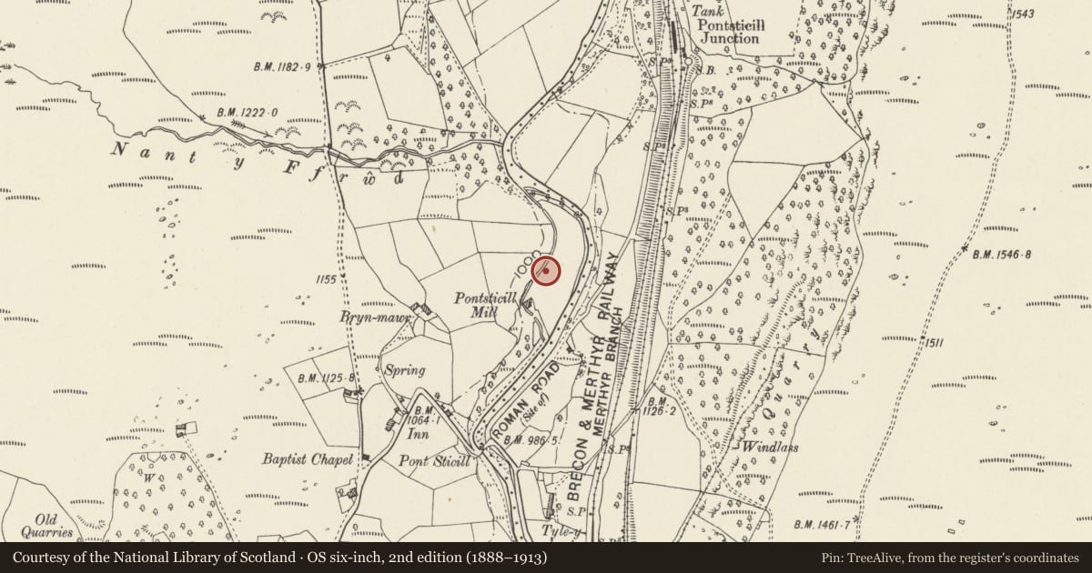
5 historical maps cover this location, the earliest the 1636 map "Cornubia : Devonia, Somersetus, Dorcestria, Wiltonia, Glocestria ..." (David Rumsey Map Collection, Stanford Libraries).
Historical maps covering this location
- 1636 · Cornubia : Devonia, Somersetus, Dorcestria, Wiltonia, Glocestria ... (David Rumsey Map Collection, Stanford Libraries)
- 1830 · V.3:11-15:XV. Britisches Reich. A. Kon: England. b. Frstenthum Wales: Shire: 37-40 (David Rumsey Map Collection, Stanford Libraries)
- 1856 · 42. Brecon. (David Rumsey Map Collection, Stanford Libraries)
- 1898 · 231 Merthyr Tydfil (Hills) (David Rumsey Map Collection, Stanford Libraries)
- 1901 · Sheet 14. (David Rumsey Map Collection, Stanford Libraries)
Cadw's description
Location
In the Water Treatment Works ,adjacent to the Compensation Basin, under the dam below Pontsticill Reservoir and SW of the Filter House.
History
Turbine House controlled the level of water flowing over the weir. This dates from the construction of the Reservoir in 1923, a massive water engineering project involving an extensive network of piping to the urban areas of S and SE Wales, which was termed 'The Two Million Scheme'. It involved a 2 shilling (10 pence) rate on local taxes and was carried out by the Taf Fechan Water Corporation, this latter body being contributed to by each local council. Resident engineer FV Stillingfleet, and engineers Sir Alex Binnie and Deacon and Thos F Harvey. 3400 million gallons (15456 million litres) of water a day was treated, as stated on the plaque on the Compensation Basin recording its opening by Lord Buckland in 1927.
Exterior
Small building of coursed occasionally snecked rock-faced sandstone with ashlar dressings, its outer side forming part of the wall of the Compensation Basin. Welsh slate roof. Round-arched doorways with heavy doors, hinges and locks at each end of inner side and multipane metal-framed round-arched windows to sides and in the gable ends, the S masked by a later addition.
Interior
Interior painted white with a stained planked ceiling. Original hydro turbine by Gilkes of Kendal is retained, though this no longer in use having been replaced by a new version. Gantry for maintenance supported by heavy corbels and valves still in place.
Reason for designation
Included as an integral part of the original Water Treatment Works.
Group value with the Compensation Basin and the Filter House.
Nearby in the register
- Compensation Basin at Pontsticill Water Treatment WorksWater Supply and Drainageunder 1 mi
- Filter House at Pontsticill Water Treatment WorksWater Supply and Drainageunder 1 mi
- Dam, valve tower, bridge and outflow on Pontsticill ReservoirCivilunder 1 mi
- Dam, valve tower, bridge and outflow on Pontsticill ReservoirCivilunder 1 mi
Other entries of the same register within about three miles of this one, by straight line.