Cof Cymru: National Historic Assets of Wales · Wales
Ty'n-y-mynydd
Pistyll, Gwynedd, Wales
A Grade II listed building in Pistyll, Pwllheli, Gwynedd, designated on 18 May 1999.
The record
- Designation
- Listed building, Grade II
- Broad class
- Domestic
- Date of designation
- 18 May 1999
- Locality
- Pistyll
- Town
- Pwllheli
- Community
- Pistyll
- Unitary authority
- Gwynedd
- Country
- Wales
- Coordinates
- 52.93813, -4.48737
- Cadw reference
- 21719
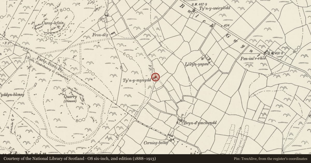
Slide toward Today to fade the historical sheet and see the modern map underneath.
David Rumsey Map Collection, Stanford LibrariesDavid Rumsey Map Collection, Stanford LibrariesDavid Rumsey Map Collection, Stanford LibrariesDavid Rumsey Map Collection, Stanford LibrariesDavid Rumsey Map Collection, Stanford Libraries
5 historical maps cover this location, the earliest the 1830 map "V.3:11-15:XV. Britisches Reich. A. Kon: England. b. Frstenthum Wales: Shire: 37-40" (David Rumsey Map Collection, Stanford Libraries).
Historical maps covering this location
- 1830 · V.3:11-15:XV. Britisches Reich. A. Kon: England. b. Frstenthum Wales: Shire: 37-40 (David Rumsey Map Collection, Stanford Libraries)
- 1883 · Watershed map England, Wales 3. (David Rumsey Map Collection, Stanford Libraries)
- 1896 · Sheet 7. Ordnance Survey of England and Wales. (David Rumsey Map Collection, Stanford Libraries)
- 1899 · 118 Nevin (Hills) (David Rumsey Map Collection, Stanford Libraries)
- 1901 · Sheet 9 and 10. (David Rumsey Map Collection, Stanford Libraries)
Cadw's description
Location
The building is located at the foot of the southern peak of Carreglefain, on the col between Carreglefain and Moel Ty-gwyn. It is reached by a farm road from Bwlch Gwynt.
History
The house is probably a mid C19 rebuild of an earlier, C18 hill farmhouse.
Exterior
The farmhouse is uphill sited, built of stone rubble and with a slate roof. Two storey, 2 bays. The house end is at the W; an off-centre door and 4-pane sash windows, and smaller 4-pane windows to the upper floor. Gable end stacks, the larger at the upper end. The house continues to the E as farm buildings, now converted for domestic use. Part-glazed door and 4-pane sash window, but one small slit window nearest the house. Two first floor windows at the rear, and a lean-to single storey outbuilding.
Reason for designation
Included as a good example of a small hill farmhouse retaining much vernacular character of the C18.
Nearby in the register
- PenrhosDomesticunder 1 mi
- LleiniauDomesticunder 1 mi
- GwynusDomesticunder 1 mi
- Tymawr Cross-Incised StoneCross-marked stoneunder 1 mi
Other entries of the same register within about three miles of this one, by straight line.