Cof Cymru: National Historic Assets of Wales · Wales
Garden Wall at No.16 New Market Street (The Lawns)
Usk, Monmouthshire, Wales
A Grade II listed building in Usk, Monmouthshire, designated on 1 April 1974.
The record
- Designation
- Listed building, Grade II
- Broad class
- Domestic
- Date of designation
- 1 April 1974
- Community
- Usk
- Unitary authority
- Monmouthshire
- Country
- Wales
- Coordinates
- 51.70115, -2.90523
- Cadw reference
- 2166
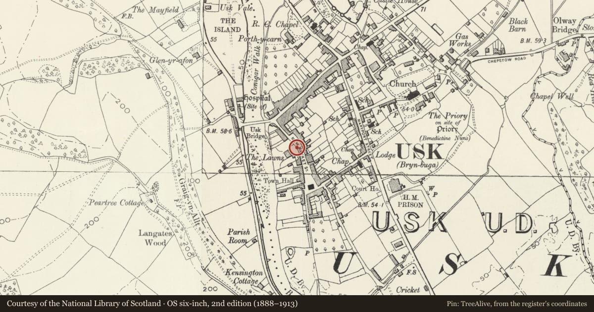
Slide toward Today to fade the historical sheet and see the modern map underneath.
David Rumsey Map Collection, Stanford LibrariesDavid Rumsey Map Collection, Stanford LibrariesDavid Rumsey Map Collection, Stanford LibrariesDavid Rumsey Map Collection, Stanford LibrariesDavid Rumsey Map Collection, Stanford Libraries
5 historical maps cover this location, the earliest the 1636 map "Cornubia : Devonia, Somersetus, Dorcestria, Wiltonia, Glocestria ..." (David Rumsey Map Collection, Stanford Libraries).
Historical maps covering this location
- 1636 · Cornubia : Devonia, Somersetus, Dorcestria, Wiltonia, Glocestria ... (David Rumsey Map Collection, Stanford Libraries)
- 1637 · The fourth table of England. Cornub. Devonia, Somerset etc. (David Rumsey Map Collection, Stanford Libraries)
- 1830 · V.3:11-15:XV.Britisches Reich. A. Kon: England. a. England ab sich: Shire:15-17, 33 (David Rumsey Map Collection, Stanford Libraries)
- 1895 · Sheet 11. Ordnance Survey of England and Wales. (David Rumsey Map Collection, Stanford Libraries)
- 1913 · Sheet 102. Newport. (David Rumsey Map Collection, Stanford Libraries)
Cadw's description
Location
Extending along the street frontage of The Lawns and joining with the former stables.
History
It is likely that much of this masonry substantially pre-dates the early C19 construction of The Lawns.
Exterior
High garden wall of stone rubble with plain centre gate posts. Section to right has blue-brick saddleback coping. Gate posts of squared stone have flat coping and plinths, smaller inserted pedestrian garden gate adjacent to left. Section to left (S) is higher and has only rough stone coping. Plentiful signs of alteration and patching to masonry.
Reason for designation
Listed as an integral part of the street frontage to New Market Street and for group value with other listed buildings in the street, especially The Lawns and the former stables.
Nearby in the register
- 17 New Market StreetDomesticunder 1 mi
- 19 New Market StreetDomesticunder 1 mi
- No.15 New Market Street, and attached iron railingsDomesticunder 1 mi
- No.21 New Market Street, and attached iron railingsDomesticunder 1 mi
Other entries of the same register within about three miles of this one, by straight line.