Cof Cymru: National Historic Assets of Wales · Wales
Pair of chest tombs at Siloh Presbyterian Church
Pontllanfraith, Caerphilly, Wales
A Grade II listed building in Gelli-groes, Pontllanfraith, Caerphilly, designated on 31 March 1999.
The record
- Designation
- Listed building, Grade II
- Broad class
- Religious, Ritual and Funerary
- Date of designation
- 31 March 1999
- Locality
- Gelli-groes
- Community
- Pontllanfraith
- Unitary authority
- Caerphilly
- Country
- Wales
- Coordinates
- 51.64552, -3.19177
- Cadw reference
- 21624
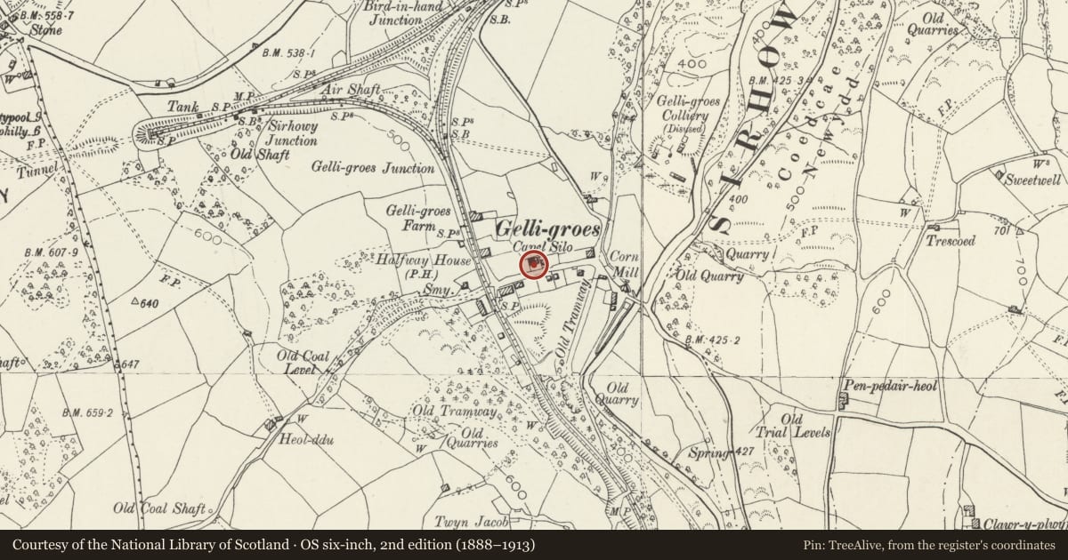
Slide toward Today to fade the historical sheet and see the modern map underneath.
David Rumsey Map Collection, Stanford LibrariesDavid Rumsey Map Collection, Stanford LibrariesDavid Rumsey Map Collection, Stanford LibrariesDavid Rumsey Map Collection, Stanford LibrariesDavid Rumsey Map Collection, Stanford Libraries
5 historical maps cover this location, the earliest the 1636 map "Cornubia : Devonia, Somersetus, Dorcestria, Wiltonia, Glocestria ..." (David Rumsey Map Collection, Stanford Libraries).
Historical maps covering this location
- 1636 · Cornubia : Devonia, Somersetus, Dorcestria, Wiltonia, Glocestria ... (David Rumsey Map Collection, Stanford Libraries)
- 1637 · The fourth table of England. Cornub. Devonia, Somerset etc. (David Rumsey Map Collection, Stanford Libraries)
- 1895 · Sheet 11. Ordnance Survey of England and Wales. (David Rumsey Map Collection, Stanford Libraries)
- 1906 · 249 Newport (Hills) (David Rumsey Map Collection, Stanford Libraries)
- 1913 · Sheet 102. Newport. (David Rumsey Map Collection, Stanford Libraries)
Cadw's description
Location
Close to the front wall of the chapel in the small graveyard fronting the road.
History
Tomb nearest church commemorates Henry Jones of Tyn-y-llwyn died 1821 and Ann his wife died 1849. The primary inscription on the further tomb is illegible, the later one, facing church, is dated 1870.
Exterior
2 similar chest tombs close to the church. Each of ashlar with narrow plinth, slightly moulded slab, end piers with Gothick arches and central panel with inscription within an oval, the tomb further away from church has lost part of its inscription. Side inscriptions in English, end epitaphs in Welsh.
Reason for designation
Listed for group value with Siloh and Heather Cottage.
Nearby in the register
- Siloh Presbyterian ChurchReligious, Ritual and Funeraryunder 1 mi
- Heather CottageDomesticunder 1 mi
- Gelli-groes Millhouse and attached BarnIndustrialunder 1 mi
- Gelli-groes MillIndustrialunder 1 mi
Other entries of the same register within about three miles of this one, by straight line.