Cof Cymru: National Historic Assets of Wales · Wales
Enclosure walls at former pilots' cottages for Trwyn Du, or Black Point, Lighthouse
Llangoed, Isle of Anglesey, Wales
A Grade II listed building in Trwyn Du, Llangoed, Isle of Anglesey, designated on 26 March 1999.
The record
- Designation
- Listed building, Grade II
- Broad class
- Maritime
- Date of designation
- 26 March 1999
- Locality
- Trwyn Du
- Community
- Llangoed
- Unitary authority
- Isle of Anglesey
- Country
- Wales
- Coordinates
- 53.31055, -4.04156
- Cadw reference
- 21616
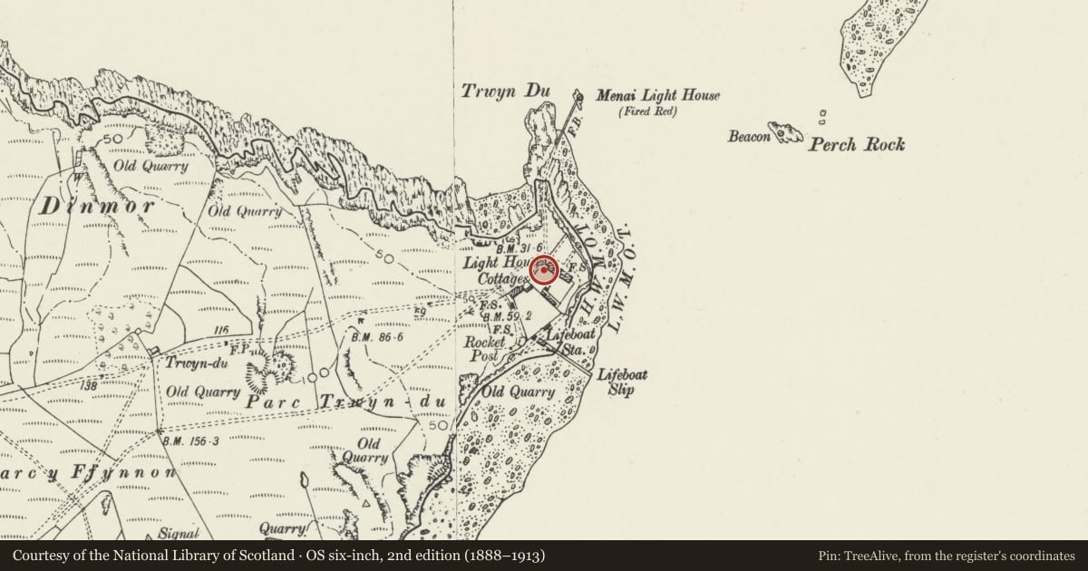
Slide toward Today to fade the historical sheet and see the modern map underneath.
David Rumsey Map Collection, Stanford LibrariesDavid Rumsey Map Collection, Stanford LibrariesDavid Rumsey Map Collection, Stanford LibrariesDavid Rumsey Map Collection, Stanford LibrariesDavid Rumsey Map Collection, Stanford Libraries
5 historical maps cover this location, the earliest the 1883 map "Watershed map England, Wales 3." (David Rumsey Map Collection, Stanford Libraries).
Historical maps covering this location
- 1883 · Watershed map England, Wales 3. (David Rumsey Map Collection, Stanford Libraries)
- 1896 · Sheet 7. Ordnance Survey of England and Wales. (David Rumsey Map Collection, Stanford Libraries)
- 1899 · 94 Beaumaris (Hills) (David Rumsey Map Collection, Stanford Libraries)
- 1901 · Sheet 9 and 10. (David Rumsey Map Collection, Stanford Libraries)
- 1919 · Sheet 41. Anglesey. (David Rumsey Map Collection, Stanford Libraries)
Cadw's description
Location
The walls define a compound around the two former pilots' cottages close to the shore at Black Point, or Trwyn Du, Penmon.
History
The two cottages are dated 1839 and it is likely that the walls were constructed at the same time, to define the garden and allotment areas for the keepers' accommodation.
Exterior
Coursed and squared rubble walling with raking copings marks out enclosures to front and rear of the cottages. On the seaward side, facing towards Puffin Island, the wall is embattled, and forms two low bastion towers.
Reason for designation
Group value with the cottages, the enclosure walls represent an important part of the whole group, since the allotments which accompanied the keepers' accomodation were a standard, and highly regarded provision. The bastion towers and embattling to the wall on the seaward side are of particular interest.
Nearby in the register
- Pilot's Cottage (former) No 1Domesticunder 1 mi
- Pilot's Cottage (former No 2)Domesticunder 1 mi
- Trwyn Du, or Black Point, LighthouseMaritimeunder 1 mi
- Penmon Dovecotedovecoteunder 1 mi
Other entries of the same register within about three miles of this one, by straight line.