Cof Cymru: National Historic Assets of Wales · Wales
Tabernacl
Llanystumdwy, Gwynedd, Wales
A Grade II listed building in Llanystumdwy, Criccieth, Gwynedd, designated on 31 March 1999.
The record
- Designation
- Listed building, Grade II
- Broad class
- Religious, Ritual and Funerary
- Date of designation
- 31 March 1999
- Locality
- Llanystumdwy
- Town
- Criccieth
- Community
- Llanystumdwy
- Unitary authority
- Gwynedd
- Country
- Wales
- Coordinates
- 52.92125, -4.26961
- Cadw reference
- 21593
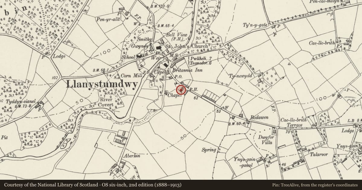
Slide toward Today to fade the historical sheet and see the modern map underneath.
David Rumsey Map Collection, Stanford LibrariesDavid Rumsey Map Collection, Stanford LibrariesDavid Rumsey Map Collection, Stanford LibrariesDavid Rumsey Map Collection, Stanford LibrariesLlyfrgell Genedlaethol Cymru – The National Library of Wales
5 historical maps cover this location, the earliest the 1795 map "To Sir Watkin Williams-Wynn Bart ... the map of the six counties of North Wales is most humbly inscribed by his obedient humble servant" (Llyfrgell Genedlaethol Cymru – The National Library of Wales).
Historical maps covering this location
- 1795 · To Sir Watkin Williams-Wynn Bart ... the map of the six counties of North Wales is most… (Llyfrgell Genedlaethol Cymru – The National Library of Wales)
- 1883 · Watershed map England, Wales 3. (David Rumsey Map Collection, Stanford Libraries)
- 1896 · Sheet 7. Ordnance Survey of England and Wales. (David Rumsey Map Collection, Stanford Libraries)
- 1899 · 118 Nevin (Hills) (David Rumsey Map Collection, Stanford Libraries)
- 1901 · Sheet 9 and 10. (David Rumsey Map Collection, Stanford Libraries)
Cadw's description
Location
The Tabernacl, also called Capel Bach, lies back from the S side of the street past a row of two cottages set end-on to the road.
History
Built, according to an inscription over the door, in 1831 for the Independent Methodists, a sister to the chapel at Rhoslan, a hamlet within the community, to the N.
Exterior
Built of coursed rock-faced rubble stonework, with a slate roof. Side entry type chapel, with boarded doors at the ends, and two large 4-pane sash windows between. Similar two windows on the S side.
Interior
Not accessible at the time of inspection. Said to be a good example of its period and well-preserved.
Reason for designation
Included as an early chapel for this area, reputedly with a good contemporary interior.
Nearby in the register
- The Feathers InnCommercialunder 1 mi
- HighgateDomesticunder 1 mi
- Tai NewyddionDomesticunder 1 mi
- Tai NewyddionDomesticunder 1 mi
Other entries of the same register within about three miles of this one, by straight line.