Cof Cymru: National Historic Assets of Wales · Wales
Beudy-y-gromlech
Llanystumdwy, Gwynedd, Wales
A Grade II listed building in Rhoslan, Criccieth, Llanystumdwy, Gwynedd, designated on 31 March 1999.
The record
- Designation
- Listed building, Grade II
- Broad class
- Domestic
- Date of designation
- 31 March 1999
- Locality
- Rhoslan
- Town
- Criccieth
- Community
- Llanystumdwy
- Unitary authority
- Gwynedd
- Country
- Wales
- Coordinates
- 52.94452, -4.25717
- Cadw reference
- 21591
Slide toward Today to fade the historical sheet and see the modern map underneath.
David Rumsey Map Collection, Stanford LibrariesDavid Rumsey Map Collection, Stanford LibrariesDavid Rumsey Map Collection, Stanford LibrariesDavid Rumsey Map Collection, Stanford LibrariesLlyfrgell Genedlaethol Cymru – The National Library of Wales
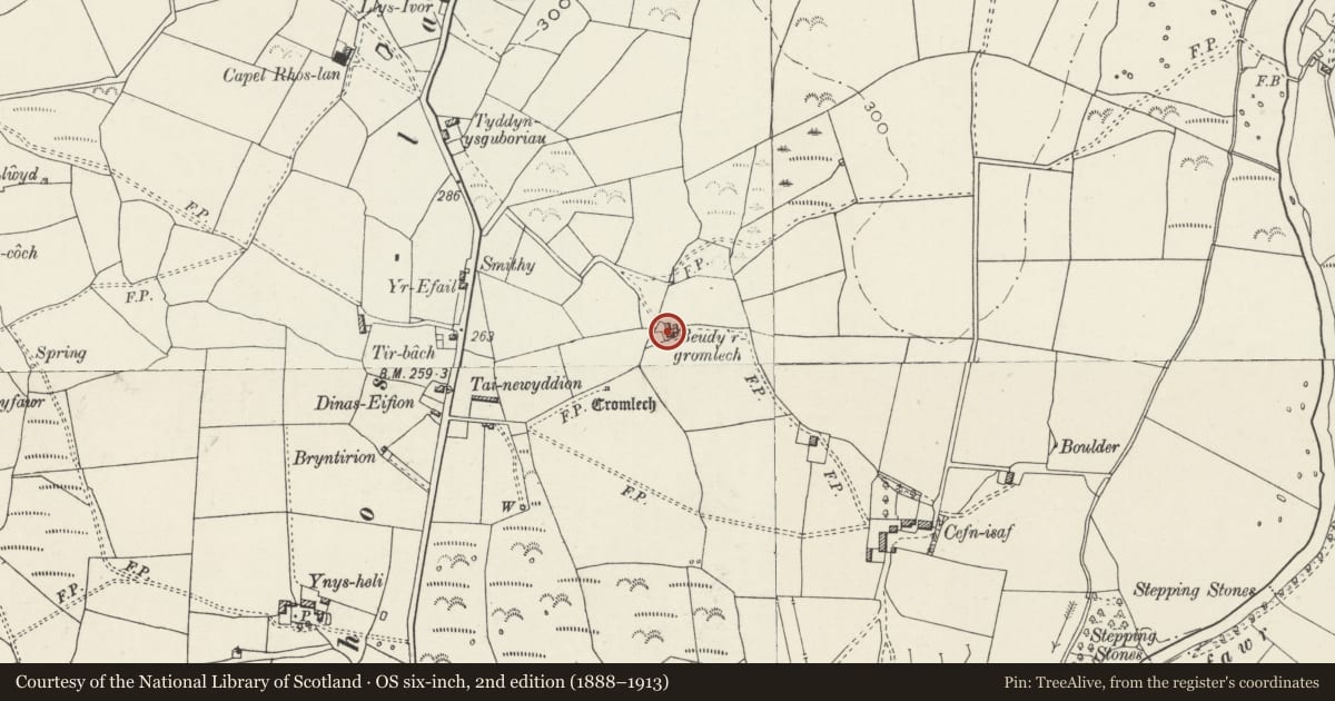
5 historical maps cover this location, the earliest the 1795 map "To Sir Watkin Williams-Wynn Bart ... the map of the six counties of North Wales is most humbly inscribed by his obedient humble servant" (Llyfrgell Genedlaethol Cymru – The National Library of Wales).
Historical maps covering this location
- 1795 · To Sir Watkin Williams-Wynn Bart ... the map of the six counties of North Wales is most… (Llyfrgell Genedlaethol Cymru – The National Library of Wales)
- 1883 · Watershed map England, Wales 3. (David Rumsey Map Collection, Stanford Libraries)
- 1896 · Sheet 7. Ordnance Survey of England and Wales. (David Rumsey Map Collection, Stanford Libraries)
- 1899 · 118 Nevin (Hills) (David Rumsey Map Collection, Stanford Libraries)
- 1901 · Sheet 9 and 10. (David Rumsey Map Collection, Stanford Libraries)
Cadw's description
Location
The house stands in a field on the E side of the village, close to Rhoslan Cromlech.
History
The building is probably of the late C18 or early C19, a type of small-holding or labourer's dwelling once typical of Llyn. It may have comprised house and cow-house in line originally, but if so, the cow-house was incorporated into the dwelling at some time, probably in the mid-late C19.
Exterior
The building is constructed with granite boulders, the joints filled and buttered. Slate roof, grouted at the rear with a single rooflight front and rear. It consists of a 2-bay single storey house, with gable end stack and what may have originally been a cowhouse at the E end under the same roof, and a rear wing, apparently service or agricultural rather than domestic in purpose, and perhaps originally a dairy. Central boarded door on the S side, and one small 4-pane sash windows each side. A single small window at the rear, and an external doorway and small window to the rear wing. The cowhouse end has a boarded door against the gable end of the cottage, and a larger and later single window. A gable end stack indicates that it was converted to other purposes at a later date.
Interior
Not seen at the time of inspection.
Reason for designation
Included as a very well preserved example of a small-holders cottage, retaining original detail. A good example of a building type now unusual in this part of Llyn.
Nearby in the register
- Cefn-Isaf Burial ChamberChambered Tombunder 1 mi
- Pont Rhyd-y-benlligTransportunder 1 mi
- Betws-bachDomesticunder 1 mi
- Ystum-Cegid Burial ChamberChambered Long Cairnunder 1 mi
Other entries of the same register within about three miles of this one, by straight line.