Cof Cymru: National Historic Assets of Wales · Wales
Gwynfryn Lodge
Llanystumdwy, Gwynedd, Wales
A Grade II listed building in Llanystumdwy, Criccieth, Gwynedd, designated on 31 March 1999.
The record
- Designation
- Listed building, Grade II
- Broad class
- Domestic
- Date of designation
- 31 March 1999
- Locality
- Llanystumdwy
- Town
- Criccieth
- Community
- Llanystumdwy
- Unitary authority
- Gwynedd
- Country
- Wales
- Coordinates
- 52.92288, -4.27916
- Cadw reference
- 21580
Slide toward Today to fade the historical sheet and see the modern map underneath.
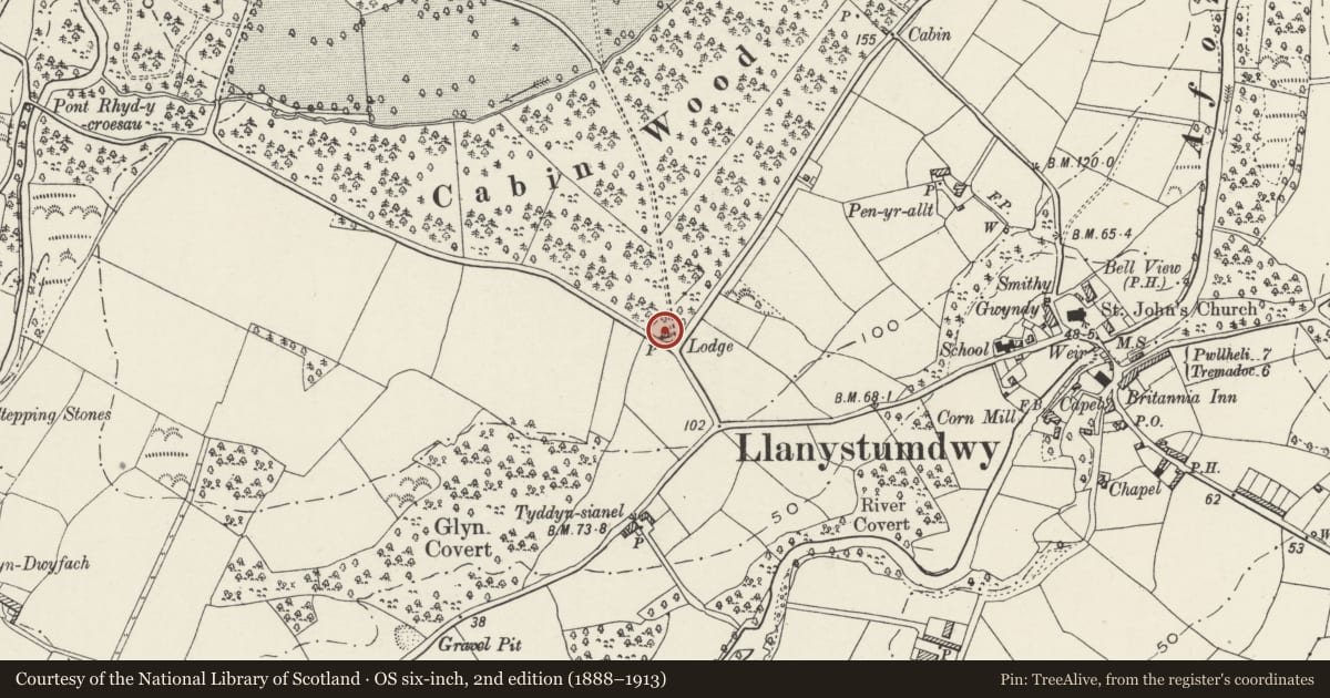
David Rumsey Map Collection, Stanford LibrariesDavid Rumsey Map Collection, Stanford LibrariesDavid Rumsey Map Collection, Stanford LibrariesDavid Rumsey Map Collection, Stanford LibrariesLlyfrgell Genedlaethol Cymru – The National Library of Wales
5 historical maps cover this location, the earliest the 1795 map "To Sir Watkin Williams-Wynn Bart ... the map of the six counties of North Wales is most humbly inscribed by his obedient humble servant" (Llyfrgell Genedlaethol Cymru – The National Library of Wales).
Historical maps covering this location
- 1795 · To Sir Watkin Williams-Wynn Bart ... the map of the six counties of North Wales is most… (Llyfrgell Genedlaethol Cymru – The National Library of Wales)
- 1883 · Watershed map England, Wales 3. (David Rumsey Map Collection, Stanford Libraries)
- 1896 · Sheet 7. Ordnance Survey of England and Wales. (David Rumsey Map Collection, Stanford Libraries)
- 1899 · 118 Nevin (Hills) (David Rumsey Map Collection, Stanford Libraries)
- 1901 · Sheet 9 and 10. (David Rumsey Map Collection, Stanford Libraries)
Cadw's description
Location
The lodge stands at the S end of the long drive to Plas Gwynfryn, 500m W of Llanystymdwy village.
History
The lodge was built c1880 for the new building of Plas Gwynfryn.
Exterior
Built of snecked square rockfaced rubble with ashlar dressings and a slate roof capped with red clayware roll ridge tiles. One storey and attic, a long N-S block with a short off-centre cross wing projecting to the E as a canted bay with pyramidal roof, and to the rear for services. Boarded door at the S end of the E front, set within a timber-framed porch, under an extension of the roof. Perforated spandrels. N of the canted front wing, a large dormer. At the S gable end, a square bay window with a stone parapet. Decorative bargeboards. Central stack with string and outsetting head. The rear wing roof is set lower than the N-S range, swept low to the S, and it has a C20 flat roofed extension in similar stone.
Reason for designation
Included as a carefully designed asymmetrical picturesque composition, with good detail, an attractive example of a Tudor Gothic park lodge.
Nearby in the register
- Ysgol LlanystumdwyEducationunder 1 mi
- No 2, MinafonDomesticunder 1 mi
- No 1, MinafonDomesticunder 1 mi
- Churchyard Wall and Lychgate to the Church of St John the BaptistReligious, Ritual and Funeraryunder 1 mi
Other entries of the same register within about three miles of this one, by straight line.