Cof Cymru: National Historic Assets of Wales · Wales
War Memorial in churchyard of St James, Rudry
Rudry, Caerphilly, Wales
A Grade II listed building in Rudry, Caerphilly, designated on 5 March 1999.
The record
- Designation
- Listed building, Grade II
- Broad class
- Commemorative
- Date of designation
- 5 March 1999
- Locality
- Rudry
- Community
- Rudry
- Unitary authority
- Caerphilly
- Country
- Wales
- Coordinates
- 51.57213, -3.16555
- Cadw reference
- 21442
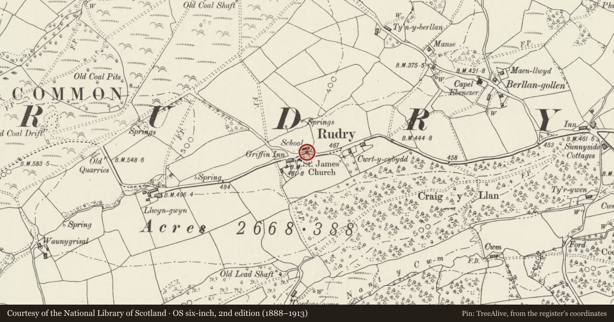
Slide toward Today to fade the historical sheet and see the modern map underneath.
David Rumsey Map Collection, Stanford LibrariesDavid Rumsey Map Collection, Stanford LibrariesDavid Rumsey Map Collection, Stanford LibrariesDavid Rumsey Map Collection, Stanford LibrariesDavid Rumsey Map Collection, Stanford Libraries
5 historical maps cover this location, the earliest the 1636 map "Cornubia : Devonia, Somersetus, Dorcestria, Wiltonia, Glocestria ..." (David Rumsey Map Collection, Stanford Libraries).
Historical maps covering this location
- 1636 · Cornubia : Devonia, Somersetus, Dorcestria, Wiltonia, Glocestria ... (David Rumsey Map Collection, Stanford Libraries)
- 1865 · England and Wales. England No. 6. (David Rumsey Map Collection, Stanford Libraries)
- 1895 · Sheet 11. Ordnance Survey of England and Wales. (David Rumsey Map Collection, Stanford Libraries)
- 1906 · 249 Newport (Hills) (David Rumsey Map Collection, Stanford Libraries)
- 1913 · Sheet 102. Newport. (David Rumsey Map Collection, Stanford Libraries)
Cadw's description
Location
In the churchyard on the N side of the nave of St James' Church facing a minor road.
Exterior
Celtic-cross style war memorial of polished granite on a stepped plinth. Above the plinth the square base has tapering sides and a ramped top. The shaft is tapered and has a ring-headed cross. The cross has interlace ornament in relief. The legend engraved in the shaft and base in black-painted letters commemorates the dead of the 1914-18 war, with the names of the 1939-45 war dead added to the side of the base.
Reason for designation
Included for its local historical interest and for group value with the church and other associated listed items in the churchyard.
Nearby in the register
- Church of St James, RudryReligious, Ritual and Funeraryunder 1 mi
- Old Church School HouseDomesticunder 1 mi
- Group of three Moses family chest tombs in churchyard of St James, RudryCommemorativeunder 1 mi
- Lime Kilns on Van RoadIndustrialunder 1 mi
Other entries of the same register within about three miles of this one, by straight line.