Cof Cymru: National Historic Assets of Wales · Wales
Michaelston Bridge (partly in Michaelston-y-Fedw Community)
Rudry, Caerphilly, Wales
A Grade II listed building in Llanfedw, Rudry, Caerphilly, designated on 5 March 1999.
The record
- Designation
- Listed building, Grade II
- Broad class
- Transport
- Date of designation
- 5 March 1999
- Locality
- Llanfedw
- Community
- Rudry
- Unitary authority
- Caerphilly
- Country
- Wales
- Coordinates
- 51.56309, -3.09437
- Cadw reference
- 21439
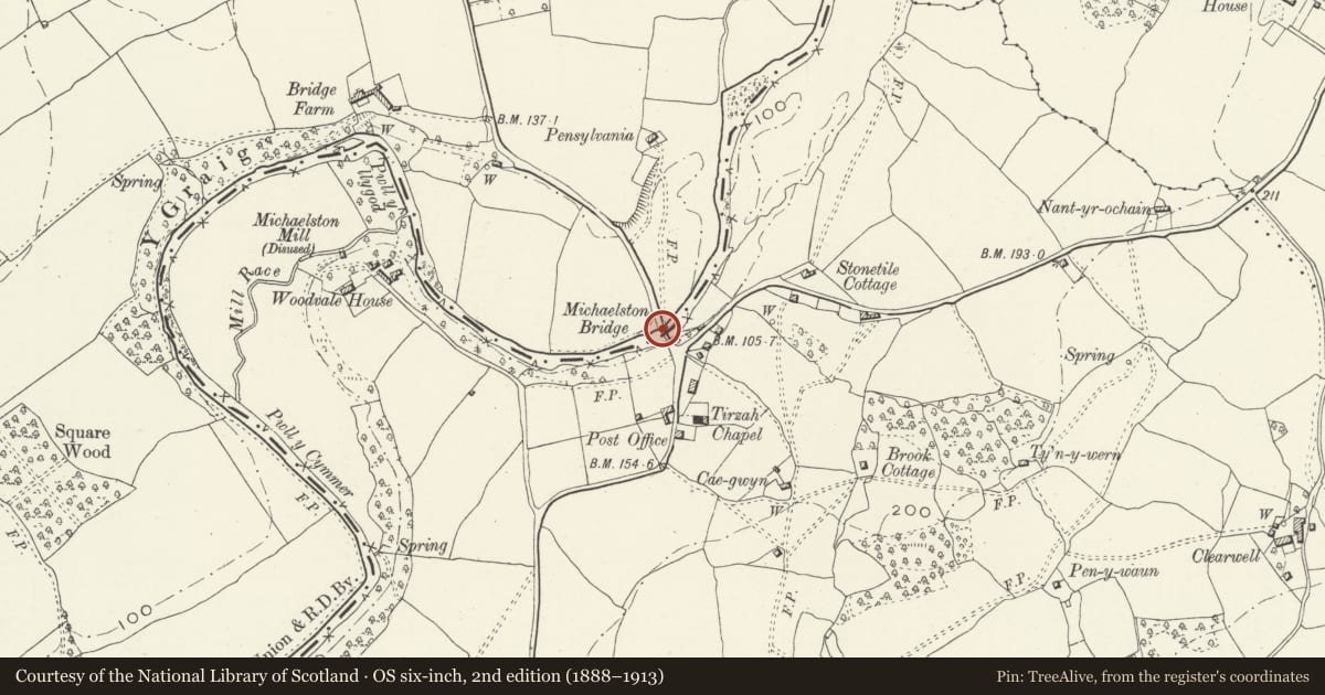
Slide toward Today to fade the historical sheet and see the modern map underneath.
David Rumsey Map Collection, Stanford LibrariesDavid Rumsey Map Collection, Stanford LibrariesDavid Rumsey Map Collection, Stanford LibrariesDavid Rumsey Map Collection, Stanford LibrariesDavid Rumsey Map Collection, Stanford Libraries
5 historical maps cover this location, the earliest the 1636 map "Cornubia : Devonia, Somersetus, Dorcestria, Wiltonia, Glocestria ..." (David Rumsey Map Collection, Stanford Libraries).
Historical maps covering this location
- 1636 · Cornubia : Devonia, Somersetus, Dorcestria, Wiltonia, Glocestria ... (David Rumsey Map Collection, Stanford Libraries)
- 1865 · England and Wales. England No. 6. (David Rumsey Map Collection, Stanford Libraries)
- 1895 · Sheet 11. Ordnance Survey of England and Wales. (David Rumsey Map Collection, Stanford Libraries)
- 1906 · 249 Newport (Hills) (David Rumsey Map Collection, Stanford Libraries)
- 1913 · Sheet 102. Newport. (David Rumsey Map Collection, Stanford Libraries)
Cadw's description
Location
Crossing the River Rhymney on N side of Michaelston-y-Fedw village and carrying a minor road between Michaelstone and Draethen.
History
Probably an C18 bridge but rebuilt in early C19 and shown in its present form on the 1839 Llanfedw Tithe map. In detail it is similar to Cefn Mably Bridge.
Exterior
Single-carriageway 2-span bridge in vernacular style, principally of snecked rubble stone. Segmental arches have fine arch rings, with a string course above the arches on the upstream side. The central pier has V-shaped cutwaters with shallow offsets, rising the full height of the parapet and defining refuges. The low parapet has a flat stone coping and is splayed out at the ends above the splayed abutments. The deck is laid with tarmac and is ramped from N to S.
Reason for designation
A well-preserved early C19 road bridge, one of a pair with Cefn Mably Bridge.
Nearby in the register
- Michaelstone BridgeTransportunder 1 mi
- Parish Church of St MichaelReligious, Ritual and Funeraryunder 1 mi
- The Old RectoryDomesticunder 1 mi
- Barn at Gwern Leyshon FarmAgriculture and Subsistenceunder 1 mi
Other entries of the same register within about three miles of this one, by straight line.