Cof Cymru: National Historic Assets of Wales · Wales
Tawelfan
Llanfair-ar-y-Bryn, Carmarthenshire, Wales
A Grade II listed building in Cynghordy, Llandovery, Llanfair-ar-y-Bryn, Carmarthenshire, designated on 25 February 1999.
The record
- Designation
- Listed building, Grade II
- Broad class
- Religious, Ritual and Funerary
- Date of designation
- 25 February 1999
- Locality
- Cynghordy
- Town
- Llandovery
- Community
- Llanfair-ar-y-Bryn
- Unitary authority
- Carmarthenshire
- Country
- Wales
- Coordinates
- 52.06122, -3.73898
- Cadw reference
- 21421
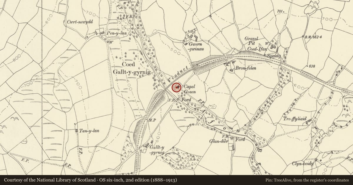
Slide toward Today to fade the historical sheet and see the modern map underneath.
David Rumsey Map Collection, Stanford LibrariesDavid Rumsey Map Collection, Stanford LibrariesDavid Rumsey Map Collection, Stanford LibrariesDavid Rumsey Map Collection, Stanford LibrariesDavid Rumsey Map Collection, Stanford Libraries
5 historical maps cover this location, the earliest the 1608 map "(13) Cambriae Typus." (David Rumsey Map Collection, Stanford Libraries).
Historical maps covering this location
- 1608 · (13) Cambriae Typus. (David Rumsey Map Collection, Stanford Libraries)
- 1636 · Cornubia : Devonia, Somersetus, Dorcestria, Wiltonia, Glocestria ... (David Rumsey Map Collection, Stanford Libraries)
- 1830 · V.3:11-15:XV. Britisches Reich. A. Kon: England. b. Frstenthum Wales: Shire: 37-40 (David Rumsey Map Collection, Stanford Libraries)
- 1899 · 196 Builth (Hills) (David Rumsey Map Collection, Stanford Libraries)
- 1901 · Sheet 14. (David Rumsey Map Collection, Stanford Libraries)
Cadw's description
Location
Situated immediately S of Cynghordy viaduct.
History
Chapel house and vestry to Calvinistic Methodist chapel of 1844, added in 1922 to designs by J O Parry of Ammanford. Chapel founded as a branch of Salem, Cilycwm.
Exterior
House to left, chapel to right in single range, unpainted roughcast with slate roof. Roughcast chimney to left. House has arched windows with small panes to upper sash, plate glass lower sash, three windows above, two below alternated with two panelled doors under flat hoods apparently of concrete. Right door has no window above, but 1922 date in raised numerals. House rear similar to front - three arched windows above three ground floor sashes, with door to right of centre. House and chapel have whitewashed rubble walls to graveyard and front garden.
Reason for designation
Listed as part of the group that includes Capel Gosen and the massive viaduct behind.
Nearby in the register
- Capel GosenReligious, Ritual and Funeraryunder 1 mi
- Cynghordy ViaductTransportunder 1 mi
- Cynghordy HallDomesticunder 1 mi
- PantyrhedynDomesticunder 1 mi
Other entries of the same register within about three miles of this one, by straight line.