Cof Cymru: National Historic Assets of Wales · Wales
Maesyberllan
Llanfair-ar-y-Bryn, Carmarthenshire, Wales
A Grade II listed building in Pentre-ty-gwyn, Llandovery, Llanfair-ar-y-Bryn, Carmarthenshire, designated on 25 February 1999.
The record
- Designation
- Listed building, Grade II
- Broad class
- Domestic
- Date of designation
- 25 February 1999
- Locality
- Pentre-ty-gwyn
- Town
- Llandovery
- Community
- Llanfair-ar-y-Bryn
- Unitary authority
- Carmarthenshire
- Country
- Wales
- Coordinates
- 52.00617, -3.71201
- Cadw reference
- 21408
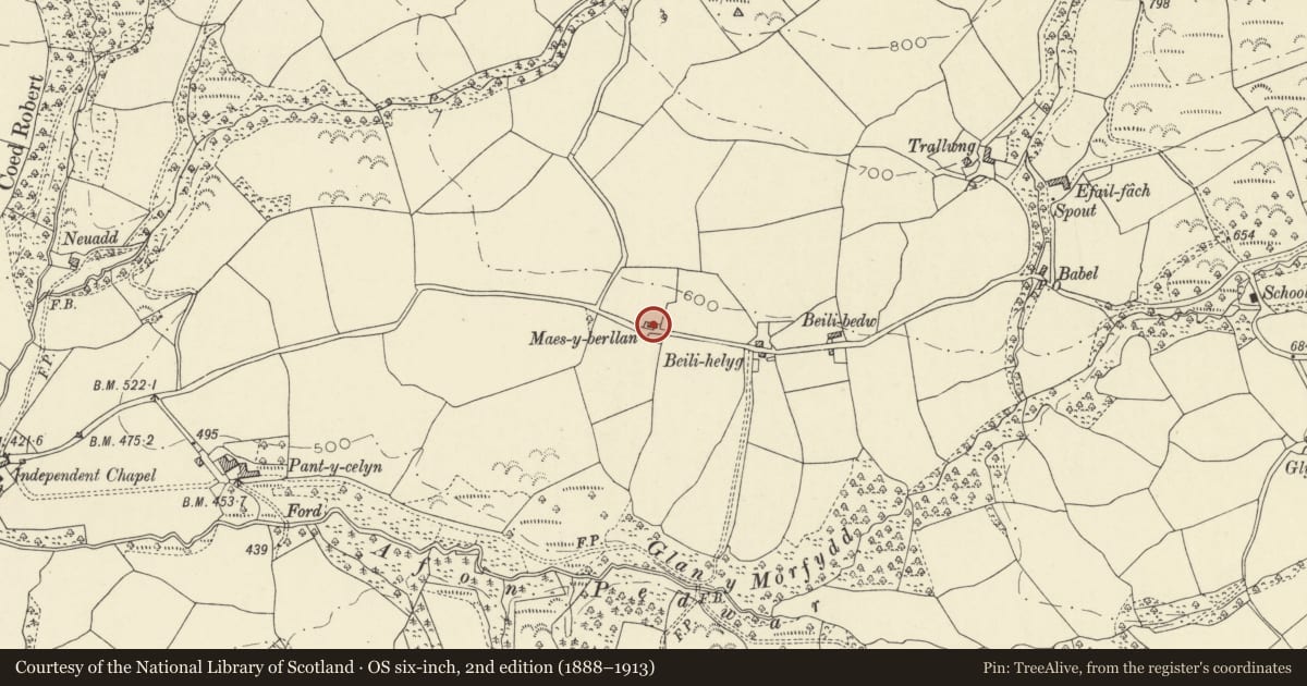
Slide toward Today to fade the historical sheet and see the modern map underneath.
David Rumsey Map Collection, Stanford LibrariesDavid Rumsey Map Collection, Stanford LibrariesDavid Rumsey Map Collection, Stanford LibrariesDavid Rumsey Map Collection, Stanford LibrariesDavid Rumsey Map Collection, Stanford Libraries
5 historical maps cover this location, the earliest the 1636 map "Cornubia : Devonia, Somersetus, Dorcestria, Wiltonia, Glocestria ..." (David Rumsey Map Collection, Stanford Libraries).
Historical maps covering this location
- 1636 · Cornubia : Devonia, Somersetus, Dorcestria, Wiltonia, Glocestria ... (David Rumsey Map Collection, Stanford Libraries)
- 1830 · V.3:11-15:XV. Britisches Reich. A. Kon: England. b. Frstenthum Wales: Shire: 37-40 (David Rumsey Map Collection, Stanford Libraries)
- 1856 · 42. Brecon. (David Rumsey Map Collection, Stanford Libraries)
- 1898 · 213 Brecon (Hills) (David Rumsey Map Collection, Stanford Libraries)
- 1901 · Sheet 14. (David Rumsey Map Collection, Stanford Libraries)
Cadw's description
Location
Situated on N side of the road from Babel to Pentre-ty-gwyn.
History
House with outbuilding, formerly forge, now Post Office. Not marked on 1841 Tithe Map. On 1851 census occupied by Morgan Prosser, blacksmith, and in 1871 by William Prosser, blacksmith.
Exterior
House and former forge, whitewashed rubble stone with slate close eaved roofs and stone end stacks with dripstones. House is 2-storey, 3-window range of horned 6-pane sashes and centre stable-type door. Upper windows under eaves, lower openings with stone voussoirs and stone sills. 4 modern casements to rear. Former forge attached to right is lower with cambered-headed door to left and part-blocked door to centre. Rubble stone end wall.
Interior
Housenow open plan with fireplace with iron range. Former forge has 2-bay roof, bolted collar to tie-beam truss.
Reason for designation
Included as a good example of a small mid C19 rural house with workshop attached.
Nearby in the register
- Outbuilding on the E side of the yard at PantycelynAgriculture and Subsistenceunder 1 mi
- Outbuilding on N side of yard at PantycelynAgriculture and Subsistenceunder 1 mi
- Pantycelyn FarmhouseDomesticunder 1 mi
- Vestry at Capel Pentre TygwynReligious, Ritual and Funeraryunder 1 mi
Other entries of the same register within about three miles of this one, by straight line.