Cof Cymru: National Historic Assets of Wales · Wales
23 Post Office Terrace
Llannor, Gwynedd, Wales
A Grade II listed building in Abererch, Pwllheli, Llannor, Gwynedd, designated on 8 February 1999.
The record
- Designation
- Listed building, Grade II
- Broad class
- Domestic
- Date of designation
- 8 February 1999
- Locality
- Abererch
- Town
- Pwllheli
- Community
- Llannor
- Unitary authority
- Gwynedd
- Country
- Wales
- Coordinates
- 52.90341, -4.38299
- Cadw reference
- 21352
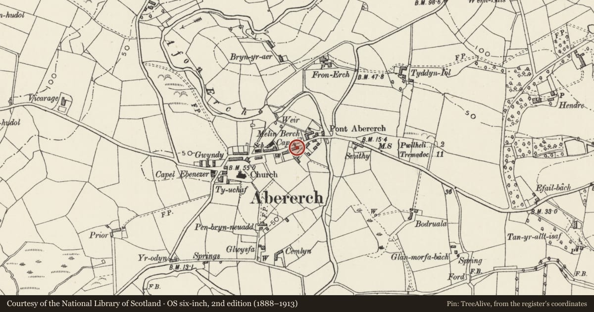
Slide toward Today to fade the historical sheet and see the modern map underneath.
David Rumsey Map Collection, Stanford LibrariesDavid Rumsey Map Collection, Stanford LibrariesDavid Rumsey Map Collection, Stanford LibrariesDavid Rumsey Map Collection, Stanford LibrariesLlyfrgell Genedlaethol Cymru – The National Library of Wales
5 historical maps cover this location, the earliest the 1795 map "To Sir Watkin Williams-Wynn Bart ... the map of the six counties of North Wales is most humbly inscribed by his obedient humble servant" (Llyfrgell Genedlaethol Cymru – The National Library of Wales).
Historical maps covering this location
- 1795 · To Sir Watkin Williams-Wynn Bart ... the map of the six counties of North Wales is most… (Llyfrgell Genedlaethol Cymru – The National Library of Wales)
- 1883 · Watershed map England, Wales 3. (David Rumsey Map Collection, Stanford Libraries)
- 1896 · Sheet 7. Ordnance Survey of England and Wales. (David Rumsey Map Collection, Stanford Libraries)
- 1899 · 134 Pwllheli (Hills) (David Rumsey Map Collection, Stanford Libraries)
- 1901 · Sheet 9 and 10. (David Rumsey Map Collection, Stanford Libraries)
Cadw's description
Location
Row of cottages, Nos 19-24 (consec), located on the S side of the main street at the centre of Abererch.
History
The terrace of cottages Nos 19-24 (consec) were built probably in the early-mid C19.
Reason for designation
Included a member of a significant row of early C19 village vernacular cottages probably the earliest and simplest of the rows of cottages which form the essence of the character of the conservation area in this nucleated village. The extent of the row and the quality of detail suggests they were built by an adjacent landowner or wealthy farmer for workers.
Nearby in the register
- SeibiantDomesticunder 1 mi
- 24 Post Office TerraceDomesticunder 1 mi
- AwelonDomesticunder 1 mi
- 20 Post Office TerraceDomesticunder 1 mi
Other entries of the same register within about three miles of this one, by straight line.