Cof Cymru: National Historic Assets of Wales · Wales
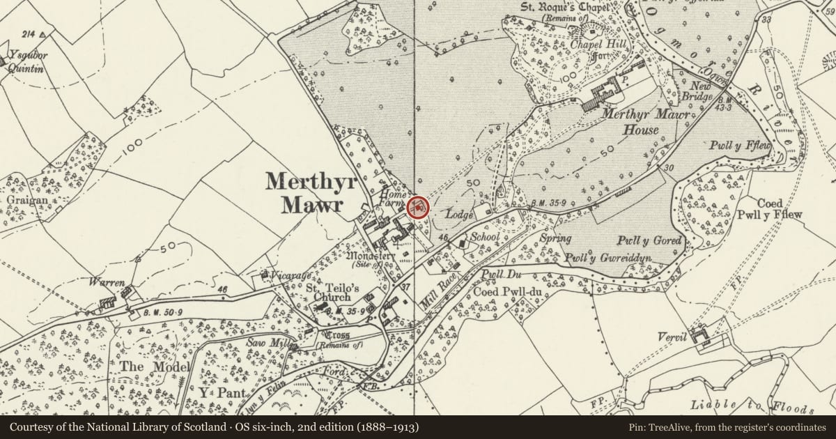
Gate and Gate Posts on E side of Home Farm
Merthyr Mawr, Bridgend, Wales
A Grade II listed building in Merthyr Mawr, Bridgend, designated on 29 January 1999.
The record
- Designation
- Listed building, Grade II
- Broad class
- Agriculture and Subsistence
- Date of designation
- 29 January 1999
- Locality
- Merthyr Mawr
- Community
- Merthyr Mawr
- Unitary authority
- Bridgend
- Country
- Wales
- Coordinates
- 51.48739, -3.60743
- Cadw reference
- 21252
Slide toward Today to fade the historical sheet and see the modern map underneath.
David Rumsey Map Collection, Stanford LibrariesDavid Rumsey Map Collection, Stanford LibrariesDavid Rumsey Map Collection, Stanford LibrariesDavid Rumsey Map Collection, Stanford LibrariesDavid Rumsey Map Collection, Stanford Libraries
5 historical maps cover this location, the earliest the 1636 map "Cornubia : Devonia, Somersetus, Dorcestria, Wiltonia, Glocestria ..." (David Rumsey Map Collection, Stanford Libraries).
Historical maps covering this location
- 1636 · Cornubia : Devonia, Somersetus, Dorcestria, Wiltonia, Glocestria ... (David Rumsey Map Collection, Stanford Libraries)
- 1637 · The fourth table of England. Cornub. Devonia, Somerset etc. (David Rumsey Map Collection, Stanford Libraries)
- 1865 · England and Wales. England No. 6. (David Rumsey Map Collection, Stanford Libraries)
- 1897 · 262 Pontypridd (Hills) (David Rumsey Map Collection, Stanford Libraries)
- 1897 · 262 Pontypridd (Outline) (David Rumsey Map Collection, Stanford Libraries)
Cadw's description
Location
Approximately 300m NE of the parish church and at the end of a track between Merthyr Mawr House and Brewhouse Cottages, on the E side of the Home Farm.
History
An early C19 gate brought to Merthyr Mawr after being salvaged from one of Thomas Telford's road-building projects, probably the Bristol to Milford Haven mail route, where work was undertaken from 1824. The design was produced specifically for the toll gates on Telford's Holyhead Road c1815-30, and was subsequently used on his other road-building projects.
Exterior
'Telford' style iron gate painted white, with wrought-iron bars emanating from the hinges in a sunburst fashion. The round cast iron posts have ball finials.
Reason for designation
Included as a farm gate of distinctive design and for group value with Home Farm and its listed farm buildings.
Nearby in the register
- Barn and Stable at Home Farm (also known as Chapel Barn)Agriculture and Subsistenceunder 1 mi
- Home FarmDomesticunder 1 mi
- Malthouse at Home FarmAgriculture and Subsistenceunder 1 mi
- Dovecote at Home FarmAgriculture and Subsistenceunder 1 mi
Other entries of the same register within about three miles of this one, by straight line.