Cof Cymru: National Historic Assets of Wales · Wales
Lower Revetment and steps at Merthyr Mawr House
Merthyr Mawr, Bridgend, Wales
A Grade II listed building in Merthyr Mawr House, Merthyr Mawr, Bridgend, designated on 29 January 1999.
The record
- Designation
- Listed building, Grade II
- Broad class
- Gardens, Parks and Urban Spaces
- Date of designation
- 29 January 1999
- Locality
- Merthyr Mawr House
- Community
- Merthyr Mawr
- Unitary authority
- Bridgend
- Country
- Wales
- Coordinates
- 51.48909, -3.60187
- Cadw reference
- 21231
Slide toward Today to fade the historical sheet and see the modern map underneath.
David Rumsey Map Collection, Stanford LibrariesDavid Rumsey Map Collection, Stanford LibrariesDavid Rumsey Map Collection, Stanford LibrariesDavid Rumsey Map Collection, Stanford LibrariesDavid Rumsey Map Collection, Stanford Libraries
5 historical maps cover this location, the earliest the 1636 map "Cornubia : Devonia, Somersetus, Dorcestria, Wiltonia, Glocestria ..." (David Rumsey Map Collection, Stanford Libraries).
Historical maps covering this location
- 1636 · Cornubia : Devonia, Somersetus, Dorcestria, Wiltonia, Glocestria ... (David Rumsey Map Collection, Stanford Libraries)
- 1637 · The fourth table of England. Cornub. Devonia, Somerset etc. (David Rumsey Map Collection, Stanford Libraries)
- 1865 · England and Wales. England No. 6. (David Rumsey Map Collection, Stanford Libraries)
- 1897 · 262 Pontypridd (Hills) (David Rumsey Map Collection, Stanford Libraries)
- 1897 · 262 Pontypridd (Outline) (David Rumsey Map Collection, Stanford Libraries)
Cadw's description
Location
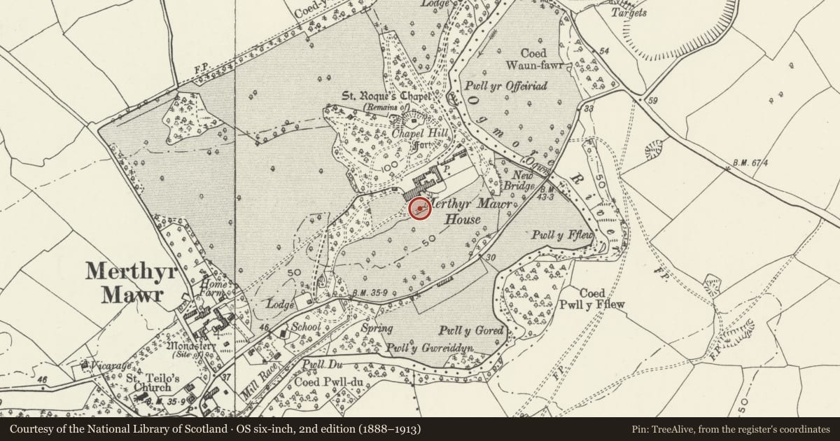
On the S side of the house and below the S terrace.
History
Sir John Nicholl purchased the Merthyr Mawr Estate in 1804 and planned a new country residence away from the old manor house, Merthyr Mawr Hall (now the site of Home Farm). A new site was chosen below Chapel Hill which overlooks the Ogmore valley. Merthyr Mawr House was built in the period 1806-9 and the park and gardens laid out later, with a garden on the S and W of the house, a kitchen garden to the E and wooded pleasure grounds to the N on Chapel Hill and to the SW. The terrace revetments on the S side of the house were added in the early C20, replacing grass terraces which were still in existence in 1899.
Exterior
A rubble stone wall with square piers flanking central stone steps, terminating in a pier on the E side and stepped on the W side. The wall has a flat coping and the piers are topped with concrete vases.
Reason for designation
Included for group value with Merthyr Mawr House and other associated listed items.
Nearby in the register
- South Terrace and Revetment at Merthyr Mawr HouseGardens, Parks and Urban Spacesunder 1 mi
- Merthyr Mawr HouseDomesticunder 1 mi
- Gate Piers to Service Court and Attached Walls at Merthyr Mawr HouseGardens, Parks and Urban Spacesunder 1 mi
- Vehicle store and workshops at Merthyr Mawr HouseTransportunder 1 mi
Other entries of the same register within about three miles of this one, by straight line.