Cof Cymru: National Historic Assets of Wales · Wales
Former house and attached barn at Coity Bach
Talybont-on-Usk, Powys, Wales
A Grade II listed building in Coity Bach, Talybont-on-Usk, Powys, designated on 17 December 1998.
The record
- Designation
- Listed building, Grade II
- Broad class
- Domestic
- Date of designation
- 17 December 1998
- Locality
- Coity Bach
- Community
- Talybont-on-Usk
- Unitary authority
- Powys
- Country
- Wales
- Coordinates
- 51.89963, -3.30522
- Cadw reference
- 21147
Slide toward Today to fade the historical sheet and see the modern map underneath.
David Rumsey Map Collection, Stanford LibrariesDavid Rumsey Map Collection, Stanford LibrariesDavid Rumsey Map Collection, Stanford LibrariesDavid Rumsey Map Collection, Stanford LibrariesDavid Rumsey Map Collection, Stanford Libraries
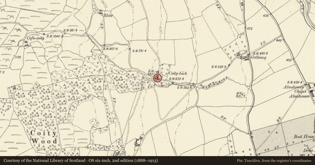
5 historical maps cover this location, the earliest the 1608 map "(13) Cambriae Typus." (David Rumsey Map Collection, Stanford Libraries).
Historical maps covering this location
- 1608 · (13) Cambriae Typus. (David Rumsey Map Collection, Stanford Libraries)
- 1636 · Cornubia : Devonia, Somersetus, Dorcestria, Wiltonia, Glocestria ... (David Rumsey Map Collection, Stanford Libraries)
- 1856 · 42. Brecon. (David Rumsey Map Collection, Stanford Libraries)
- 1896 · 214 Talgarth (Hills) (David Rumsey Map Collection, Stanford Libraries)
- 1901 · Sheet 14. (David Rumsey Map Collection, Stanford Libraries)
Cadw's description
Location
Coity Bach is on the mountain lane leading W from the Pencelli Aberclydach road, a little NW of Talybont village.
History
C17. This house preceded the current farmhouse built probably late C18 on a nearby site, whereupon it became part of a barn range, now used as an animal shed.
Exterior
Small former farmhouse with attached barn range. Of stone rubble with boulder footings; steep pitched corrugated roof. Large end chimney, masked by ivy. Lane frontage has the square hoodmoulds to blocked former openings. Attached higher 5 bay barn is stepped forward at laneside, with similar pitch to roof; limewashed rubble, stone lintels to ventilation slits, roof extended to hood over double doors. Farmyard side has roof raised over loft opening, doorway with timber lintel, inserted double doorway left.
Interior
Former house retains fireplace with adjacent curved stone steps to first floor. No interior partitions survive. Barn has pegged collar and tie trusses.
Reason for designation
Included notwithstanding its poor condition as an interesting survival of a small early regional house.
Nearby in the register
- Cottage and barn range and courtyard wall at Coity MawrDomesticunder 1 mi
- Coity MawrDomesticunder 1 mi
- 1 Lower Cross Oak CottagesDomesticunder 1 mi
- 3 Lower Cross Oak CottagesDomesticunder 1 mi
Other entries of the same register within about three miles of this one, by straight line.