Cof Cymru: National Historic Assets of Wales · Wales
Former boathouse to W of Storehouse Bridge
Talybont-on-Usk, Powys, Wales
A Grade II listed building in Llanfrynach, Talybont-on-Usk, Powys, designated on 17 December 1998.
The record
- Designation
- Listed building, Grade II
- Broad class
- Transport
- Date of designation
- 17 December 1998
- Locality
- Llanfrynach
- Community
- Talybont-on-Usk
- Unitary authority
- Powys
- Country
- Wales
- Coordinates
- 51.92341, -3.33227
- Cadw reference
- 21146
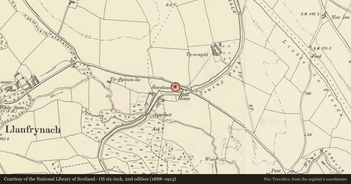
Slide toward Today to fade the historical sheet and see the modern map underneath.
David Rumsey Map Collection, Stanford LibrariesDavid Rumsey Map Collection, Stanford LibrariesDavid Rumsey Map Collection, Stanford LibrariesDavid Rumsey Map Collection, Stanford LibrariesDavid Rumsey Map Collection, Stanford Libraries
5 historical maps cover this location, the earliest the 1608 map "(13) Cambriae Typus." (David Rumsey Map Collection, Stanford Libraries).
Historical maps covering this location
- 1608 · (13) Cambriae Typus. (David Rumsey Map Collection, Stanford Libraries)
- 1636 · Cornubia : Devonia, Somersetus, Dorcestria, Wiltonia, Glocestria ... (David Rumsey Map Collection, Stanford Libraries)
- 1830 · V.3:11-15:XV. Britisches Reich. A. Kon: England. b. Frstenthum Wales: Shire: 37-40 (David Rumsey Map Collection, Stanford Libraries)
- 1856 · 42. Brecon. (David Rumsey Map Collection, Stanford Libraries)
- 1901 · Sheet 14. (David Rumsey Map Collection, Stanford Libraries)
Cadw's description
Location
Situated just W of Storehouse Bridge (Canal Bridge No.158) between the Storehouse and the Canal.
History
The Brecknock and Abergavenny Canal was promoted in 1792 to connect the upper Usk valley with the Monmouthshire Canal at Pontymoile and from there to the sea at Newport. First section, between Gilwern and Talybont, was cut between 1797 and 1799, with upper section between Talybont and Brecon opened in 1800, both sections engineered by Thomas Dadford. Lower section between Gilwern and Pontymoile completed 1812 and engineered by William Crosley. Linked to tramroads, the canal was an important artery for trade in iron, lime and coal. In 1865 the Brecknock and Abergavenny and the Monmouthshire Canals merged to become the Monmouthsire and Brecon Canal which was later incorporated into the Great Western railway. This stretch of the Brecknock and Abergavenny Canal was constructed c 1800. The boathouse built over a small inlet of the canal provided a maintenance workshop. The two buildings shown as now on Tithe of 1841. Converted into dwelling with forge added C20. The adjacent storehouse was reputedly built mainly to store fleeces.
Exterior
Small rectangular building entered at first floor level from lane, lower storey faces onto canal. Of stone rubble with tooled dressings, roof of large Welsh slates and overhanging eaves; end stack right. Gothick shaped window openings to first floor with replaced glazing. Gable end facing canal has wide segmental canal arch and large window above under wide hoodmould. C20 porch added to front entrance and corrugated iron forge to rear.
Reason for designation
Listed for its special interest as a surviving Brecknock and Abergavenny Canal building of uncommon type.
Nearby in the register
- Ty Newydd Lower Bridge (Canal Bridge No. 159)Transportunder 1 mi
- Low Bridge (Canal Bridge No.156)Transportunder 1 mi
- Cross-Slab in ChurchCrossunder 1 mi
- Church of St Peter and St IlltydReligious, Ritual and Funeraryunder 1 mi
Other entries of the same register within about three miles of this one, by straight line.