Cof Cymru: National Historic Assets of Wales · Wales
Bank House
Talybont-on-Usk, Powys, Wales
A Grade II listed building in Talybont on Usk, Powys, designated on 17 December 1998.
The record
- Designation
- Listed building, Grade II
- Broad class
- Domestic
- Date of designation
- 17 December 1998
- Locality
- Talybont on Usk
- Community
- Talybont-on-Usk
- Unitary authority
- Powys
- Country
- Wales
- Coordinates
- 51.89566, -3.29070
- Cadw reference
- 21141
Slide toward Today to fade the historical sheet and see the modern map underneath.
David Rumsey Map Collection, Stanford LibrariesDavid Rumsey Map Collection, Stanford LibrariesDavid Rumsey Map Collection, Stanford LibrariesDavid Rumsey Map Collection, Stanford LibrariesDavid Rumsey Map Collection, Stanford Libraries
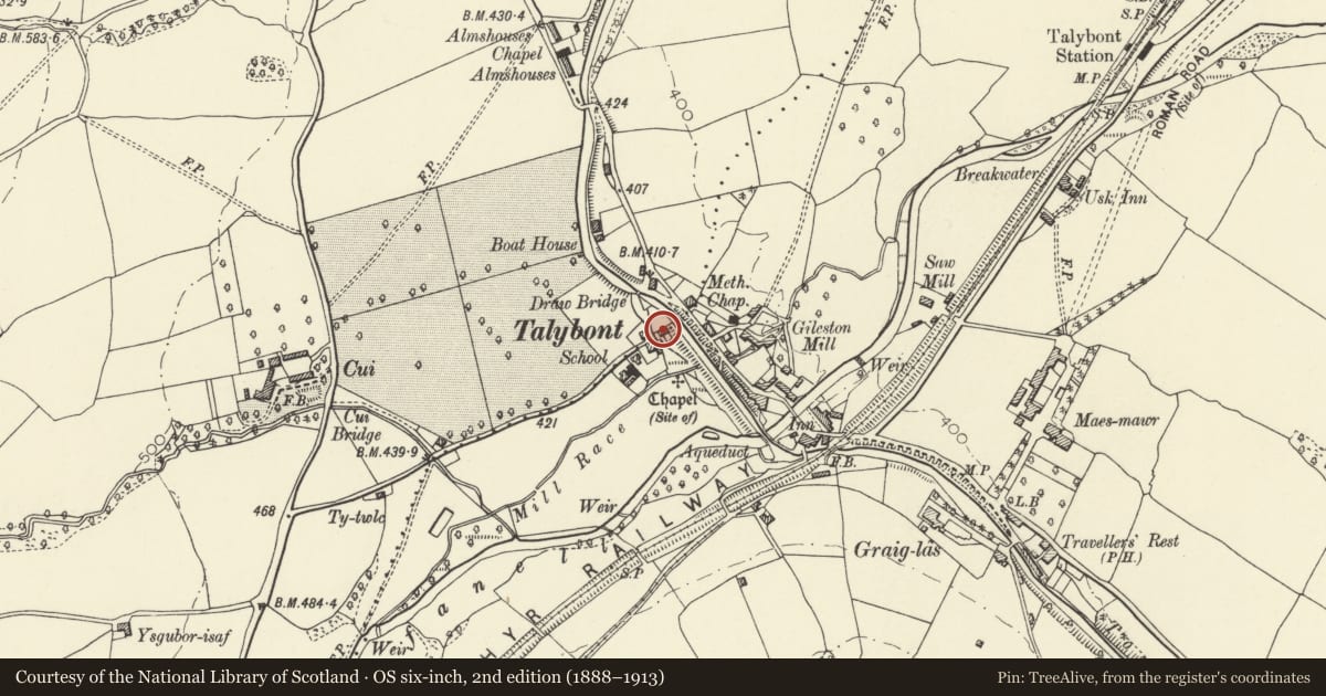
5 historical maps cover this location, the earliest the 1608 map "(13) Cambriae Typus." (David Rumsey Map Collection, Stanford Libraries).
Historical maps covering this location
- 1608 · (13) Cambriae Typus. (David Rumsey Map Collection, Stanford Libraries)
- 1636 · Cornubia : Devonia, Somersetus, Dorcestria, Wiltonia, Glocestria ... (David Rumsey Map Collection, Stanford Libraries)
- 1856 · 42. Brecon. (David Rumsey Map Collection, Stanford Libraries)
- 1896 · 214 Talgarth (Hills) (David Rumsey Map Collection, Stanford Libraries)
- 1901 · Sheet 14. (David Rumsey Map Collection, Stanford Libraries)
Cadw's description
Location
Close to the S bank of the canal in Talybont village and adjacent to the swing bridge.
History
Belonged to the Brecknock and Abergavenny Canal Co as evidenced by inscription plaque B&ACC with date 1843, although a building appears to be in this position on tithe map of 1841.
Exterior
Small rendered stone house extended to rear, painted lean-to left; Welsh slate roof with rendered end stacks. Two window range of horned sashes in reveals with painted sills, glazing bars removed, and high hoodmoulds above. Ground floor has continuous hoodmould over the two windows and central doorway which has a 6 panelled door. Altered/inserted windows to sides.
Interior
Interior not inspected at the time of survey (30th October 1997).
Reason for designation
Included for its historical interest in relation to the canal.
Nearby in the register
- Gileston Mill aka Talybont MillIndustrialunder 1 mi
- Former skittle alley and tea-roomRecreationalunder 1 mi
- The Star InnCommercialunder 1 mi
- Talybont Aqueduct (Monmouthshire and Brecon Canal)Transportunder 1 mi
Other entries of the same register within about three miles of this one, by straight line.